



Walkable communities have become one of the clearest expressions of what sustainable urban growth looks like in practice. They bring together land use, transportation, housing, public health, and local economic development into a single urban framework that is easier for residents to use and easier for cities to support over time. In an era defined by housing pressure, infrastructure constraints, climate risk, and rising household costs, walkability is no longer a secondary design feature. It is a strategic planning tool that helps cities grow in a more efficient, resilient, and humane way.
Table Of Content
- Why Walkability Matters in the Growth Strategy of Cities
- The Core Design Elements of a Walkable Community
- Connected street networks and short blocks
- Continuous sidewalks and safe crossings
- Mixed-use development and nearby destinations
- Transit access and multimodal integration
- Traffic calming and street design for safety
- The Economic Logic of Walkable Urban Form
- Social, Health, and Equity Benefits Beyond Transportation
- Walkability Is Not Just for Downtowns
- The Role of Policy, Planning, and Governance
- Common Trade-Offs and Why Projects Face Resistance
- Strategic Approaches for Planners and Developers
- What the Future of Sustainable Urban Growth Looks Like
- Conclusion
At a surface level, many people associate walkability with pleasant sidewalks and lively main streets. That matters, but the deeper value of walkable design lies in how it changes the relationship between people and place. When homes, schools, transit, shops, parks, and services are connected through safe and direct routes, the city starts functioning as a network of daily access rather than a collection of isolated land uses. This shift reduces dependence on private vehicles, supports local commerce, lowers transportation costs for households, and strengthens the long-term productivity of urban land.
Across Canada and the United States, public policy is increasingly reflecting this broader understanding. Canadian federal guidance on active transportation highlights mixed land use, safe streets, and proximity between homes and everyday destinations as critical enablers of walking. Canada’s National Active Transportation Strategy has also elevated walkability from a local advocacy issue to a coast-to-coast-to-coast national priority tied to evidence-based investment and better planning data. In the United States, agencies such as the CDC and EPA similarly connect walkability to physical activity, safety, reduced emissions, stronger local economies, and community well-being.
For urban planners, developers, and municipal leaders, the implication is significant. Walkability should not be treated as a cosmetic enhancement layered on after major land use decisions are made. It should be integrated into the structure of growth itself, shaping how streets are connected, how housing is distributed, how retail is positioned, and how infrastructure investments are prioritized. Designing walkable communities is ultimately about making cities more capable of absorbing growth while preserving quality of life.
This article takes a strategic view of walkable community design and its role in sustainable urban growth. It explores the design principles that make neighborhoods genuinely walkable, the economic and social benefits that follow, the policy tools supporting this shift, and the implementation challenges that often emerge. The central point is straightforward: walkable communities are not merely attractive places to live, they are high-performing urban systems.
Why Walkability Matters in the Growth Strategy of Cities
Cities do not become sustainable simply by adding more housing or widening transportation networks. Sustainable growth depends on how well urban form supports daily life with the least amount of friction, cost, and environmental burden. A neighborhood where every basic task requires a car imposes ongoing demands on road capacity, parking supply, land consumption, household budgets, and public infrastructure maintenance. A neighborhood where more trips can be completed on foot, by transit, or through other active modes creates more flexibility within the same urban footprint.
This is why walkability has become central to contemporary planning concepts such as complete communities, smart growth, and the 15-minute city. These frameworks all share a basic premise that urban life works better when daily needs are closer together and accessible through a connected, safe public realm. The EPA has consistently noted that compact neighborhoods with walkable street grids and convenient access to transit, jobs, stores, and services are more likely to give residents transportation options and reduce driving. That is not only a mobility outcome. It is a land use efficiency outcome as well.
Household economics make this especially important. Housing affordability is often discussed without enough attention to transportation costs, yet the two are deeply linked. A household that pays less for housing but must own multiple vehicles, absorb fuel costs, and rely on long-distance driving may not be meaningfully better off than one living in a slightly denser, better-located, walkable district. Walkability therefore changes the affordability equation by reducing the cost of access. It allows people to reach more of what they need without paying for every trip with time, fuel, insurance, and parking.
There is also a productivity dimension that deserves more attention. Walkable communities tend to use land more intensively and more effectively. Streets become not only conduits for cars but also public spaces that support commerce, social interaction, and multiple transportation modes. Ground-floor retail becomes more viable when foot traffic is built into the surrounding urban form. Transit service becomes more efficient when riders can comfortably walk to stations and stops. Existing infrastructure delivers more value when the pattern of development around it supports higher access with fewer spatial inefficiencies.
Walkability is best understood not as a lifestyle preference, but as an urban operating system that aligns growth, mobility, land value, and quality of life.
Public health research reinforces this strategic importance. The CDC states that improving community walkability helps people be physically active and can improve safety, social interaction, local economies, and air quality. Its research also found a strong gradient in transportation walking across neighborhoods with different walkability levels, with transportation walking reported by 21.6 percent of adults in the least walkable areas and 51.6 percent in the most walkable ones. Those numbers illustrate a simple but powerful truth: built form influences behavior. When communities are designed for walking, people walk more.
The Core Design Elements of a Walkable Community
Walkability is sometimes oversimplified as the presence of sidewalks. In reality, sidewalks are only one visible component of a larger urban system. A truly walkable community depends on whether people can move between meaningful destinations through routes that are direct, safe, comfortable, and interesting. The design challenge is therefore both physical and strategic. It requires planners to think about movement patterns, land use relationships, street hierarchy, public realm quality, and accessibility at the same time.
Connected street networks and short blocks
One of the strongest predictors of walkability is the structure of the street network itself. Higher intersection density and shorter block lengths create more route choices, shorter walking distances, and a more permeable urban fabric. By contrast, disconnected streets, superblocks, and cul-de-sac patterns force pedestrians to take indirect paths even when destinations appear geographically close. The EPA’s Smart Location Mapping resources emphasize that compact neighborhoods with walkable street grids are more supportive of walking trips and less dependent on driving.
Connected networks do more than improve convenience. They also distribute traffic more effectively and can reduce pressure on a few oversized arterial roads. This matters because many car-oriented districts are designed around high-capacity corridors that are efficient for vehicle throughput but hostile for pedestrian movement. If the only way to reach a grocery store, school, or transit stop is to navigate long blocks, wide intersections, and fast traffic, the practical value of nearby destinations declines sharply. A finer-grained street network helps restore human scale to urban movement.
Continuous sidewalks and safe crossings
Sidewalk quality remains foundational, but continuity is just as important as presence. Sidewalks need to be wide enough to accommodate regular pedestrian flow, wheelchairs, strollers, and social walking side by side. They should continue without abrupt gaps, awkward utility conflicts, or unsafe transitions at intersections. Safe curb ramps, tactile warning surfaces, adequate lighting, weather protection where possible, and regular maintenance all contribute to whether a route is usable by a broad range of people.
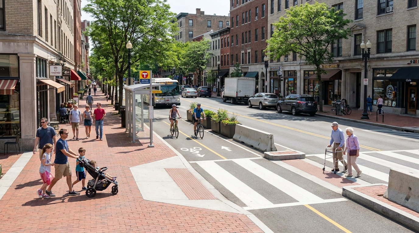
Crossings often determine whether a place feels walkable in practice. A neighborhood can have decent sidewalks, but if residents must cross wide roads with long signal waits, poor sightlines, or turning conflicts, walkability remains compromised. Raised crosswalks, curb extensions, median refuges, leading pedestrian intervals, and narrower travel lanes can materially improve the safety and comfort of walking. These are not small technical measures. They shape the perceived legitimacy of walking as a normal way to move through the city.
Mixed-use development and nearby destinations
The CDC has stressed that the most effective community design approaches combine activity-friendly routes with everyday destinations, rather than relying on sidewalks alone. This distinction is crucial. People do not walk because a path exists. They walk because there is somewhere useful to go within a reasonable distance. That means housing must be connected to stores, schools, parks, services, workplaces, and civic spaces through compatible land use patterns.
Mixed-use development plays a central role here. When residential, commercial, and institutional uses are separated too rigidly, neighborhoods lose the functional diversity that supports frequent walking trips. Even modest integration of uses can make a significant difference. A small grocery store, childcare facility, pharmacy, school, clinic, or neighborhood café within a short walk can change how people structure their daily routines. From a planning perspective, this is where zoning reform becomes central to walkability. The street can only do so much if the surrounding land uses make walking impractical.
Transit access and multimodal integration
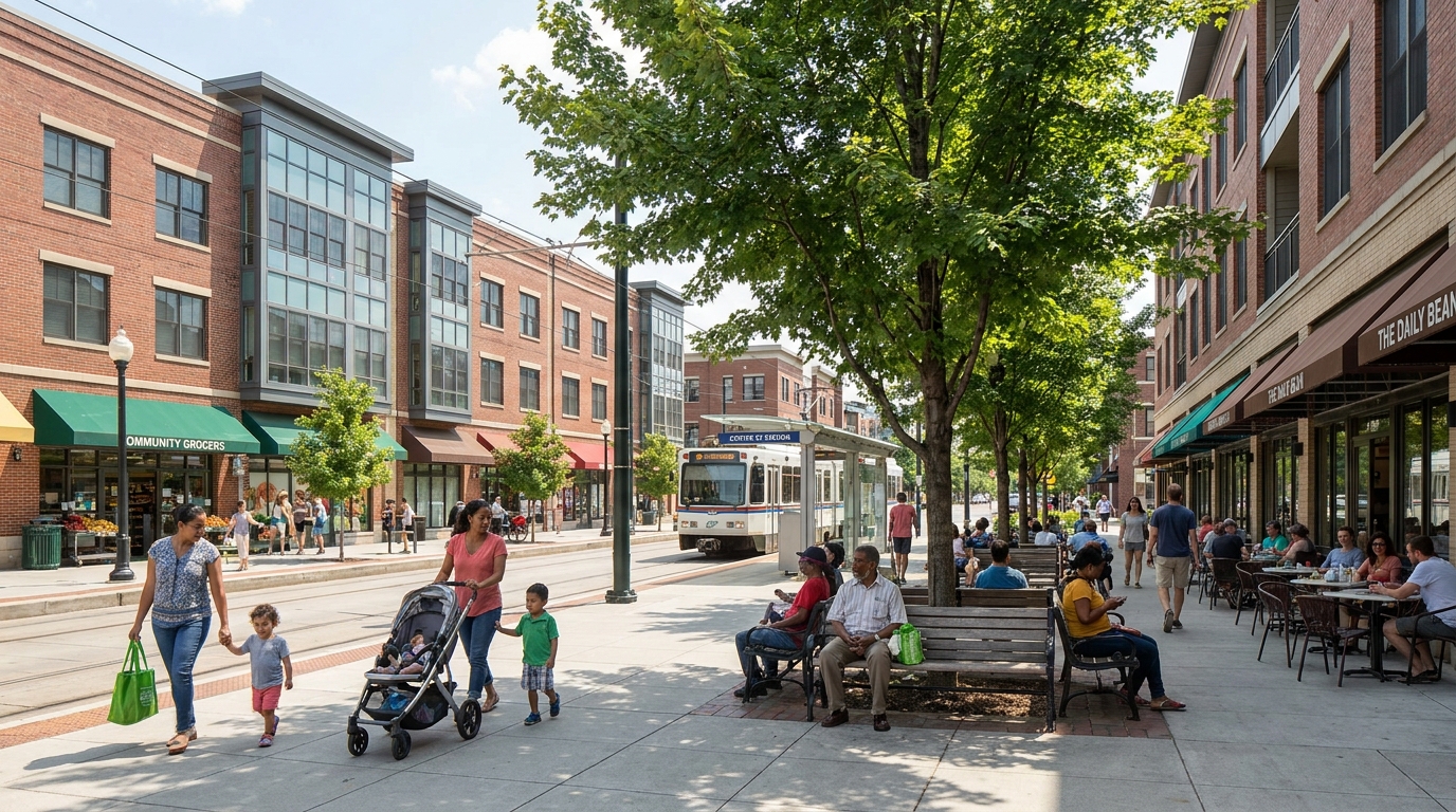
Walkability and transit are mutually reinforcing. Very few transit trips begin and end without walking, which means the quality of the pedestrian environment directly affects the usefulness of the transit system. A bus stop or rail station that is physically close but difficult to reach is less valuable than one embedded in a safe and attractive walking network. Transit-oriented development succeeds when station areas are designed as complete places rather than isolated infrastructure nodes.
Good multimodal integration also expands opportunity beyond the immediate neighborhood. Walkable communities do not need to contain every possible destination within a few blocks. They need to provide convenient access to a larger network of destinations through transit and active modes. This is especially important for employment, education, healthcare, and regional mobility. When planners align density, street design, and transit service, they create a broader geography of access that supports both local and metropolitan growth.
Traffic calming and street design for safety
Speed management is fundamental to pedestrian-friendly environments. A street can have beautiful sidewalks and active storefronts, but if traffic speeds remain high, many users will still feel unsafe. Traffic calming strategies such as narrowed lanes, tighter curb radii, raised intersections, textured paving, on-street parking buffers, and tree-lined edges all help communicate that the street is a shared civic space rather than a traffic corridor alone. Complete streets frameworks in cities such as Toronto, Calgary, and Ottawa reflect this broader design philosophy by explicitly accommodating walking, cycling, transit, and driving.
Safer street design is also one of the more publicly understandable components of walkability. The CDC trade-off study found that about 33 percent of adults strongly favored safer street design even if driving became slower, while only 19 percent strongly favored walkable destinations if homes were closer together. This suggests that while the public often recognizes the value of safety improvements, support for the land use changes associated with walkability can be more conditional. For planners and decision-makers, that means safety can be a powerful entry point, but long-term walkability still requires deeper conversations about density, land use, and neighborhood evolution.
The Economic Logic of Walkable Urban Form
Walkable communities are often marketed through quality-of-life language, but their economic case is just as compelling. A walkable district tends to support stronger local commerce because foot traffic is built into the environment. Businesses benefit from visibility, repeat visits, and a customer base that does not depend entirely on available parking. Streets with active storefronts, residential density, and regular pedestrian movement create a more resilient local economy than areas where commercial activity is isolated in large-format destinations surrounded by surface parking.
From a municipal finance perspective, walkability can also contribute to stronger tax productivity. Compact, mixed-use areas often generate more economic activity per acre than low-density, auto-oriented forms. They direct investment toward existing infrastructure and make better use of already serviced land. This matters for long-term fiscal sustainability because sprawling growth patterns usually create larger liabilities for roads, utilities, and public services across wider geographies. Walkable growth, especially when tied to infill and transit corridors, can improve the return on infrastructure already in place.
Households benefit economically as well. Reduced reliance on driving can lower expenses related to fuel, insurance, vehicle ownership, maintenance, and parking. For many families, transportation is one of the largest recurring costs after housing. In practical terms, walkability expands economic resilience by giving households more mobility choices. A family does not need to eliminate car use entirely to experience savings. Even reducing the number of required vehicle trips or delaying the need for a second car can materially improve financial flexibility.
Walkability can also influence land value and development feasibility in important ways. Neighborhoods with strong access, mixed uses, transit connections, and high-quality public realm often become more attractive to both residents and employers. That can support absorption, sustain commercial demand, and justify investments in housing typologies that depend on amenity-rich environments. In growth planning, this is where walkability becomes more than a social good. It becomes a value framework for long-term urban competitiveness.
Social, Health, and Equity Benefits Beyond Transportation
The social value of walkable communities is often visible in ways that data only partly captures. Streets that are comfortable for walking create more opportunities for casual interaction, neighborhood familiarity, and civic presence. People see one another more often. Public space is used more consistently. Children gain greater independence when basic destinations can be reached safely on foot. Older adults can remain active and connected even when driving becomes less practical. These conditions strengthen community life in ways that are difficult to engineer through private space alone.
Public health outcomes are also closely tied to the built environment. When walking is integrated into daily routines, physical activity becomes less dependent on scheduled exercise and more embedded in ordinary life. That matters because health outcomes improve most consistently when healthy behavior is easy and routine. The CDC’s guidance on activity-friendly communities underscores that walkability supports not only physical activity but also better safety, social interaction, improved local economies, and cleaner air. In this sense, urban design acts as preventive infrastructure.
Equity is another central dimension. Car-dependent communities can create serious barriers for people who cannot drive, cannot afford to drive, or should not be expected to drive for every daily need. That includes many seniors, youth, people with disabilities, lower-income households, and residents navigating temporary life constraints. Walkable design broadens access by making the city more usable for a wider share of the population. Features such as accessible curb ramps, smooth sidewalks, shorter crossings, transit integration, and well-located services improve inclusion not as a special program but as a normal part of the urban environment.
Canadian public-health guidance increasingly recognizes these relationships, emphasizing mixed land use, safe streets, and proximity between homes and services as key supports for active transportation. This shift is important because it frames walkability as a public systems issue rather than a niche urban design preference. A healthier, more accessible neighborhood is not simply nicer. It is more socially functional and more just.
Walkability Is Not Just for Downtowns
One of the most persistent misconceptions about walkable communities is that they are only achievable in dense urban cores. In reality, walkability is adaptable across a range of contexts, including suburban districts, small towns, and rural centers. The exact form will differ, but the principles remain consistent: connected routes, safe crossings, useful destinations, and a public realm designed for everyday movement rather than exclusively for cars.
In suburban settings, this may mean retrofitting arterial corridors with mixed-use nodes, improving pedestrian links between residential areas and commercial plazas, and introducing missing housing types near transit and services. In small towns, it may involve reinforcing a traditional main street, improving accessibility, and allowing more housing within walking distance of schools, shops, and civic institutions. In rapidly growing edge areas, it may require planning connected block structures and local destinations before auto-oriented patterns become locked in.
What changes from place to place is not the value of walkability but the implementation pathway. Some communities will focus on infill around existing transit. Others will prioritize school access, neighborhood centers, or downtown revitalization. The strategic principle is that every community can improve its location efficiency and mobility options by bringing daily destinations closer together and making walking safer and more practical.
The Role of Policy, Planning, and Governance
Walkable communities do not emerge by accident. They are typically the result of deliberate policy choices across planning, transportation, infrastructure, and development regulation. Municipal official plans, zoning bylaws, street design manuals, parking standards, capital budgets, and transit strategies all influence whether walkability becomes possible at scale. This is why implementation often succeeds only when multiple departments and levels of government move in the same direction.
Canada’s National Active Transportation Strategy is a meaningful example of this policy alignment. Described by the federal government as the country’s first coast-to-coast-to-coast strategic approach to promoting active transportation and its benefits, it signals that walking and cycling are no longer peripheral issues. They are now linked to investment, data collection, and long-term infrastructure planning. This matters because local governments often need both financial support and policy legitimacy to redesign streets, improve accessibility, and prioritize active transportation networks.
Municipal complete streets policies are equally important because they translate high-level goals into practical design standards. When cities adopt complete streets frameworks, they acknowledge that roads are not solely for moving vehicles efficiently. They are public assets that must accommodate a range of users and support broader urban outcomes. This reframing has major implications for corridor redesign, redevelopment approvals, and capital project evaluation.
Zoning reform is another critical lever. If planning frameworks continue to separate uses rigidly, limit small-scale retail in residential areas, or restrict housing near transit and services, walkability remains constrained regardless of streetscape improvements. To design walkable communities, municipalities often need to permit more mixed-use development, more varied housing forms, and more compact growth patterns in strategic areas. The result is not density for its own sake. It is a better alignment between population, services, and access.
Common Trade-Offs and Why Projects Face Resistance
Despite broad support for safer streets and better communities, walkability projects often encounter resistance. This is not surprising. Walkable growth can involve visible changes to parking supply, street space allocation, building form, traffic operations, and neighborhood expectations. Residents may support the idea of pleasant, accessible communities in principle while expressing concern about local impacts such as congestion, density, curbside changes, or perceived loss of convenience.
The CDC trade-off findings help explain this dynamic. Many adults strongly support safer street design, but fewer strongly favor denser, more walkable destinations when those changes imply homes being closer together. This suggests that implementation succeeds when leaders communicate the full package of benefits rather than presenting walkability as a narrow transportation intervention. The case must connect safety, affordability, economic vitality, climate resilience, accessibility, and infrastructure efficiency.
Parking is one of the most common flashpoints. In many municipalities, parking has historically been treated as an unquestioned land use entitlement. Yet excessive parking requirements can undermine walkability by spreading destinations farther apart, inflating development costs, and consuming land that could otherwise support housing, retail, trees, or public space. Reducing parking minimums or reallocating curb space often triggers concern, but in walkable districts these changes can improve access overall by supporting a more balanced transportation system.
Density can be another point of tension, particularly where communities associate it with overcrowding rather than with service viability and housing choice. The planning challenge is to demonstrate that well-designed density supports local shops, better transit, stronger public space, and more efficient infrastructure. Higher density does not automatically reduce livability. In many cases, when paired with good design and nearby destinations, it is what makes walkability possible.
Strategic Approaches for Planners and Developers
For planners and developers working on growth areas, infill sites, or corridor regeneration, the question is not whether walkability is desirable. It is how to deliver it in a way that is feasible, durable, and aligned with market and infrastructure realities. The most successful projects usually start by identifying where access advantages already exist. Transit stations, aging commercial strips, institutional anchors, underused parking lots, and established neighborhood nodes often provide the best foundation for walkable transformation.
A strategic approach also means thinking in phases. Few communities become fully walkable at once. Progress often begins with a combination of zoning reform, public realm upgrades, safer crossings, and targeted mixed-use development around key destinations. Over time, as more housing and services accumulate, walking becomes more practical for a larger share of trips. This gradualism is important because it allows public investment and private development to reinforce one another rather than operate in isolation.
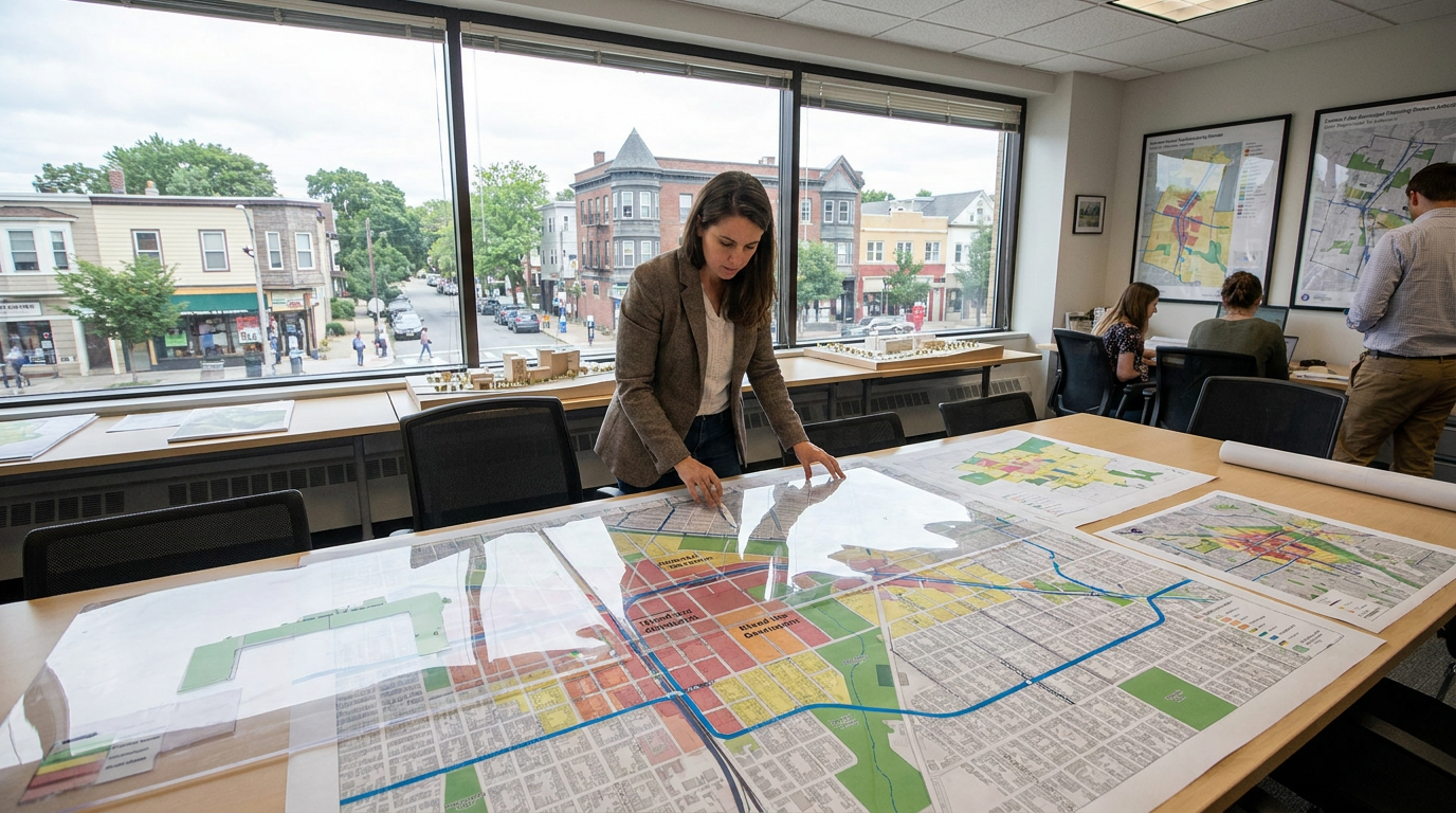
Infrastructure prioritization should follow the same logic. Sidewalk upgrades, intersection redesigns, street trees, lighting, accessible transit stops, and traffic calming measures yield the greatest value when they connect people to meaningful destinations. Data tools such as walkability indices, smart location metrics, and location-efficiency analysis can help municipalities identify where investment will produce the strongest returns. The goal is not to improve every street at once. It is to create connected networks of usefulness.
Developers also have a substantial role to play. Site design, building placement, ground-floor activation, block structure, retail programming, and mobility planning all influence whether a project contributes to or undermines walkability. Projects that turn inward, front major streets with blank walls, or separate uses too aggressively may limit long-term urban value even if they meet immediate market demand. By contrast, projects that engage the street, support multiple modes, and fit into a broader complete-community framework can hold strategic value far beyond the parcel itself.
What the Future of Sustainable Urban Growth Looks Like
The direction of urban planning in North America is increasingly clear. Walkability is moving from advocacy language into mainstream planning practice. Federal active transportation strategies, municipal complete streets standards, healthy built environment policies, transit-oriented development frameworks, and 15-minute city discussions all point toward the same conclusion: cities need growth models that produce more access with fewer burdens. That is precisely what walkable communities are designed to do.
This does not mean every neighborhood will look the same or that every trip will be taken on foot. It means the next generation of urban growth must be more intentional about how land use, mobility, and infrastructure interact. A sustainable city is not simply denser or greener in the abstract. It is more capable of helping residents reach daily needs safely, affordably, and efficiently. Walkability is one of the most practical ways to deliver that capability.
For decision-makers, the strategic opportunity is substantial. Investments in walkability can improve safety, support local business, expand transportation choice, strengthen tax productivity, and make housing growth more functional. For residents, walkable communities offer something equally valuable: more time, more independence, lower transportation costs, and a stronger connection to place. For cities facing long-term growth pressures, these are not soft benefits. They are core indicators of urban resilience.
Designing walkable communities is therefore not about nostalgia for traditional neighborhoods or aesthetics alone. It is about building places that perform better over time. It is about creating urban form that supports households, businesses, infrastructure systems, and public life simultaneously. In the years ahead, the cities that grow most successfully will be the ones that understand this clearly and plan accordingly.
Conclusion
Walkable communities represent one of the most effective strategies available for sustainable urban growth. They align transportation, land use, housing, health, and economic development in ways that create long-term value for both residents and municipalities. The evidence from Canadian and U.S. policy guidance is increasingly consistent: mixed land use, connected street networks, safe crossings, transit access, and complete streets design produce communities where people can move more easily, spend less on transportation, and enjoy better access to daily life.
The challenge is not defining walkability. The challenge is delivering it with enough strategic clarity to overcome fragmented planning, outdated standards, and public hesitation around change. That requires leadership from planners, governments, and developers who understand that walkability is not a niche amenity. It is foundational infrastructure for a more resilient urban future.
As cities continue to grow, the question is no longer whether walkable design matters. The question is whether communities are willing to treat it as the serious economic, social, and planning priority it has become. The places that do will not only be easier to walk through. They will be better positioned to thrive.



No Comment! Be the first one.