Ontario Line Construction Is Now Becoming a Development Signal
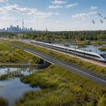
The Ontario Line has moved from policy promise to physical urban infrastructure. New drone images released by Metrolinx and reported by Ontario Construction News show major progress on the northern section of the line, where excavation, foundations, piers, guideway piles, bridge works, and early station structures are now becoming visible across Toronto’s northeast.
For developers, planners, and landowners, that visibility matters. Transit projects change land economics long before opening day, but the market often treats above-ground construction as a different class of signal. It reduces uncertainty. It confirms alignment. It begins to shift the conversation from speculative future access to measurable place-making around station areas.

The northern works are especially important because they run through areas where Toronto’s growth pressure, employment lands, apartment neighbourhoods, ravine systems, and infrastructure constraints all collide. Thorncliffe Park, Flemingdon Park, the Don Valley corridor, and the Don Mills connection are not blank-slate development zones. They are complex urban environments where new transit capacity must be integrated with existing communities, roads, utilities, open space, and long-term housing demand.
Trillium Guideway Partners, led by Acciona and AMICO, is delivering major civil works on this section, including elevated guideways, stations, bridges, and related infrastructure. The project details highlighted by Metrolinx are not minor construction updates. Foundation structures for the Don Valley bridge, piers at Thorncliffe Park Station, excavation for the operations, maintenance and storage facility, retaining wall work near Beth Nealson, and station-related works at Flemingdon Park and Don Valley are all indicators that this corridor is moving into a more consequential phase.
Once major transit infrastructure becomes visible, land strategy around the corridor becomes less theoretical and more time-sensitive.
The development implication is clear: station-area planning in the northeast should now be treated as active growth strategy, not future visioning. The Ontario Line will connect Exhibition Place, the downtown core, east Toronto, and the Eglinton Crosstown at Don Mills Road. That network effect is what creates value. A station is not just a mobility node. It is a permissions signal, an infrastructure anchor, and a reason to reconsider density, mixed-use formats, public realm investment, and housing supply around access points.
The more difficult question is whether zoning, servicing, and local planning frameworks will move fast enough to capture the public investment. Transit alone does not produce housing. It creates the conditions for housing, but only if policy, land assembly, approvals, and infrastructure capacity align. In corridors like this, the market will watch for secondary plan updates, major transit station area permissions, parking reductions, community benefit expectations, and any municipal moves that either unlock or slow intensification.
Large-scale investors should also pay attention to the operations, maintenance and storage facility. These facilities are often viewed only as technical infrastructure, but they shape surrounding land use, access patterns, employment activity, and future compatibility discussions. Their placement can stabilize certain uses while limiting others. That matters for anyone underwriting land near the corridor.
The Ontario Line’s northern construction progress is not just a transit milestone. It is a land-use milestone. The next phase belongs to those who can read the corridor before the ribbon cutting: where density will be supported, where infrastructure remains constrained, where communities will resist poorly framed growth, and where public transit investment will translate into durable urban value.
Source: Ontario Construction News