



Urban population growth is one of the clearest signals shaping the future of cities. It influences where homes need to be built, how roads and transit systems are designed, where schools and hospitals must expand, and how governments think about resilience, affordability, and long term infrastructure costs. In Canada and across North America, this growth is not a simple story of more people moving into downtown towers. It is a more complex pattern involving metropolitan expansion, suburban edge growth, migration shifts, changing household formation, and rising pressure on systems that were often designed for slower change.
Table Of Content
- Why Urban Population Growth Matters More Than Ever
- Urban Growth Is Not Just Downtown Growth
- The Importance of Functional Urban Areas
- The Main Drivers Behind Urban Population Growth
- Reading the Data: What the Numbers Actually Tell Us
- How Data Analytics Changes Urban Population Analysis
- Smart City Technology and the Response to Growth
- Digital Twins, Scenario Modeling, and Urban Foresight
- The Infrastructure Challenge: Growth Must Be Serviced
- Housing, Affordability, and the Population Signal
- Governance, Privacy, and the Limits of Smart Systems
- Common Misconceptions About Urban Population Growth
- What Smarter Urban Growth Management Looks Like
- Conclusion: The Future of Urban Intelligence
- Key Takeaways
That complexity is exactly why population growth analysis has become a data problem as much as a demographic one. Traditional census snapshots still matter, but they no longer provide enough speed or granularity for cities that are managing rapid change. Urban leaders increasingly need integrated intelligence from census data, GIS layers, administrative records, mobility systems, utility networks, and IoT sensors to understand not only how many people are arriving, but where they are settling and what services will be strained next.
This matters because growth can improve economic vitality while also exposing structural weaknesses. A city can add residents and still lose livability if housing supply lags, commute times rise, and water or transit systems fall behind demand. The practical challenge is not just absorbing growth, but directing it with enough intelligence to preserve quality of life.
In this article, we will examine the major trends behind urban population growth, with a focus on Canada and the wider North American context. We will also explore how data analytics, AI, digital twins, and smart city systems are changing the way planners interpret these shifts and respond to them. The most important takeaway is simple: urban population growth is not merely a size issue. It is an urban intelligence issue.
Why Urban Population Growth Matters More Than Ever
Urbanization is now the dominant demographic pattern in much of the world. The United Nations has reported that more than half of the global population lives in urban areas, and that urbanization will continue to rise over time. That long term movement has major implications because cities concentrate jobs, housing demand, emissions, public infrastructure, and economic opportunity in the same physical systems. As urban populations expand, the margin for planning error becomes smaller.
In Canada, the trend is especially pronounced. According to the 2021 Census, all 41 of Canada’s large urban centres experienced population growth between 2016 and 2021. During that same period, 83.9% of Canadians lived in a census metropolitan area or census agglomeration. These are not minor statistical details. They show that the overwhelming majority of population pressure is now linked to urban and metropolitan systems rather than isolated local jurisdictions.
The implications are broad. Housing markets feel pressure first because households need to be placed somewhere quickly. Transit systems feel it through ridership shifts and commuting expansion. Water, wastewater, roads, schools, healthcare, and emergency services all experience secondary strain. Climate adaptation also becomes more urgent because larger urban populations increase exposure to heat, flooding, and infrastructure failure.
What makes this moment different from previous decades is the speed and volatility of the change. Statistics Canada reported a strong rebound in growth across large urban regions in 2021 and 2022, with many census metropolitan areas recording their fastest annual growth since at least 2001 and 2002. Growth remained positive more recently as well, though at a slower pace. For planners, this means static assumptions no longer work. Population demand is persistent, but its timing and geography can shift quickly.
Urban Growth Is Not Just Downtown Growth
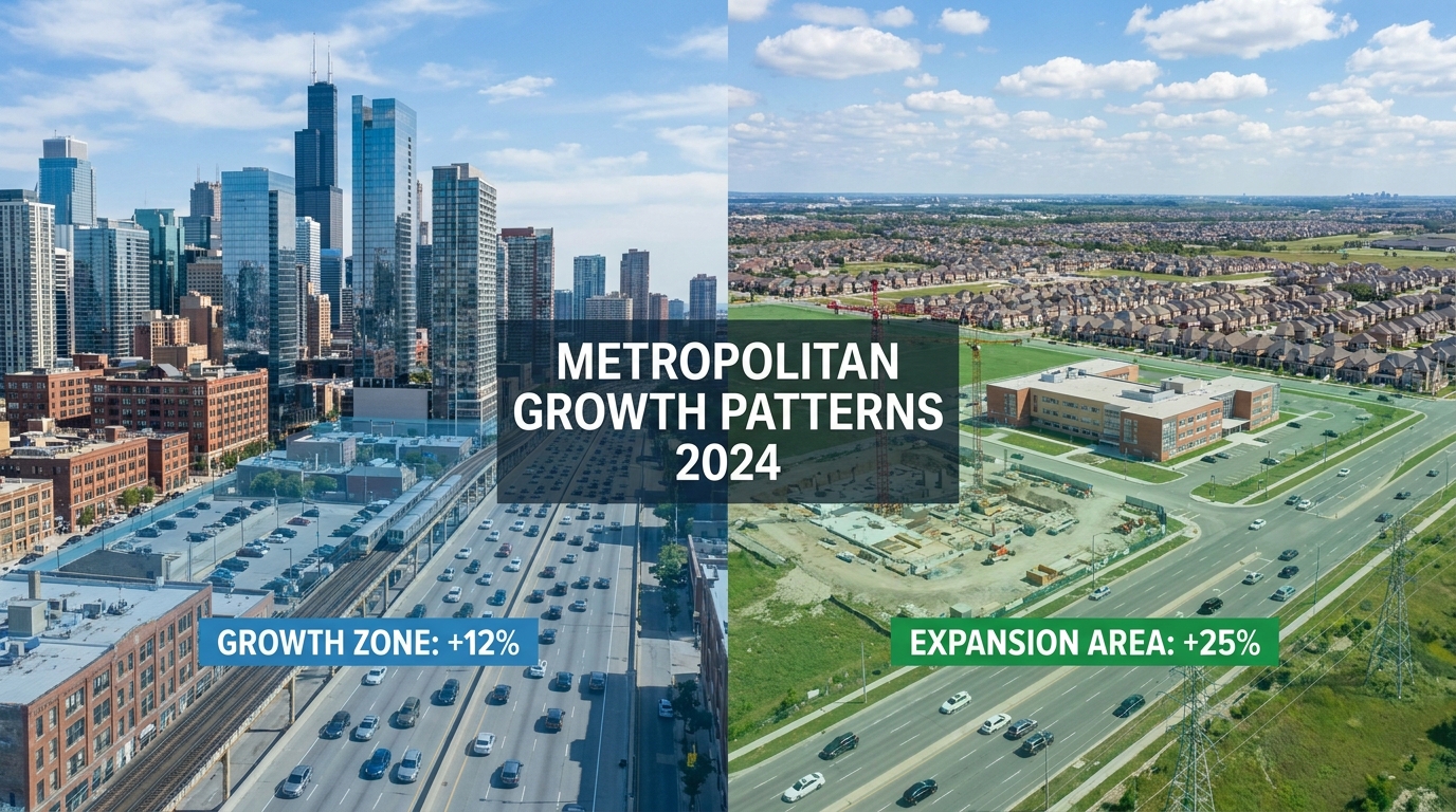
One of the most common misconceptions in public discussion is that urban population growth mainly means denser downtowns. In reality, much of the change in North America happens outside the traditional core. Statistics Canada found that many of the fastest growing municipalities from 2016 to 2021 were located on the outskirts of major metro areas. This pattern points to suburbanization, commuting belt expansion, and the continued pull of lower density residential development near large employment regions.
That distinction matters because growth at the edge creates a very different planning challenge from growth in established urban neighbourhoods. A downtown district adding thousands of residents may need school capacity, utility upgrades, and better transit frequency, but the basic network is often already there. A fast growing fringe municipality may require entirely new roads, water systems, stormwater infrastructure, transit links, and social services. The capital cost per new resident can be much higher when development spreads outward.
At the same time, urban edge growth is not inherently negative. For many households, peripheral growth reflects affordability constraints, preferences for more space, or proximity to emerging employment nodes. The planning problem is not that suburban growth exists. The problem arises when population growth outpaces transportation options, infrastructure financing, or regional coordination.
That is why analysts increasingly avoid treating municipal boundaries as the full story. A city can appear stable within its official border while surrounding municipalities absorb substantial growth that still depends on the same labour market, highways, hospitals, airports, and transit corridors. If decision makers only measure the core municipality, they risk underestimating the true footprint of urban demand.

The Importance of Functional Urban Areas
To understand modern population growth properly, the idea of the functional urban area is essential. The OECD has emphasized that cities should often be defined using density and commuting patterns rather than administrative boundaries alone. This approach captures the real economic geography of urbanization, which is especially important in North America where development often stretches across multiple municipalities with deeply connected labour markets.
A functional urban area reflects how people actually live and move. Residents may work in one municipality, live in another, attend school in a third, and use healthcare or retail services across the region. If analysis is restricted to one city hall boundary, the resulting picture can be misleading. Population growth may seem modest in one jurisdiction while the wider region experiences intense housing and mobility pressure.
Canada’s census metropolitan areas already point in this direction by grouping urban cores with surrounding municipalities linked through commuting patterns. This makes them far more useful for growth analysis than narrow municipal counts. For policymakers, this also supports a more realistic conversation about who benefits from growth, who pays for infrastructure, and where service demand actually lands.
Functional thinking changes planning decisions in practical ways. It improves transit modeling because commuting corridors become visible across the entire region. It improves housing analysis because supply can be assessed relative to metropolitan demand rather than one local zoning map. It improves infrastructure planning because water, waste, roads, and emergency systems can be understood as shared regional networks rather than isolated assets. In fast growing metropolitan areas, that shift from local to regional intelligence is critical.
The Main Drivers Behind Urban Population Growth
Urban population growth does not come from a single source. It typically reflects a combination of international migration, interprovincial or interstate migration, natural increase, local economic opportunity, educational concentration, and changing household patterns. In recent years, migration has been a particularly important factor in Canadian urban growth, especially in major metropolitan regions that attract newcomers through employment, institutions, and social networks.
Housing supply also shapes the geography of growth. When central neighbourhoods become too expensive or too constrained by limited supply, population pressure does not disappear. It relocates. Households look toward suburban municipalities, exurban communities, and transit accessible edge zones where homes are relatively more attainable. This often produces the outward growth pattern that census data captures around major metropolitan regions.
Demographic structure matters as well. Aging populations influence the types of housing and services cities need, while younger adult migration affects rental demand, transit use, and household formation. A city gaining many students and early career workers will experience different infrastructure needs from one growing through family formation in peripheral subdivisions. The headline growth number may look similar, but the service profile is very different.
Economic restructuring adds another layer. Hybrid work, logistics expansion, advanced manufacturing, healthcare growth, and knowledge sector clustering all influence where population concentrates. In some regions, remote or flexible work has reduced the need to live in the downtown core every day, making outer municipalities more attractive. In others, central city employment continues to pull residents inward despite high costs. This is one reason urban growth is never uniform across North America. Local context still determines the shape of the trend.
Reading the Data: What the Numbers Actually Tell Us
Population growth analysis starts with census and demographic estimates, but the most useful interpretation comes from combining sources. Census data gives validated benchmarks and broad structural trends. Administrative records can reveal changes in school enrollment, health registrations, or building activity. Mobility data shows commuting flows and congestion. Utility demand indicates where service pressure is rising. GIS layers help connect all of that information spatially, which is crucial because location is the real engine of urban planning.
Consider the Canadian pattern from 2016 to 2021. Canada overall grew 5.2% over that period, while all metropolitan areas grew 6.1%, and every one of the 41 large urban centres posted positive growth. That confirms a broad national urbanization trend. But on its own, that statistic does not tell planners where road widenings are needed, where school capacity is about to fail, or where rental markets are becoming dangerously tight. Those questions require local and regional layering of data.
This is where analytics becomes powerful. Instead of asking only how many people were added over five years, cities can ask sharper questions. Which neighbourhoods are adding families versus single person households? Where is permit activity strong but occupancy lagging? Which commuter corridors are experiencing the steepest pressure? How does growth overlap with flood risk or transit accessibility? The better the data architecture, the more targeted the policy response becomes.
Good analysis also helps avoid false conclusions. For example, rising population in a municipality does not automatically mean stronger livability. If housing completions trail migration, rents may surge. If transit capacity is not upgraded, travel times worsen. If hospitals and schools do not expand, public systems strain. Growth can be a sign of success, but only if infrastructure and governance scale with it.
How Data Analytics Changes Urban Population Analysis
For decades, population planning often relied on periodic census releases and long range projections built from historical averages. That approach still has value, but it is too slow for cities where growth conditions can change sharply within a year. Data analytics introduces a more dynamic model. Instead of occasional snapshots, planners can work with continuous signals from multiple systems to detect emerging growth hotspots and service risks earlier.
The OECD has noted that smart cities depend on real time data for policy and public service delivery. That includes mobility feeds, sensor networks, digital service records, environmental monitoring, and utility operations. In the context of population growth, these datasets act like an early warning system. Rising transit boardings, increased water demand, new school registrations, or changing mobile movement patterns can reveal that a district is absorbing population faster than official counts alone may show.
Spatial analytics is especially important because urban growth is never evenly distributed. GIS tools help cities map development permits, land values, demographic shifts, zoning constraints, transit access, and infrastructure capacity in the same visual environment. That allows planners to identify not just where growth is occurring, but whether the local system can support it efficiently. A neighbourhood with strong transit access and underused utility capacity may be a logical target for intensification. A fringe area with weak infrastructure may require phased growth or a different investment sequence.
Forecasting models add another layer of intelligence. With enough data quality, cities can test scenarios around migration, housing starts, household size, labor market shifts, and climate exposure. These models do not predict the future with certainty, but they reduce guesswork. They help planners compare outcomes and prioritize investments where the consequences of being wrong would be most costly.
Smart City Technology and the Response to Growth
Understanding growth is only one half of the equation. The other half is responding to it in ways that are efficient, inclusive, and resilient. This is where smart city technology becomes valuable. The OECD highlights AI, big data, and IoT as core tools for improving public services. In practical terms, these technologies allow cities to adapt infrastructure operations in response to changing population demand instead of relying entirely on fixed assumptions.
Transit is a good example. Population growth changes commuting patterns, but those changes may be uneven by corridor, time of day, or season. Smart scheduling systems can analyze ridership data continuously and adjust service levels more precisely. Traffic management systems can optimize signal timing in congested growth areas. Parking data can help reduce bottlenecks in high demand districts. None of these tools replaces physical investment, but they make existing systems perform better while larger projects are planned.
Utilities are another major application. Water, wastewater, and energy systems are under growing pressure in expanding metropolitan regions. Sensor enabled monitoring can detect unusual demand, leaks, overload risks, and maintenance needs in near real time. For fast growing communities, this supports more efficient infrastructure lifecycle planning because cities can prioritize upgrades based on actual stress rather than generalized assumptions.
Emergency response also benefits from urban intelligence. As population density and regional sprawl increase, response times can become harder to maintain. Smart routing, real time traffic data, and predictive modeling help emergency services deploy resources more effectively. During extreme weather events, integrated data systems can also identify vulnerable neighborhoods where growth has increased exposure but infrastructure resilience remains weak.
Waste collection, street operations, and public facility management are often less visible, yet they matter for everyday urban quality of life. Growth adds pressure on these systems too. Digital optimization tools can improve route planning, reduce fuel use, and ensure that basic municipal services keep pace with changing population distribution. Over time, these operational gains become meaningful because they lower friction in rapidly expanding cities.
Digital Twins, Scenario Modeling, and Urban Foresight
One of the most promising innovations in urban intelligence is the use of digital twins. A digital twin is a virtual model of a city or infrastructure system that integrates real and historical data to simulate conditions and test scenarios. For population growth planning, this is especially valuable because it allows decision makers to ask what happens if a district gains 20,000 more residents, if a transit line opens earlier than expected, or if climate risk intersects with high growth housing development.
Digital twins support smarter trade offs. A city can compare whether to invest first in a sewer expansion, a bus rapid transit corridor, or a school cluster by modeling how each choice interacts with projected growth. It can test densification strategies around stations, evaluate congestion outcomes, and identify infrastructure bottlenecks before they become expensive failures. In a constrained fiscal environment, this kind of simulation makes capital planning more strategic.
The value here is not only technical. It also improves communication. Population growth can be politically contentious because residents worry about traffic, affordability, service quality, and neighborhood change. Scenario models help governments explain the consequences of different choices in concrete terms. They make planning debates less abstract and more evidence based.
Still, digital twins are only as useful as the data and governance behind them. If data is fragmented, outdated, or inconsistent across departments, the model will inherit those weaknesses. That is why the intelligence layer of urban planning must include not just software, but standards, coordination, and institutional capacity.
The Infrastructure Challenge: Growth Must Be Serviced
Population growth creates a simple but expensive reality: every new resident depends on infrastructure. Some of that demand is visible, such as traffic, crowded buses, or rising rents. Some of it is less visible, such as wastewater capacity, stormwater drainage, transformer loads, or emergency service coverage. The deeper challenge is that infrastructure systems often have long planning timelines, while population growth can accelerate much faster.
Lower density growth at the metropolitan edge illustrates this tension clearly. New subdivisions may be approved relatively quickly, but the roads, transit links, water mains, schools, and recreation facilities needed to support them can take years to finance and build. If growth arrives before service capacity does, quality of life declines and long term costs rise. This is one reason urban sprawl remains such a difficult planning issue.
Densification, by contrast, can make better use of existing infrastructure, but it also has limits. Transit lines can become overcrowded. Aging pipes in older neighbourhoods may need replacement. Public space and social infrastructure must adapt to higher intensity use. In other words, neither edge growth nor core growth is automatically easy. Each pattern needs tailored analysis.
Infrastructure lifecycle planning is becoming more important because cities are now managing both expansion and renewal at the same time. Many mature systems across North America already require rehabilitation, even as urban populations continue to rise. Data driven asset management helps prioritize investments by showing where growth and asset deterioration overlap. That is a far better approach than treating all infrastructure needs as separate line items without a shared geographic logic.
Housing, Affordability, and the Population Signal
No discussion of urban population growth is complete without housing. Population growth does not automatically create a housing crisis, but when supply fails to keep pace, affordability deteriorates quickly. This is especially visible in large metropolitan regions where demand is strong, land is limited, and regulatory processes are slow. In these conditions, growth data becomes a critical signal for housing policy rather than a background statistic.
Better population analysis helps cities and regions understand what kinds of housing are actually needed. A rising number of families may require larger units, schools, and parks near transit. Growth driven by students or younger workers may increase demand for rental housing in accessible employment zones. Aging populations may need more accessible units near services. Without this demographic detail, housing strategy becomes too generic to be effective.
Transit oriented development is often one of the most useful responses because it aligns housing growth with mobility infrastructure. When higher density housing is concentrated near frequent transit, cities can reduce car dependence, limit congestion growth, and use land more efficiently. But this only works when zoning, service planning, infrastructure finance, and market conditions are coordinated. Population growth data helps determine where those alignments are strongest.
There is also a timing issue. Housing systems often react slowly, while population pressures can rise quickly. That mismatch is why high frequency indicators matter. Building permits, completions, rental vacancy, migration flows, and household formation trends should be monitored together. The objective is not simply to count new residents, but to identify where demand is intensifying before affordability stress becomes extreme.

Governance, Privacy, and the Limits of Smart Systems
Smart tools are powerful, but they are not a substitute for governance. The OECD has been clear that smart city data systems face real barriers, including privacy concerns, interoperability problems, cybersecurity risks, skills gaps, and funding constraints. This is one of the most important realities in urban intelligence. Cities can collect enormous volumes of data, but if they cannot store, process, govern, and share it responsibly, the value remains limited.
Privacy is especially important when population analysis begins to incorporate high frequency mobility or behavioral data. Residents need confidence that data is being anonymized, protected, and used for legitimate public purposes. Public trust is not a secondary issue. Without it, even technically strong initiatives can face resistance or fail to scale.
Interoperability is another challenge. Urban growth touches planning, transit, housing, utilities, emergency management, and finance, yet these functions often operate on separate systems with different standards. If departments cannot connect datasets, the city loses the integrated view required for effective decision making. Cross departmental coordination is therefore as important as the software itself.
Capacity also matters. Smaller municipalities in fast growing metropolitan regions may experience the greatest pressure but have the fewest technical resources. Regional partnerships, provincial support, and shared data platforms can help bridge that gap. Growth is regional, so in many cases the intelligence response should be regional too.
Common Misconceptions About Urban Population Growth
Several misconceptions continue to distort public understanding of population growth. The first is the idea that urban growth means downtown growth. As the data shows, much of the expansion occurs in suburbs, exurbs, and commuting zones. Ignoring that geography leads to poor transportation and infrastructure planning because the real demand pattern is spread across the metropolitan region.
The second misconception is that official municipal boundaries tell the whole story. They often do not. Functional urban areas and census metropolitan areas are usually better tools because they reflect commuting and economic integration. This matters for everything from transit to housing targets to infrastructure cost sharing.
A third misconception is that growth always improves prosperity and livability. Growth can support economic dynamism, but without housing, mobility, and service capacity it can also worsen congestion, affordability, and inequality. Population increase is not automatically a success metric unless systems adapt with it.
The fourth misconception is that smart city tools can solve urban growth on their own. They cannot. Technology is a decision support layer, not a substitute for planning, governance, public engagement, or capital investment. Better dashboards do not fix an undersupplied housing market by themselves, and predictive models do not replace the need for political choices.
What Smarter Urban Growth Management Looks Like
The most effective approach to urban population growth combines demographic analysis, spatial intelligence, infrastructure planning, and governance discipline. Cities that manage growth well tend to monitor data continuously, plan at the metropolitan scale, and align land use with transportation and service capacity. They do not rely on one dataset or one department. They build an intelligence layer that connects systems.
In practice, that means several things. It means using census data as a foundation, but updating the picture with mobility, utility, permit, and administrative records. It means planning around functional urban areas instead of narrow municipal assumptions. It means identifying where densification can be supported efficiently and where edge growth requires careful phasing. It also means treating digital infrastructure, data standards, and cybersecurity as core urban assets rather than optional extras.
It further means acknowledging volatility. Post pandemic rebounds in Canadian metropolitan growth demonstrated how quickly urban demand can shift. Cities should build forecasting frameworks that can be updated often, test multiple scenarios, and guide investment under uncertainty. The goal is not to predict perfectly. The goal is to reduce blind spots.
Urban population growth is not just about counting people. It is about understanding where pressure is building, which systems are vulnerable, and how data can guide a faster, fairer response.
For the public, this framing is useful because it connects abstract demographic change to daily experience. Housing affordability, commute times, school crowding, emergency response, and climate resilience are all downstream effects of how well a city interprets and manages growth. When growth is treated as an intelligence problem, these issues become more measurable and therefore more manageable.
Conclusion: The Future of Urban Intelligence
Urban population growth will remain one of the defining planning issues of the coming decades. In Canada, the evidence is already clear: urban centres continue to grow, metropolitan regions absorb the bulk of demand, and suburban fringes play a larger role than many people assume. Across North America, the same broad pattern is visible, though each region experiences it differently depending on migration, housing supply, economic structure, and governance capacity.
The most important shift is methodological. Cities can no longer understand growth through occasional population counts alone. They need integrated, real time, spatially aware data systems that reveal how people move, where they settle, and which infrastructure networks are reaching their limits. Analytics, AI, GIS, IoT, and digital twins do not eliminate the hard choices of urban planning, but they make those choices more informed.
That is why the future of urban growth management belongs to cities that can connect data to action. They will be better positioned to expand housing where it is most viable, strengthen transit where demand is emerging, maintain infrastructure before failure occurs, and adapt to climate risks with greater precision. They will also be better equipped to preserve livability as populations rise.
In the end, the real question is not whether urban populations will continue to grow. In many regions, they will. The deeper question is whether cities will build the intelligence systems needed to manage that growth well. The places that do will not just be larger. They will be smarter, more resilient, and more capable of delivering a better urban life.
Key Takeaways
- Urban population growth in Canada and North America is increasingly concentrated across metropolitan regions rather than only in downtown cores.
- All 41 large urban centres in Canada grew from 2016 to 2021, and 83.9% of Canadians lived in a census metropolitan area or census agglomeration in 2021.
- Many of the fastest growing municipalities are located on the suburban fringe of major metros, creating different infrastructure needs from core intensification.
- Functional urban areas and commuting based geographies provide a more accurate picture of urban growth than municipal boundaries alone.
- Real time data, GIS, mobility analytics, AI, IoT, and digital twins help cities forecast demand and allocate infrastructure more effectively.
- Smart systems improve decision making, but privacy, interoperability, skills, and governance remain major constraints.
- Population growth is best understood as an intelligence problem that links housing, transit, utilities, affordability, and resilience.



No Comment! Be the first one.