What Biidaasige Park Teaches Us About Turning Contaminated Land Into Community Value
Toronto just added another 10 acres to Biidaasige Park, and on the surface this reads like a parks and recreation story. Looked at from a development strategist’s chair, it is something bigger: a case study in how patient, coordinated land strategy converts liability into long term value. This is a site that carried more than a century of industrial contamination. Today it carries waterfront trails, a canoe cove, a 3,000 person event lawn, and the foundation for entire new neighbourhoods.
The expansion was unveiled on July 24, with Toronto Mayor Olivia Chow, Waterfront Toronto board chair Kevin Sullivan, and Mississaugas of the Credit First Nation Chief Margaret Sault marking the occasion alongside cultural ceremonies. Chow was direct about the ambition behind it, calling the effort part of building “not only a world-class park, but complete communities with new homes, jobs and public spaces.” That line matters more than the ribbon cutting itself. It signals that this park was never conceived as an isolated amenity. It is infrastructure for housing capacity.
The park sits inside the $1.4 billion Port Lands Flood Protection Project, which renaturalized the mouth of the Don River and removed flood risk from surrounding neighbourhoods. That distinction is the whole story from a development lens. Flood risk and contamination are two of the most reliable ways to freeze land value indefinitely. Remove both, and you unlock a corridor of the city that was effectively undevelopable for generations. Landscape designers, soil scientists, environmental engineers, and marine hydrology experts spent years since construction began in 2017 doing the unglamorous work that makes everything after it possible.
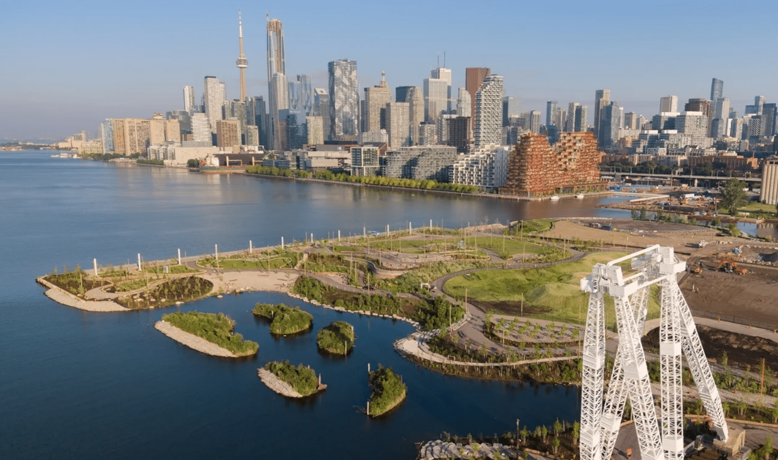
The involvement of Indigenous partners, including the selection of native and culturally significant plantings like sacred tobacco, white sagebrush, sweet grass and black cherry, is not a soft addition to the project. It is part of how this land regained ecological function fast enough to support the density around it. Wetlands and habitat restoration reduce infrastructure burden on stormwater systems, which is exactly the kind of long horizon planning that separates resilient waterfront districts from ones that flood every decade.
Everything you see is a culmination of an unprecedented feat of landscape design and engineering.
For anyone tracking Toronto’s housing supply pipeline, the Port Lands deserve close attention over the next decade. A decontaminated, flood protected, amenity rich waterfront is precisely the profile that attracts sustained residential and mixed use investment. The city is not simply building a park. It is de-risking a district and setting the terms for how it will grow. Development decisions rarely announce themselves through recreation programming, but this is one of those moments where the park is the leading indicator, not the finished product.
Source: Ontario Construction News