

Waterfront development is undergoing a profound shift. For decades, many cities treated waterfronts primarily as lifestyle destinations, tourism corridors, or premium real estate opportunities. That model is no longer sufficient. Today, the future of waterfront developments is being shaped by a far more strategic question: how can cities use their waterfronts to absorb climate risk, expand housing, improve public space, and strengthen economic resilience at the same time?
Table Of Content
- Why Waterfront Development Has Become a Climate Issue First
- From Single-Purpose Projects to Multi-Benefit Urban Systems
- Core Design Principles for the Next Generation of Waterfronts
- Plan for Water as a Permanent Design Condition
- Use Green-Blue Infrastructure Alongside Gray Infrastructure
- Protect and Expand Public Access
- Support Compact, Mixed-Use, Transit-Oriented Development
- The Canadian Opportunity: Waterfronts as Housing and Infrastructure Platforms
- Case Studies That Show the Direction of Travel
- Toronto’s Waterfront: Building Protection Before Full Buildout
- Boston: From Reactive Defense to District-Scale Coastal Planning
- The Role of Nature-Based Solutions in Waterfront Regeneration
- Equity, Inclusion, and Who the Waterfront Is For
- Economic Growth Without Short-Term Thinking
- Common Misconceptions That Need to Be Retired
- What the Future Waterfront Will Look Like
- Conclusion: Waterfront Development as a Test of Urban Leadership
This is not a narrow design discussion but a defining issue in urban growth policy. As cities intensify and populations concentrate near major employment areas, waterfront lands are becoming some of the most valuable and contested sites for long-term planning: they hold major potential for housing, infrastructure renewal, mobility, and investment, yet face growing exposure to flooding, erosion, storm surge, and sea level rise. In response, waterfront redevelopment across Canada and North America is being reframed as a climate adaptation and urban regeneration strategy rather than a simple amenity play. The strongest projects now combine flood protection, mixed-use development, environmental repair, transit access, and public realm investment into a single integrated vision, reflecting a larger truth in planning: resilient cities are not built by separating environmental protection from development, but by designing both together.
For housing development, this shift matters enormously. Urban waterfronts often sit close to downtowns, regional transit, and legacy industrial lands that can be remediated and repurposed. If these sites are planned well, they can support dense communities near jobs and services while reducing long-term climate risk. If they are planned poorly, they can lock in expensive hazards, vulnerable infrastructure, and social inequities for decades.
The future of waterfront developments, then, is not about building next to water for its own sake. It is about using these strategic lands to create safer, greener, more inclusive, and more economically productive cities. That requires a new planning mindset, one that treats adaptation as foundational infrastructure and views public investment in resilience as a catalyst for sustainable growth.
Why Waterfront Development Has Become a Climate Issue First
The logic behind waterfront growth used to be relatively straightforward. Water creates value. It attracts residents, visitors, employers, and investors. It improves urban identity and can help transform obsolete port lands or industrial edges into active mixed-use districts. That logic still holds, but it now sits inside a more urgent reality. Climate risk has become inseparable from waterfront planning.
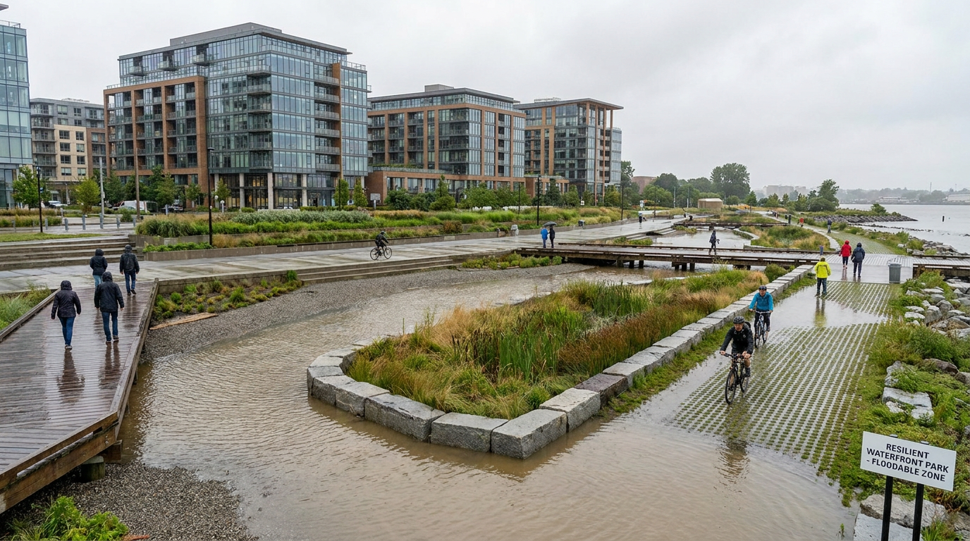
Natural Resources Canada has identified flooding from coastal and inland sources as one of the country’s most pervasive and costly natural disasters, with damages expected to rise without intervention. In the United States, NOAA has repeatedly shown that sea level rise is increasing coastal flooding even in the absence of major storms. In several coastal cities, annual tidal flooding occurrences have increased several-fold since the 1960s. This means the baseline condition has changed. Flooding is no longer only a storm event problem. It is becoming a recurring operational challenge for infrastructure, roads, utilities, and communities.
That shift has major implications for land development. Higher water levels, more frequent nuisance flooding, and stronger storm events all undermine traditional assumptions about site servicing, access, insurance, asset durability, and public safety. As more housing and commercial activity are pushed toward waterfronts by market demand and urban intensification, the cost of getting these decisions wrong becomes much greater. Cities are no longer planning only for today’s shoreline. They are planning for future hydrological realities.
This is why adaptation can no longer be treated as an optional add-on or a technical appendix to a master plan. It must shape the structure of the district itself, from grading and land use to infrastructure corridors, open space systems, and development phasing. In practical terms, that means asking harder questions earlier. Where should density go? What areas need protection, elevation, or setback? Which spaces should be designed to flood safely? How should emergency access and utility redundancy be built in from the start?
The most forward-looking waterfronts answer these questions not by retreating from urban growth, but by making growth contingent on resilience. That is the strategic pivot defining the next generation of development.
From Single-Purpose Projects to Multi-Benefit Urban Systems
One of the most important changes in waterfront planning is the move away from single-purpose investments. Older approaches often separated flood control, park design, transportation, ecology, and real estate into different silos. The result was frequently fragmented infrastructure, weaker public outcomes, and missed opportunities for value creation. By contrast, current best practice treats the waterfront as a system in which one investment should produce several benefits at once.
This multi-benefit model is now central to the value proposition of waterfront redevelopment. A flood protection investment can also unlock housing supply. Brownfield remediation can also improve environmental health and expand tax-generating land use. A floodable park can also serve as recreation space, cooling infrastructure, biodiversity habitat, and a civic destination. A new transit corridor can also support walkable density and lower emissions. The point is not to stack aspirations rhetorically, but to design districts in which functions reinforce one another physically and financially.
That integrated logic is increasingly visible in public policy. Federal and municipal initiatives tied to Toronto’s waterfront, including the Toronto Waterfront Enabling Initiative and the Port Lands Flood Protection project, reflect this approach directly. Infrastructure Canada has described these efforts as supporting flood protection, public access, brownfield remediation, mixed-use density, climate adaptation, and economic growth in one connected package. In policy terms, that is significant. It signals that resilience infrastructure is not merely defensive spending. It is enabling infrastructure for city building.
This is especially relevant for housing development. Across major urban regions, the need for new supply is colliding with infrastructure deficits and land scarcity. Waterfront lands can help address that pressure, but only where governments are willing to make coordinated upfront investments in protection, servicing, access, and environmental repair. Once that framework is in place, development becomes safer, more financeable, and more aligned with long-term public interest.
The future waterfront is not a luxury edge condition. It is an urban system where resilience, housing, ecology, mobility, and economic development are planned together.
Core Design Principles for the Next Generation of Waterfronts
Climate-resilient waterfronts are not defined by one signature building or one engineering solution. They are shaped by a set of planning principles that work together across the district. These principles help cities manage risk while preserving flexibility, public value, and development potential over time.
Plan for Water as a Permanent Design Condition
The first principle is simple but transformative: assume water will be more present, more dynamic, and more disruptive than past patterns suggest. This means designing with hydrology rather than treating it as an external threat. Streets, parks, grading, drainage networks, and building interfaces must anticipate future water levels and more intense precipitation. In many cases, the most effective strategy is not to keep all water out at all times, but to guide, store, delay, or absorb it in controlled ways.
This approach changes the physical form of development. Instead of maximizing the buildable edge at the shoreline, planners may create layered zones of protection and adaptation. Sensitive utilities can be elevated or hardened. Public spaces can serve as temporary storage areas. Building entrances can be lifted above projected flood levels. Critical routes can maintain safe access during extreme events. These decisions may not always be visually dramatic, but they are decisive in determining whether a district performs under stress.
Use Green-Blue Infrastructure Alongside Gray Infrastructure
The strongest waterfront strategies blend traditional engineering with ecological systems. Gray infrastructure still has a role. Berms, flood walls, pumps, outfalls, and structural shoreline protections are sometimes necessary, particularly in dense urban settings. Yet relying on hard defenses alone can create new problems if broader drainage, landscape performance, and water pathways are ignored. NOAA has warned that hard shoreline defenses such as seawalls can increase inland flooding when they are not paired with wider adaptation measures.
This is where green-blue infrastructure becomes essential. Restored wetlands, bioswales, permeable surfaces, living shorelines, floodable parks, and shoreline buffers can reduce runoff, slow water, support habitat, and improve thermal comfort. UN-Habitat has emphasized that nature-based solutions can deliver flood mitigation, cooling, biodiversity, health, and jobs, and in some contexts may be more cost-effective than gray infrastructure alone. The strategic point is not to romanticize soft systems, but to integrate them where they improve district performance and co-benefits.
For developers and city builders, this matters because green-blue infrastructure can increase both resilience and place quality. The public tends to support adaptation investments more strongly when those investments also produce parks, access, ecological amenities, and attractive streetscapes. In other words, resilience becomes more durable politically when it improves everyday urban life.
Protect and Expand Public Access
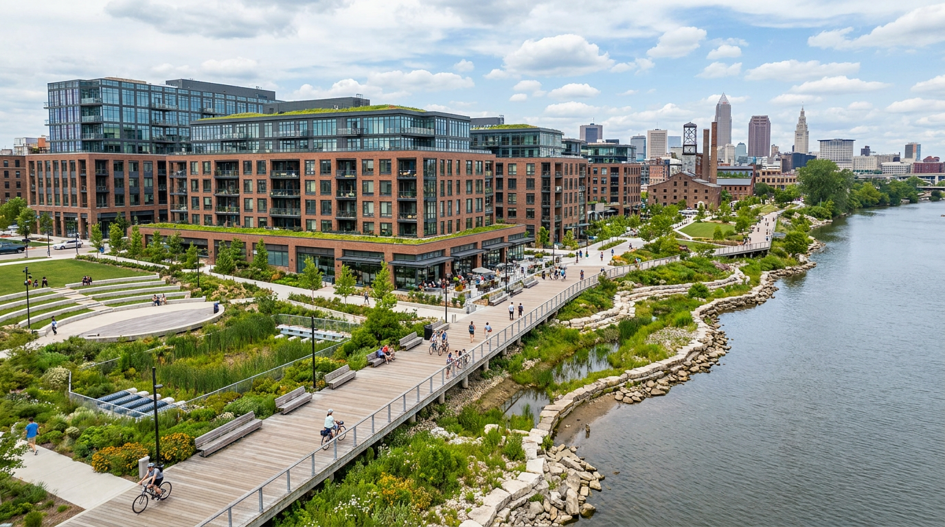
Waterfronts succeed over the long term when they are understood as civic assets rather than private edges. Public access should not be treated as a residual feature added after development rights are secured. It should be a structuring principle. Continuous promenades, connected parks, view corridors, active transportation routes, and universally accessible open spaces help ensure that waterfront value is shared broadly.
This is also an economic issue. High-quality public realm increases desirability, supports local retail and tourism, improves health outcomes, and enhances adjacent land values. EPA guidance for coastal and waterfront smart growth emphasizes preserving waterfront access, strengthening development in existing communities, and integrating hazard resilience into land use decisions. Those principles remain highly relevant because they tie spatial quality to urban resilience rather than treating them as separate policy fields.
Support Compact, Mixed-Use, Transit-Oriented Development
Poorly planned waterfront expansion can create isolated enclaves that depend heavily on cars, underuse infrastructure, and fail to support inclusive city growth. Stronger models concentrate mixed-use density in walkable districts that connect directly to transit and surrounding neighborhoods. This aligns with broader guidance from UN-Habitat, which argues for compact, integrated, equitable urban fabrics in an era of climate stress.
Compact development can reduce emissions, support local services, and make expensive public infrastructure more efficient. It can also improve feasibility for affordable housing and community facilities when paired with a coherent district plan. For cities confronting both housing shortages and infrastructure constraints, this is a powerful argument. The goal is not density for density’s sake. It is safer density in places where public investment, mobility, and resilience can work together.
The Canadian Opportunity: Waterfronts as Housing and Infrastructure Platforms
In Canada, the case for resilient waterfront development is especially compelling. Many major urban regions face acute housing pressure, aging infrastructure, and the need to reduce emissions while maintaining competitiveness. Waterfront lands often sit at the intersection of these challenges. They include former industrial areas, underused port-adjacent parcels, rail-linked lands, and strategic downtown edges that can absorb growth if unlocked properly.
Toronto offers the clearest example of this shift. Federal infrastructure materials describe the Toronto Waterfront Enabling Initiative as supporting a new mixed-use, high-density community with the potential to become one of Canada’s first climate-positive communities. That language is notable because it frames waterfront redevelopment as more than a local beautification project. It positions the waterfront as a platform for next-generation city building, where development intensity, emissions reduction, public space, and adaptation are considered together.
The Port Lands Flood Protection and Enabling Infrastructure Project is equally instructive. Infrastructure Canada has described it as protecting southeastern downtown Toronto from flooding while improving public access, brownfield remediation, climate adaptation capacity, and economic growth. This is a model other cities should study carefully. It demonstrates that major flood protection works can unlock land value and development opportunity, but only when they are tied to a broader urban plan rather than treated as isolated protective infrastructure.
Other Canadian coastal cities are moving in related directions, even where the development context differs. Standards are evolving to account for flood thresholds, shore protection, stormwater systems, and long-term sea level risk. What matters is not that every city adopts the same physical design, but that they accept the same strategic premise: waterfront growth must be calibrated to future hazard conditions, not past assumptions.
For housing delivery, this has major implications. Publicly funded resilience infrastructure can become a prerequisite for adding safe density in some of the most strategically located urban land banks in the country. When planned effectively, waterfront projects can support a mix of market housing, affordable housing, employment space, civic uses, and public amenities. They can also relieve pressure on peripheral greenfield expansion by accommodating more people in existing urban areas near jobs and services.
Case Studies That Show the Direction of Travel
Toronto’s Waterfront: Building Protection Before Full Buildout
Toronto’s waterfront transformation stands out because it illustrates a mature understanding of sequencing. The city and its public sector partners recognized that meaningful redevelopment in vulnerable areas required major enabling works first. Flood risk reduction was not postponed to a later phase. It became the condition that made long-term development credible.
This matters from both planning and market perspectives. Developers, lenders, insurers, and residents need confidence that major districts will remain functional over time. By investing in flood protection, environmental remediation, public infrastructure, and landscape transformation upfront, Toronto has demonstrated a pathway for turning formerly constrained lands into viable urban neighborhoods. That sequence helps de-risk future housing and commercial delivery while preserving broader public objectives.
The deeper lesson is that waterfront districts cannot be judged only by their architectural output. Their success depends on whether the enabling system beneath them is robust. Streets, soil conditions, stormwater networks, shoreline forms, ecological systems, and public space frameworks all shape long-term performance. Toronto’s experience suggests that cities willing to think at district scale can achieve far more than those that rely on parcel-by-parcel approvals in high-risk waterfront areas.
Boston: From Reactive Defense to District-Scale Coastal Planning
Boston is another important case because it reflects a wider North American shift from reactive protection toward proactive planning. Rather than focusing only on isolated barriers or property-level measures, Boston’s waterfront and coastal resilience work has increasingly considered interconnected systems, public space adaptation, and district-wide strategies. That change is critical in urban settings where water does not respect property lines or administrative silos.
Boston’s relevance lies in its acknowledgment that resilience is also an urban design problem. How a city shapes streets, edges, elevations, and open spaces can determine whether it becomes more vulnerable or more adaptable over time. This aligns with the broader lesson emerging across leading waterfronts: infrastructure must be spatially integrated, visible where helpful, and coordinated with public life rather than hidden as an afterthought.
The Role of Nature-Based Solutions in Waterfront Regeneration
One of the most promising developments in contemporary waterfront planning is the rise of nature-based solutions as serious urban infrastructure. For too long, ecological features were treated as decorative enhancements around development rather than as functional systems in their own right. That view is changing quickly. In resilient waterfronts, landscape is infrastructure.
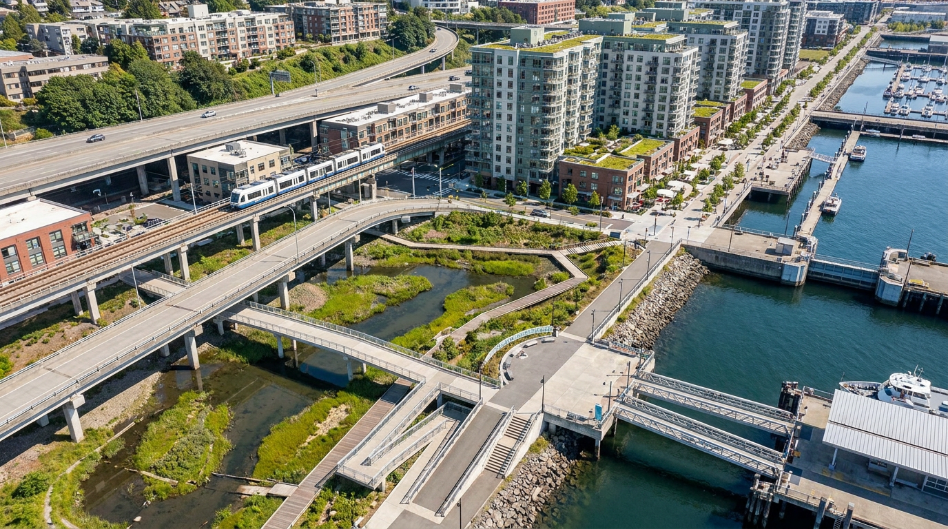
Living shorelines, restored marshes, wetlands, vegetated buffers, urban forests, permeable surfaces, and floodable parks can all contribute to district performance. They can store and slow water, reduce erosion, improve water quality, support biodiversity, lower urban heat, and create healthier public environments. In some settings, they can also support blue-carbon objectives by protecting or restoring ecosystems that sequester carbon. This is one reason waterfront planning is increasingly linked to the language of both the blue economy and climate-positive development.
That said, nature-based systems are not interchangeable or universally sufficient on their own. Their value depends on site conditions, maintenance, regulatory frameworks, hydrology, and integration with built infrastructure. The strongest plans avoid simplistic either-or thinking. They do not ask whether to choose engineered protection or ecological adaptation. They ask how both can be combined in ways that are technically credible, spatially efficient, and socially beneficial.
From a public acceptance standpoint, nature-based solutions can also shift the politics of adaptation. Residents may be more receptive to investments that create beautiful, usable spaces than to infrastructure perceived as purely defensive or exclusionary. A floodable park that doubles as a major community amenity can create support for resilience spending in ways a bare concrete wall may not. This is not a substitute for technical rigor, but it is an important governance advantage.
Equity, Inclusion, and Who the Waterfront Is For
No discussion of waterfront developments is complete without confronting the equity question. Waterfront regeneration has often been criticized, sometimes rightly, for producing exclusionary outcomes. Premium districts can drive up land values, displace vulnerable communities, privatize access, and concentrate public investment in already advantaged areas. If resilience becomes simply another way to justify elite enclaves, the broader public case for waterfront development weakens considerably.
The next generation of waterfront planning must therefore be explicit about inclusion. That means mixed-income housing, accessible public spaces, transparent governance, and direct links to surrounding communities rather than self-contained islands of prosperity. It also means understanding resilience as a social issue. The communities least equipped to absorb flood losses, infrastructure failures, and heat stress are often those with the fewest resources to adapt on their own.
There is also a growing emphasis on Indigenous engagement and inclusive governance in waterfront regeneration. In many places, waterfronts are deeply tied to Indigenous histories, stewardship traditions, ecological knowledge, and ongoing rights. Meaningful engagement is not merely procedural. It can improve project legitimacy, strengthen ecological understanding, and lead to more durable, place-specific planning outcomes.
For city leaders and developers, the strategic takeaway is clear. A resilient waterfront that excludes the public or fails to broaden opportunity is only partially successful. Long-term urban value depends on social legitimacy as much as on physical design. The strongest districts are those that expand access to housing, public space, and economic participation while also reducing risk.
Economic Growth Without Short-Term Thinking
Waterfront redevelopment remains a major economic development tool, and it should. These districts can attract investment, increase tax revenues, support construction activity, grow tourism, and create jobs in sectors ranging from design and engineering to marine services, culture, retail, and technology. In some cities, waterfronts are also being tied more deliberately to blue economy strategies that include port innovation, clean marine industries, research clusters, and environmental services.
But economic growth on the waterfront must be judged over the full lifecycle of the district. A project that generates short-term land value while embedding future flood liabilities is not truly accretive. It simply externalizes costs to future residents, taxpayers, and governments. Strategic urban development requires a longer horizon. It values durable infrastructure, adaptable public space, and land use patterns that can remain functional under changing environmental conditions.
This is where resilient waterfront planning can improve development feasibility rather than constrain it. While adaptation measures require capital, they can also reduce long-term risk, improve insurability, stabilize infrastructure performance, and make large districts more investable. Public sector leadership is often essential here because many enabling works are too large or too distributed to be funded solely through individual parcels. Once those systems are in place, however, the private market can operate on a much stronger foundation.
In this sense, waterfront development offers a useful lesson for urban growth generally. Public infrastructure and private development are not opposing forces. When aligned properly, they can create a virtuous cycle in which resilience spending unlocks housing, environmental repair strengthens land value, and better public spaces support both quality of life and market confidence.
Common Misconceptions That Need to Be Retired
Several misconceptions continue to distort public debate about waterfront development. The first is the idea that waterfront projects are mainly about luxury housing or tourism. While that has certainly been true in some cases, the strongest contemporary models are much broader. They combine flood protection, public access, stormwater systems, parks, housing supply, and economic development in integrated frameworks. Reducing these projects to a lifestyle narrative misses their strategic significance.
A second misconception is that seawalls or shoreline hardening alone solve coastal risk. In reality, hard defenses can redirect water, constrain drainage, and worsen inland flooding if broader systems are not considered. Waterfront adaptation must include elevation strategy, landscape performance, stormwater management, utility resilience, and evacuation planning. Technical complexity cannot be replaced by a single visible structure.
A third misconception is that climate adaptation and urban growth are opposing goals. In fact, many of the most ambitious waterfront projects use adaptation as the precondition for growth. They make it possible to add safer density, attract capital, remediate land, and improve urban quality in areas that would otherwise remain constrained. Adaptation, when done well, is a growth strategy grounded in risk realism.
Finally, nature-based solutions are too often dismissed as superficial landscaping. At district scale, they can function as serious infrastructure. They can manage water, support habitat, reduce heat, and improve public health while contributing to a strong sense of place. The key is design discipline, maintenance planning, and integration with other systems.
What the Future Waterfront Will Look Like
The future waterfront will not look the same in every city, but several traits are becoming increasingly consistent. It will be more mixed-use, more climate-aware, and more infrastructure-rich than older models. It will include public landscapes designed to perform during extreme conditions rather than simply decorate the edge. It will embed stormwater systems and resilient utilities into the urban fabric. It will create room for water where necessary, while protecting critical assets and access routes.
It will also be more strategic about density. Rather than treating every parcel as an isolated development opportunity, successful waterfronts will be planned as coherent districts with phased infrastructure, connected mobility, and shared public spaces. Housing will remain central, especially in high-demand urban regions, but the best districts will balance residential growth with jobs, schools, community services, culture, and year-round public life.
Governance will matter as much as design. District-scale resilience requires coordination among multiple levels of government, agencies, utilities, communities, and private partners. It also requires long time horizons that outlast political cycles. That is why publicly led frameworks are so important. They create the structure within which market delivery can occur without undermining long-term resilience goals.
The future waterfront will also be more honest about tradeoffs. Not every edge can be maximally developed. Not every area should be defended in the same way. Some places may require setbacks, adaptive land uses, or limited forms of occupation. Good planning will not promise immunity from change. It will create the capacity to live with change more safely and intelligently.
Conclusion: Waterfront Development as a Test of Urban Leadership
Waterfront developments now sit at the intersection of some of the most important issues facing cities: climate adaptation, housing supply, infrastructure renewal, economic competitiveness, ecological restoration, and public access. That is what makes them so consequential. They are not niche projects. They are a test of whether cities can think systemically and invest for the long term.
The most successful waterfronts will be those that reject outdated binaries. They will not choose between growth and resilience, or between engineering and ecology, or between development value and public value. Instead, they will build integrated urban systems where these objectives reinforce one another. Toronto’s recent waterfront work offers a strong Canadian example of this direction, showing that protective infrastructure can also unlock housing, repair damaged landscapes, and strengthen the city’s economic future.
For planners, developers, and public leaders, the message is straightforward. Waterfront land is too important to treat as a short-term branding exercise. In an era of rising climate risk and persistent housing pressure, these districts must be planned as long-horizon civic assets. Done well, they can protect people and infrastructure, deliver new homes, restore ecological function, expand opportunity, and redefine the relationship between cities and water.
That is the real future of waterfront developments. Not a prettier shoreline alone, but a smarter urban edge. One that helps cities grow with greater confidence, greater resilience, and a clearer sense of what responsible development should achieve.


No Comment! Be the first one.