



Construction has always been a business of measurements, timing, coordination, and risk. For a long time, getting accurate information from a job site meant boots on the ground, tape measures, ladders, lifts, handwritten notes, and a lot of back and forth between field crews and office staff. That still matters, and there is no technology that replaces solid field judgment. What has changed is the speed and quality of the information teams can gather. Drones have moved from being a novelty on job sites to being a practical tool for collecting usable data that helps people make better decisions.
Table Of Content
- Why Drones Matter on Today’s Job Sites
- The Most Practical Applications of Drones in Construction
- Aerial Mapping and Site Survey Support
- Cut and Fill Calculations and Stockpile Measurement
- Progress Monitoring and Project Reporting
- As Built Verification and QA or QC Documentation
- Roof, Façade, and Building Envelope Inspections
- Thermal Inspection and Hidden Condition Detection
- How Drones Improve Safety Without Replacing Skilled People
- The Regulatory Side Professionals Cannot Ignore
- Why Data Workflow Matters More Than the Drone Itself
- How Homeowners Can Benefit From Drones
- How Contractors Can Start Using Drones the Right Way
- Questions to Ask Before Launching a Drone Program
- Common Mistakes and Misconceptions
- What the Near Future Looks Like
- Final Thoughts
When people hear about drones in construction, they often picture flashy aerial footage for marketing videos. That is part of the story, but it is not the main value. Drones now support surveying, inspections, progress tracking, quality control, cut and fill analysis, stockpile measurement, roof reviews, façade checks, and reliable project documentation. For both large contractors and smaller residential professionals, that means less guesswork, fewer blind spots, and better records when a question comes up later. In the United States, the Federal Aviation Administration has explicitly recognized drones as useful for civil infrastructure inspection, bridge inspection, highway inspection, and construction work progress monitoring. In Canada, updated RPAS rules have opened more pathways for advanced operations, including expanded frameworks for medium drones and beyond visual line of sight activities in specific conditions.
Regulators have also started treating drones as serious operational tools rather than toys. That matters because the more mature the rules become, the easier it is for responsible professionals to build drones into standard workflows.
The most important point for anyone considering drone use is this: drones create value when they are part of a process. A drone is not just a flying camera. It is a data collection tool that works best when the flights are planned properly, the pilot is qualified, the images are processed correctly, and the results are connected to BIM, GIS, project management software, cloud collaboration tools, and QA or QC procedures. If that sounds technical, it is, but the practical benefit is simple. You get better information faster, and that usually leads to better outcomes.
This article looks at how drones are changing construction in practical terms. It covers what they are actually used for, why they improve efficiency and safety, what homeowners should know, how professionals can start using them, and where the biggest mistakes happen. The goal is not to oversell the technology. It is to explain where drones genuinely help, where they still require skill and oversight, and how to use them in a way that delivers real value on actual projects.
Why Drones Matter on Today’s Job Sites
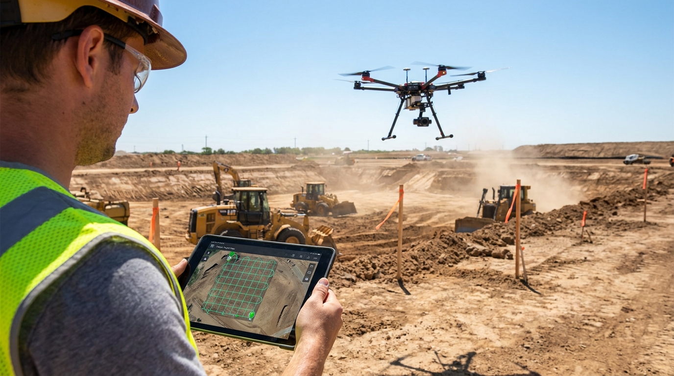
Construction projects are information heavy. Every phase depends on knowing existing conditions, tracking changes, comparing plans to field reality, and documenting what has been built. Traditional methods still do a lot of that work, but they can be slow, labor intensive, and difficult to repeat consistently. A drone gives teams the ability to capture broad site conditions quickly and from angles that are hard or unsafe to reach on foot. On a large commercial site, that can save hours each week. On a residential job, it can mean spotting roof damage or drainage issues without climbing into a risky position too early.
Another reason drones matter is that construction is becoming more digital across the board. Firms are tying together scheduling software, BIM models, cost tracking, cloud collaboration platforms, and reality capture tools. Drone imagery fits neatly into that shift because it can feed these systems with current site data instead of relying on outdated assumptions. Autodesk and other industry platforms have pointed to drone use in site analysis, planning and design, asset inventory, project reporting and collaboration, and dispute resolution. That is a broad range, but the common thread is better visibility into what is happening in the field.
There is also a practical labor and safety angle. Every time a person needs to climb a roof, walk unstable terrain, cross active equipment zones, or inspect a high façade, the risk goes up. Drones do not eliminate the need for physical inspections, but they can reduce how often crews need to enter dangerous areas just to gather basic visual information. That alone can make them worthwhile in situations involving large roofs, bridge components, utility corridors, steep slopes, water exposure, or partially completed upper levels of buildings.
For owners and clients, drones improve communication. Many disputes start because one side thinks work was completed, another side says conditions were different, and the documentation in between is weak. Regular aerial captures create a repeatable visual record that can show progress over time, establish site conditions before work begins, and help explain delays or changes. On a complex job, that record can become one of the most useful parts of the project file.
The Most Practical Applications of Drones in Construction
Aerial Mapping and Site Survey Support
One of the most valuable uses for drones is aerial mapping. A drone can fly a planned route over a site and collect overlapping images that are processed into orthomosaic maps, terrain models, and 3D representations of the ground surface. This is especially useful on raw land, subdivisions, utility corridors, road work, and large commercial developments where site conditions cover too much ground to assess efficiently from the surface alone. Teams can use those maps to understand slopes, drainage, access routes, and current grading conditions.
It is important to be realistic here. A drone flight does not automatically replace a licensed surveyor. Accuracy depends on flight planning, camera calibration, good ground control, proper processing, and understanding the limits of the output. In practice, drones often support survey operations by collecting data faster and more frequently, while licensed professionals validate, interpret, and apply that data where legal or contractual precision matters. That is why the smartest firms treat drones as an enhancement to survey workflows, not a shortcut around them.
On active projects, repeated mapping flights can reveal how the site changes week by week. That helps superintendents, project managers, and civil teams compare the plan to actual field conditions. If haul roads are shifting, staging areas are getting crowded, or drainage paths are not behaving as expected, those issues become visible early. Catching them early is where time and money are saved.
Cut and Fill Calculations and Stockpile Measurement
Earthwork is one of the clearest examples of where drones produce measurable value. Aerial data can be processed to estimate cut and fill volumes, track grading progress, and measure stockpiles. Traditionally, these tasks could take substantial field time, especially across large or irregular sites. With drone capture, teams can document the shape and volume of materials more quickly and more often, which supports better production tracking and payment verification.
For contractors, this matters because earthmoving errors become expensive fast. If the site balance is off, if imported material quantities are misunderstood, or if stockpiles are misreported, the budget feels it. A drone-based volumetric workflow can provide a repeatable method for checking quantities before they become billing disputes or scheduling problems. It also gives managers a stronger basis for planning equipment allocation and haul sequencing.
Owners and lenders benefit too. Progress claims tied to measured site change are easier to verify when there is a clear visual and volumetric record. In an industry where documentation often lags behind field activity, that kind of objective record has real practical value.
Progress Monitoring and Project Reporting
Progress monitoring is one of the easiest drone uses to understand. The pilot flies the same route on a regular schedule, such as weekly or biweekly, and the project team uses that imagery to see what has changed. This is valuable on large commercial buildings, road and utility work, industrial sites, and even custom residential builds with complex sequencing. Instead of relying only on scattered ground photos, the team gets consistent whole site visibility.
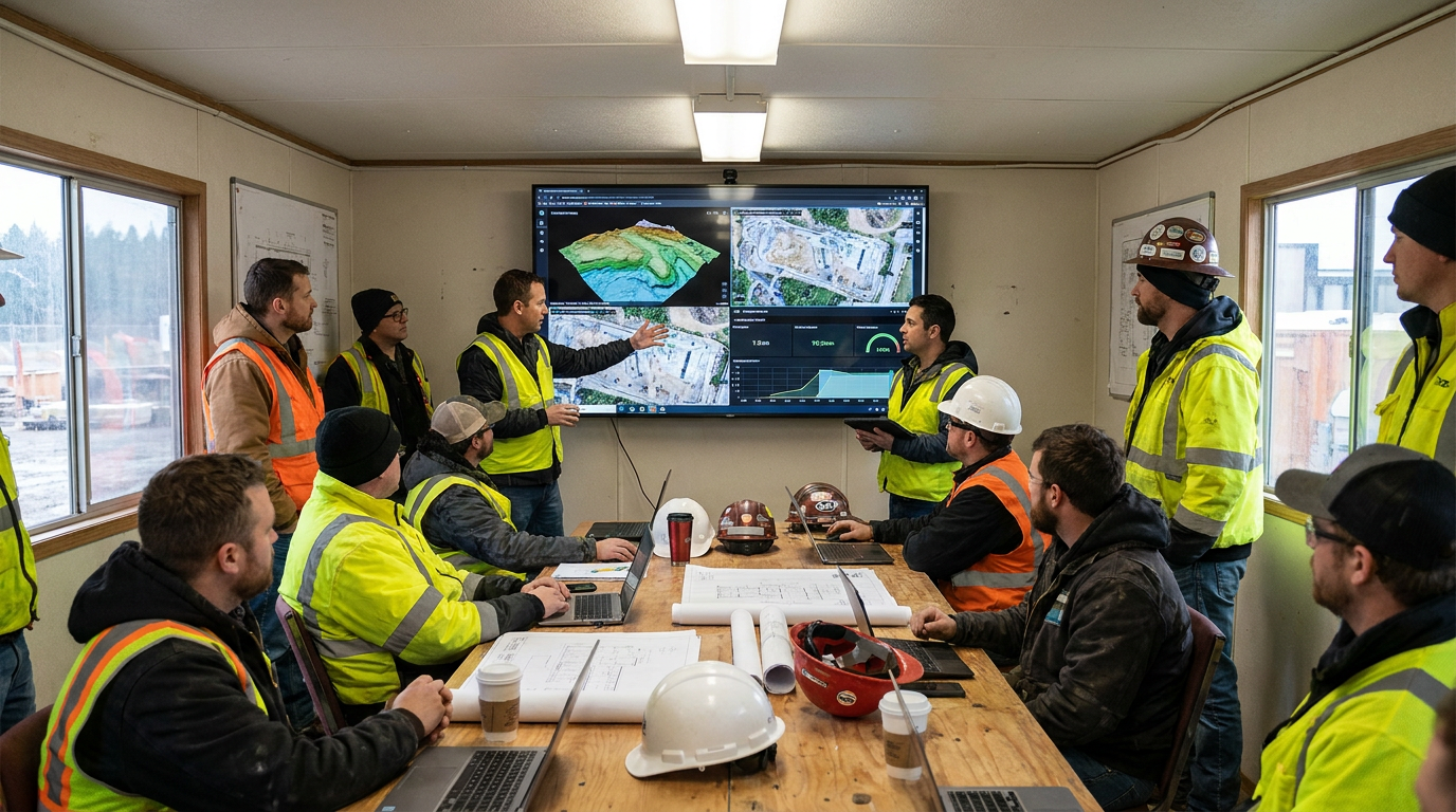
This is where drones start improving communication across the entire project chain. Site teams can brief office staff more clearly. Owners can understand real progress without visiting the site as often. Lenders and insurers can see documented conditions. Subcontractors can coordinate staging and access with a better sense of what space is available. In practical terms, everyone spends less time arguing over what the site looked like last week.
When linked with scheduling tools and common data environments, progress imagery becomes more than a visual update. It can help verify milestone completion, show whether sequencing is holding, and flag mismatches between planned work and field reality. This is why many firms now treat drone flights as a routine project reporting step rather than an occasional extra.
As Built Verification and QA or QC Documentation
Construction quality depends on checking whether installed work matches the design intent and approved changes. Drones help by creating frequent records of what is actually in place. On some jobs that means checking roof-mounted equipment layouts, façade installation progress, grading transitions, paving alignment, or site utility trench restoration. On others it means simply preserving visual proof of conditions before they are covered, altered, or handed off.
As built verification works best when the drone output is tied into a broader quality process. Aerial imagery and models can be compared with BIM or plan sets to identify obvious mismatches, but the real gain is having a repeatable archive. If a question comes up months later about site drainage, equipment placement, material storage, access damage, or envelope sequencing, the team has more than memory to work from. They have time-stamped records.
That record can also help with warranty questions and turnover packages. Owners want proof of what was delivered, and contractors want proof of what conditions existed when their scope was completed. Drone documentation does not solve every argument, but it usually gives everyone a firmer starting point.
Roof, Façade, and Building Envelope Inspections
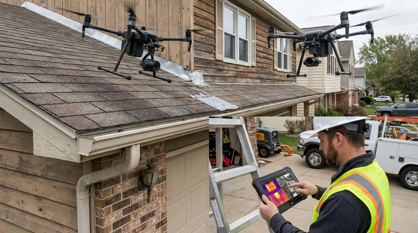
Drones are especially useful for inspecting roofs and exterior building surfaces. These are areas that often require ladders, lifts, scaffolding, or controlled access just to perform an initial review. A drone can quickly capture high resolution visual data across large roof areas, parapets, flashing details, gutters, downspouts, wall cladding, and hard to reach transitions. That makes it easier to identify visible damage, missing components, pooling water patterns, or installation concerns before mobilizing more expensive access equipment.
For homeowners, this is one of the most practical entry points. After a storm, before a roof replacement, during a renovation, or while checking on chimney, siding, or gutter conditions, a drone can provide a safer first look. It is also useful before buying a property, especially one with complex roof geometry or high areas that are difficult to access. The key is hiring an operator who understands both aviation compliance and what to look for on the building itself.
For commercial and institutional owners, roof and façade reviews become easier to schedule and document when drone capture is part of the maintenance plan. A single flight does not replace a hands on investigation where that is needed, but it can narrow the problem areas and reduce unnecessary exposure for inspection crews.
Thermal Inspection and Hidden Condition Detection
Some drones can carry thermal cameras, which adds another layer of practical use. Thermal imaging can help identify moisture intrusion patterns, insulation gaps, air leakage indicators, overheated electrical components, and roof conditions that are not obvious in normal visual light. On building envelopes, this can be especially helpful when trying to understand whether a visible problem is isolated or part of a larger pattern.
That said, thermal work requires experience. Conditions such as weather, time of day, material type, surface reflectivity, and recent heating or cooling cycles can all affect what the camera sees. Thermal images are not self-explanatory proof of a defect. They are clues that need interpretation. In the right hands, though, they can direct follow up inspections much more efficiently than a blind search.
This is one area where homeowners should be careful about oversimplified promises. A drone thermal scan can be very useful, but it is not magic. The best results come when the operator understands building science and when the findings are tied to on site verification or repair planning.
How Drones Improve Safety Without Replacing Skilled People
Safety is one of the strongest arguments for using drones, but it helps to be precise about why. Drones reduce the need for people to access certain hazardous areas just to collect basic visual information. That can mean fewer climbs onto steep roofs, fewer trips near unstable edges, fewer preliminary inspections in active traffic zones, and less time walking rough or muddy terrain with heavy equipment moving nearby. Even reducing a few of those exposures on every project adds up over time.
What drones do not do is replace experienced inspectors, surveyors, foremen, or project managers. A drone might show that a flashing detail looks wrong, but a skilled roofer still needs to diagnose the installation issue. A drone might reveal grading that appears off, but a civil professional still has to decide what correction is required. Good technology supports craft and judgment. It does not remove the need for them.
This distinction matters because some of the disappointment around new technology comes from expecting it to replace people entirely. In construction, that is rarely how the best tools work. Drones are most effective when they free up skilled people from repetitive data gathering and let them spend more time on interpretation, coordination, and problem solving.
Practical rule of thumb: the value of a drone is not that it flies. The value is that it helps the right person see the right condition sooner, with less risk and better documentation.
The Regulatory Side Professionals Cannot Ignore
If there is one mistake companies make early, it is assuming commercial drone use is casual or lightly regulated. It is not. In the United States, operators must comply with FAA rules for commercial use, including applicable certification, Remote ID requirements, airspace restrictions, and any needed waivers or authorizations. That is especially important near airports and in controlled airspace. FAA materials have also noted frequent drone sighting reports near airports, which underlines the need for careful flight planning and strong compliance habits.
In Canada, the RPAS framework has continued to mature, with 2025 updates expanding pathways for more advanced activities, including new rules affecting medium drones and certain beyond visual line of sight and extended visual line of sight operations. Advanced operations can allow more flexibility in controlled airspace and closer to people, but only when the pilot, aircraft, and operating conditions meet the required standards. The broader lesson is the same on both sides of the border: serious commercial use requires serious operational discipline.
For contractors, this means drone use should be managed like any other regulated field activity. Someone should verify pilot credentials, airspace status, flight area risks, emergency procedures, privacy considerations, insurance, and data handling. If the site is near an airport, hospital helipad, utility corridor, or sensitive facility, the planning needs to be even tighter. The days of casually launching a drone because someone brought one to the site should be over.
Homeowners should also understand that hiring a drone operator involves more than getting pretty footage. Ask whether the operator is properly certified for commercial work in your country, whether they carry insurance, and whether they understand local flight restrictions. A responsible contractor will not treat aviation rules as optional.
Why Data Workflow Matters More Than the Drone Itself
Many first time buyers focus on the aircraft. They compare cameras, battery life, range, obstacle avoidance, and price. Those things matter, but they are only part of the picture. The real return comes from what happens after the flight. If the imagery never gets organized, processed, shared, and connected to project decisions, the drone becomes an expensive camera that creates digital clutter.
The highest value setups connect drone data to existing construction systems. Orthomosaic maps may be overlaid with design information. Progress imagery may be linked to schedule reporting. 3D models may feed BIM coordination or reality capture workflows. Site records may be stored in a common data environment so the owner, architect, and contractor are all working from the same documented conditions. This is where many firms are also adding AI assisted analytics to detect changes, flag anomalies, and speed up review.
For a smaller builder or residential contractor, the workflow can be simpler but the principle stays the same. Capture should follow a standard process, files should be named and stored consistently, and reports should answer a clear question. That question might be whether roof damage is visible, whether excavation is progressing correctly, or whether a storm affected drainage paths on a property. The technology only pays off when it serves a defined need.
How Homeowners Can Benefit From Drones
There is a common misconception that drones are only useful on major commercial projects. In reality, homeowners can benefit from them in several practical ways. Roof inspections are the most obvious example. Instead of climbing onto a steep or damaged roof for an initial look, a contractor can use a drone to document visible wear, storm damage, missing shingles, flashing problems, or clogged gutters. That helps the homeowner understand whether a small repair or a larger intervention may be needed.
Drones can also help during renovations and additions. Before work starts, aerial photos can document property conditions, access constraints, tree locations, drainage patterns, and neighboring structures. During the job, the images can help owners understand progress and preserve a record of what was happening at each stage. After severe weather, a post storm review can quickly show whether there is obvious roof or exterior damage that warrants a closer hands on inspection.
For larger rural or waterfront properties, drones can also support site reviews involving slopes, shoreline exposure, drainage channels, retaining walls, and access roads. In these cases, a top down view often reveals patterns that are hard to grasp from ground level. Again, the key is using the technology for a practical purpose, not just because it is available.
How Contractors Can Start Using Drones the Right Way
Contractors do not need to jump straight into a large drone program to see results. The best approach is to start with repeatable use cases. Weekly progress flights, roof inspections, stockpile checks, and preconstruction site documentation are all good starting points because the value is easy to understand. The team can compare the time spent, the quality of records produced, and the way the information improves planning or communication.
From there, companies should decide whether to build an internal capability or work with a specialist. An internal program can make sense for firms with frequent recurring needs and staff who can be trained properly. Outsourcing can make more sense for occasional flights, more technical mapping work, thermal inspections, or regulated operations in complex airspace. There is no single right answer. The decision should come down to volume, risk, and the kind of data needed.
Whichever route is chosen, a standard operating procedure is essential. That should cover preflight planning, site coordination, battery handling, weather checks, emergency response, data storage, file naming, privacy practices, and reporting format. If a drone program is informal, the results will be inconsistent. If the process is standardized, the data becomes more reliable and easier to use over time.
Questions to Ask Before Launching a Drone Program
-
What exact problem are we trying to solve, such as roof access, progress reporting, stockpile measurement, or as built documentation?
-
Will the data be visual only, or do we need measurable outputs like maps, models, or volume calculations?
-
Who will interpret the results and turn them into decisions?
-
Are we operating in controlled airspace or near sensitive locations that require extra planning?
-
Do we have a storage and reporting workflow that makes the information easy to retrieve later?
-
Would a trained outside provider deliver better results than an internal beginner setup?
Common Mistakes and Misconceptions
One of the biggest misconceptions is that a drone camera alone produces survey grade answers. It does not. The quality of output depends on the flight plan, overlap, control points, calibration, environmental conditions, and processing method. If someone needs legal, contractual, or engineering precision, the workflow has to be set up accordingly and reviewed by the right professionals.
Another common mistake is assuming any drone can do any task. A simple visual inspection flight is very different from a thermal envelope scan, a stockpile volumetric survey, or an advanced operation in controlled airspace. Aircraft capability, sensor quality, pilot skill, and legal authority all matter. Using the wrong setup usually leads to weak data or unnecessary risk.
Some firms also make the mistake of collecting far more imagery than they can manage. Hundreds of photos are not useful if nobody can find them, compare them, or tie them to a project event. Construction already generates enough paperwork and digital clutter. Drone programs need discipline or they add to the problem instead of solving it.
Finally, there is the misconception that drones replace core construction roles. In practice, they support them. Surveyors still survey. Inspectors still inspect. Project managers still coordinate. The drone simply helps those people see conditions faster, more safely, and with better records than they might have had otherwise.
What the Near Future Looks Like
The direction of travel is clear. Construction is moving toward more routine, governed, and connected drone use. The interesting trend is not just that there are more drones in the market. It is that they are being built into standard workflows for progress monitoring, asset inspection, dispute documentation, and reality capture. As regulatory systems continue to mature in the United States and Canada, more companies will be able to use drones confidently within well defined operating frameworks.
Beyond visual line of sight operations are especially important to watch for large sites and linear infrastructure. On utility scale projects, roads, pipelines, and wide civil corridors, being able to operate more efficiently over long distances can materially improve workflow. Canada’s regulatory changes and the FAA’s broader integration planning both point toward a future where these operations become more normalized under the right controls.
There is also growing interest in pairing drones with BIM, GIS, cloud collaboration, digital twin workflows, and AI assisted analytics. That combination is where the biggest long term gains are likely to come from. The drone gathers repeatable site data. The software compares it to planned conditions. The team acts on the differences. That is a practical loop, and it fits the way construction is already evolving.
Final Thoughts
Drones are changing construction because they solve real field problems. They help teams collect site data faster, inspect hard to reach areas more safely, document progress more clearly, and compare actual conditions to planned work with less guesswork. For homeowners, they offer a practical way to inspect roofs, review storm damage, and document renovation conditions. For professionals, they support mapping, measurement, QA or QC, reporting, and dispute resolution.
Still, the technology should be approached with clear eyes. Drones are not a replacement for skilled trades, experienced inspectors, licensed surveyors, or disciplined project management. They are a tool, and like any good tool, their value depends on how they are used. The best results come from trained pilots, clear compliance practices, good data handling, and a defined purpose for every flight.
If you are considering drones for a project, start with the practical question: what would better site visibility help you do right now? If the answer is to inspect a roof safely, measure stockpiles accurately, document progress consistently, or improve coordination between the field and the office, then drones may already have a place in your workflow. Used properly, they are not just changing how construction looks from above. They are changing how construction gets managed on the ground.


No Comment! Be the first one.