



Land value analysis sits at the center of strategic urban development because land is the one input that cannot be moved, replicated, or manufactured. It reflects location, access, infrastructure, regulation, and market demand all at once. When cities expand transit, adjust zoning, or invest in public amenities, a significant portion of the economic effect is captured in land value. For that reason, understanding land value is not simply an appraisal exercise. It is a planning discipline, a finance tool, and a decision framework that shapes whether growth becomes productive, inclusive, and sustainable.
Table Of Content
- Why land value analysis matters more than ever
- Land value analysis is not the same as property valuation
- Core methodologies that make land value analysis credible
- Comparable sales analysis
- Residual land value modeling
- Highest and best use testing
- Scenario analysis
- Data sources that strengthen decision-making
- The relationship between zoning, transit, and land value uplift
- Connecting land value analysis to the housing supply crisis
- Land value capture tools and their strategic use
- Evaluating greenfield versus infill through a land value lens
- A practical framework for applying land value analysis
- Common mistakes that weaken land value analysis
- The long-term strategic value of getting this right
Across Canada and North America, this issue has become more urgent. Housing supply shortages, rising infrastructure costs, climate pressures, and changing mobility patterns are forcing municipalities and developers to make more disciplined choices about where and how to intensify. In this environment, land value analysis helps answer difficult questions. Which sites can support more housing? Where will transit create meaningful value uplift? How should public benefits be structured so that growth helps pay for the infrastructure and amenities it requires? These are not theoretical concerns. They define whether cities can add homes, improve affordability, and maintain quality of life at the same time.
The scale of the housing challenge makes the stakes clear. According to CMHC, restoring Canadian housing affordability to 2019 levels would require roughly 430,000 to 480,000 new housing units per year over the next decade, which is about double the current pace of construction. That target cannot be approached without a sharper understanding of land economics. If land is mispriced, underused, constrained by outdated regulations, or disconnected from servicing and mobility planning, housing supply remains limited. If land is analyzed strategically, however, cities can identify where policy reform, infrastructure timing, and development sequencing can unlock meaningful new capacity.
This article explains how to approach land value analysis in a practical way. It covers the core methods, the key data sources, the link to zoning and infrastructure, the role of scenario testing, and the policy tools that help convert value uplift into public outcomes. The broader point is straightforward. Land value analysis is not just about what a site is worth today. It is about what a site can become, what public actions influence that outcome, and how those changes can support both development feasibility and community impact.
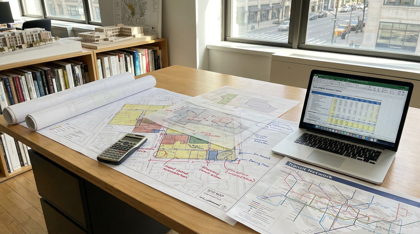
Why land value analysis matters more than ever
In growing urban regions, land is the stage on which every major housing and infrastructure decision plays out. It determines what can be built, how much can be built, how quickly projects become feasible, and whether public investments generate broader returns. Unlike many project costs, land value is deeply shaped by public choices. A zoning amendment can expand permitted density. A transit line can improve accessibility and support higher absorption. A sewer upgrade can convert a constrained parcel into a development-ready site. In each case, land value changes because the city has changed what the site can do.
This is why the OECD places such strong emphasis on land value capture and land-based finance. Public actions often create substantial uplifts in site value, and in many cases that uplift can help fund infrastructure, parks, affordable housing, and community facilities. The practical implication is that land value analysis should not be isolated inside a valuation report. It should be embedded into strategic planning, capital budgeting, and development negotiation. When municipalities understand value uplift, they can make more informed decisions about rezoning, density bonuses, developer obligations, or public land strategies.
It also matters because higher land values do not automatically mean better planning. In some markets, elevated land prices reflect scarcity rather than healthy growth. Restrictive zoning, lengthy approvals, and uncertain servicing can push developable land values upward by limiting supply. CMHC has reported that stricter land use regulations raise costs and reduce the number of new homes built each year, especially in high demand markets. In other words, a city can experience rising land values while still underperforming on housing production. A serious analysis must therefore distinguish between value created by productive urban improvement and value inflated by avoidable constraints.
From a strategic perspective, land value analysis also clarifies tradeoffs. It helps compare greenfield expansion with urban infill, transit-oriented intensification with auto-dependent growth, and mixed-use redevelopment with lower-value legacy uses. It can quantify whether a parcel near transit should remain underutilized or support missing-middle housing, rental apartments, or a mixed-use node. It can also show when policy ambitions exceed economic reality. A site may be zoned for density, but if construction costs, financing conditions, and absorption rates do not support delivery, the value uplift on paper may not translate into actual housing starts.
Land value analysis is not the same as property valuation
A common misconception is that land value analysis simply means estimating what a property would sell for. That is only one part of the picture. Conventional property valuation often measures market value for a site and any improvements already on it. Land value analysis goes further by isolating the site value from the building value, testing development potential, and examining how future changes in use or regulation could alter economic performance. It is a more dynamic and strategic process.
This distinction matters in urban development because current use is often not the same as highest value use. A low-rise commercial building on a transit corridor may generate modest income today, yet have significantly greater long-term value as a mid-rise residential or mixed-use project. A parcel occupied by aging industrial improvements may support a very different outcome once remediation, zoning transition, and servicing upgrades are considered. The analyst’s role is to separate what exists from what is possible. That requires a framework that links land economics with planning realities.
It is also important to separate improvement value from land value. Assessment systems and market transactions often blend the two together. For development decision-making, however, the site itself must be understood in relation to location, frontage, lot dimensions, servicing, entitlement status, and permitted density. Two properties may have similar sale prices while having very different underlying land economics because one includes a more valuable building or stronger in-place income. Without isolating the land component, comparisons can become misleading.
A robust land value analysis therefore asks a sequence of questions. What is the site worth under its current use? What is the highest and best use given market conditions and policy context? What would happen to value if zoning changed, if transit arrived, or if infrastructure capacity improved? How sensitive is the outcome to construction costs, interest rates, or absorption assumptions? These questions move the analysis from static valuation into forward-looking urban strategy.
Core methodologies that make land value analysis credible
The strongest land value analysis does not rely on one method alone. Urban land markets are too complex, and development outcomes are too sensitive to assumptions, for a single approach to be reliable in every case. In practice, analysts combine several complementary methods to build a realistic picture of site potential. The most useful techniques include comparable sales analysis, residual land value modeling, highest and best use testing, and scenario analysis linked to zoning and infrastructure timing.
Comparable sales analysis
Comparable sales remain one of the most familiar tools because they ground the analysis in actual market behavior. By reviewing sales of similar development sites, an analyst can establish benchmark values based on location, lot size, permitted density, built form, frontage, servicing, and timing. This method is especially useful when there is a healthy volume of recent transactions and when zoning conditions are reasonably comparable. It helps answer a basic question: what are informed buyers paying for similar land in similar contexts?
That said, comparables require careful adjustment. No two parcels are identical, and urban land values can shift rapidly as regulations, capital markets, and local demand evolve. A site near a future transit station may command a premium relative to a similar parcel without the same accessibility outlook. A parcel with clean title, straightforward assembly, and servicing certainty may outperform a site with fragmented ownership or environmental risk. Comparable sales are therefore a starting point, not the entire conclusion.
Residual land value modeling
Residual land value analysis is one of the most important methods in development economics because it estimates what a prudent developer can afford to pay for land after accounting for revenue, hard costs, soft costs, financing, fees, contingencies, and target profit. In simple terms, it works backward from the expected value of the completed project. If a proposed building can generate a certain level of revenue, and all development costs are deducted, the residual amount left over is the value attributable to the land.
This method is especially powerful when evaluating redevelopment potential, rezoning proposals, or competing use scenarios. It reveals whether a site can support its market asking price under realistic development assumptions. It also exposes the financial effect of planning policy. If a municipality increases density, reduces parking requirements, accelerates approvals, or expands servicing capacity, the residual land value may improve materially. If requirements become too onerous, the opposite occurs and housing delivery can stall even where demand is strong.
Residual modeling also disciplines public negotiation. It helps all parties understand how much of a land lift is truly available once feasibility constraints are considered. This is central to discussions about community benefits, affordability requirements, and infrastructure contributions. If obligations are structured without understanding residual economics, they can unintentionally suppress viable development. If they are informed by sound analysis, they can capture a fair share of uplift while preserving project feasibility.
Highest and best use testing
Highest and best use analysis examines the legally permissible, physically possible, financially feasible, and maximally productive use of a site. In urban development, this is where market logic and planning logic meet. A parcel may physically support a taller building, but not be legally permitted to do so. A rezoning may be legally possible, but financially infeasible if rents or sale prices are insufficient to support current construction costs. The highest and best use is therefore not just the biggest building. It is the use that makes strategic and economic sense in context.
This methodology is particularly useful in areas experiencing transition. Former commercial strips, aging employment lands, underused shopping centres, and surface parking lots often sit between legacy use patterns and emerging urban needs. Highest and best use testing helps evaluate whether these sites should remain as they are, shift gradually to mixed use, or support more significant intensification. It also supports public planning by identifying where policy reform could unlock better outcomes without overreaching market reality.
Scenario analysis
Scenario analysis is what turns land value work into a strategic planning tool. Instead of testing one static future, it compares multiple plausible pathways. A site can be modeled under existing zoning, moderate upzoning, transit expansion, phased servicing upgrades, or changing market conditions. Each scenario can be tested against revenues, costs, timing, and public benefits. This approach is essential because urban development is shaped by uncertainty, and decisions made today often play out over many years.
For municipal decision makers, scenario testing supports more informed sequencing. A city may find that a transit corridor can absorb much more housing value after utility upgrades are completed. A developer may discover that a project only becomes viable at a certain density threshold or with reduced parking standards. A landowner may realize that immediate sale is less attractive than holding through a planned policy change. In each case, scenario analysis connects land value to timing, infrastructure, and strategic choice rather than just current market snapshots.
Data sources that strengthen decision-making
Good methodology depends on good data. In Canada, one important source is Statistics Canada, which publishes annual residential property value tables and property assessment value datasets that can support benchmarking by province, territory, and census metropolitan area. These data do not replace parcel-level investigation, but they help establish regional trends, compare market conditions, and frame broader value patterns. They are useful for understanding whether local assumptions align with larger market evidence.
At the local level, municipal assessment rolls, land registry records, planning maps, servicing maps, and development application databases provide more precise inputs. Assessment records can help distinguish improvement value from site value. Land registry records help confirm transaction timing, ownership structure, and parcel history. Zoning maps, secondary plans, and urban design guidelines clarify what is currently permitted and what may be negotiable. Infrastructure records indicate whether water, sewer, roads, and transit capacity support near-term intensification or require major upgrades.
Private market intelligence also matters. Broker opinions, builder surveys, lease comparables, condo absorption data, and cost consultant reports all improve calibration. Land value analysis is rarely improved by relying on one clean spreadsheet in isolation. It becomes credible when different sources point toward a coherent conclusion. If public assessments suggest one range, transaction evidence suggests another, and residual modeling suggests a third, the analyst must reconcile the differences rather than ignore them.
The best practice is to treat data as layered evidence. Regional datasets establish context, parcel-level records establish specificity, and market intelligence establishes live conditions. Together they reduce the risk of overconfidence and make it easier to explain assumptions to councils, investors, lenders, or community stakeholders. In a market where interest rates, construction costs, and approval environments can shift quickly, this layered approach is not optional. It is essential.

The relationship between zoning, transit, and land value uplift
One of the most important lessons in urban development is that land value does not rise in a vacuum. It responds to accessibility, entitlement, demand, and the realistic ability to convert permission into built form. Transit-oriented development is a clear example. When rapid transit improves travel times and expands access to jobs, services, and amenities, nearby land often becomes more attractive for residential and mixed-use intensity. If planning policy allows that accessibility gain to translate into additional development rights, site values can increase significantly.
This is where value capture enters the discussion. The OECD has emphasized that value increases created by public infrastructure investment and land use regulation changes can be substantial enough to help finance infrastructure, parks, and affordable housing. That principle is powerful because it ties growth to public return. A city that creates value through transit and rezoning should understand how much uplift is being generated and what portion can reasonably support community objectives without undermining project feasibility.
Vancouver offers a widely cited example. The Lincoln Institute has noted that the city’s Community Amenity Contributions have often recovered roughly 70 percent to 80 percent of the land lift created by rezoning and other public actions. Whether one agrees with every detail of that model or not, the strategic lesson is important. When municipalities understand land uplift, they can negotiate from evidence rather than intuition. They can also set expectations earlier, which reduces uncertainty and improves the development environment.
Transit and zoning must also be coordinated with servicing capacity. A station area may look ideal on paper, but if water, sewer, roads, school capacity, or utility upgrades lag behind, the full value potential may not be realized in the near term. Land value analysis should therefore model not only entitlement and market demand but also infrastructure timing. Accessibility without capacity creates friction. Capacity without supportive land use can leave public investment underleveraged. Strategic growth requires both.
Connecting land value analysis to the housing supply crisis
The housing supply challenge in Canada is often framed through starts, completions, rent growth, and affordability pressures. Those indicators matter, but beneath them sits the issue of land. If the right land is unavailable, unserviceable, overpriced relative to feasible density, or locked behind restrictive regulations, housing supply cannot scale. This is why land value analysis belongs at the heart of housing strategy. It helps reveal where the system is blocked and what reforms could unlock production.
CMHC has made clear that restrictive land use rules raise costs and reduce new housing output, with especially large effects in high-demand markets. That finding has direct implications for land economics. When approvals are uncertain, carrying periods extend. When density is capped too low, residual land values weaken relative to asking prices. When parking standards are inflexible, buildable area is consumed by unproductive cost. When servicing capacity is unclear, risk premiums rise. Each of these conditions suppresses feasible housing delivery even if demand remains strong.
Land value analysis helps quantify those effects. It can show how many additional units become viable when a site shifts from detached-only permissions to multiplex, townhouse, or mid-rise forms. It can estimate how reduced approval times affect the developer’s ability to carry land and debt. It can compare existing zoning with as-of-right intensification frameworks near transit. The point is not simply to argue for more density in the abstract. The point is to identify where specific changes create enough economic improvement to generate real projects.
This is also why missing-middle housing deserves attention in the analysis. Not every valuable site should become a high-rise tower. Many neighbourhoods contain underused parcels where gentle intensification can add homes efficiently while preserving urban fabric. Laneway housing, multiplexes, stacked townhomes, and small apartment forms can materially improve land productivity if regulations, lot standards, and servicing frameworks support them. A strategic land value lens helps cities see these opportunities as part of the supply solution rather than as isolated exceptions.
Land value capture tools and their strategic use
Land value capture is often misunderstood as a narrow revenue mechanism, but in practice it is a broader governance tool. It allows municipalities to recover part of the uplift created by public action and direct that value toward public benefits. The OECD’s Canada profile identifies several frequently used tools, including developer obligations, density bonuses, public land leasing, and public land banking. Tax increment financing is also used in Canada and the United States to borrow against expected future tax revenue growth associated with development and rising assessments.
Each tool has a different strategic role. Developer obligations can help fund site-specific infrastructure or amenities needed to support growth. Density bonuses allow additional floor area in exchange for public benefits such as affordable housing, open space, or community facilities. Public land leasing can preserve public ownership while enabling development and long-term revenue generation. Public land banking gives governments more control over timing, affordability outcomes, and coordinated area development. Tax increment financing can be useful where large upfront infrastructure investments are needed and future tax base growth is reasonably predictable.
These tools work best when grounded in transparent land value evidence. If charges or obligations are detached from local economics, they may discourage the very development they aim to shape. If they are too weak, cities may miss the opportunity to convert publicly created value into community return. The strategic task is balance. Municipalities need enough uplift capture to fund growth responsibly, while developers need enough remaining residual value to proceed with risk-adjusted investment.
It is also important to remember that value capture is not a substitute for sound planning. Rezoning alone does not create value unless there is demand, infrastructure, and feasible building economics. Public benefits must therefore be tied to realistic development conditions. The strongest systems are predictable, evidence-based, and aligned with area planning rather than improvised parcel by parcel negotiation. That predictability reduces friction, supports land pricing discipline, and improves long-term market confidence.
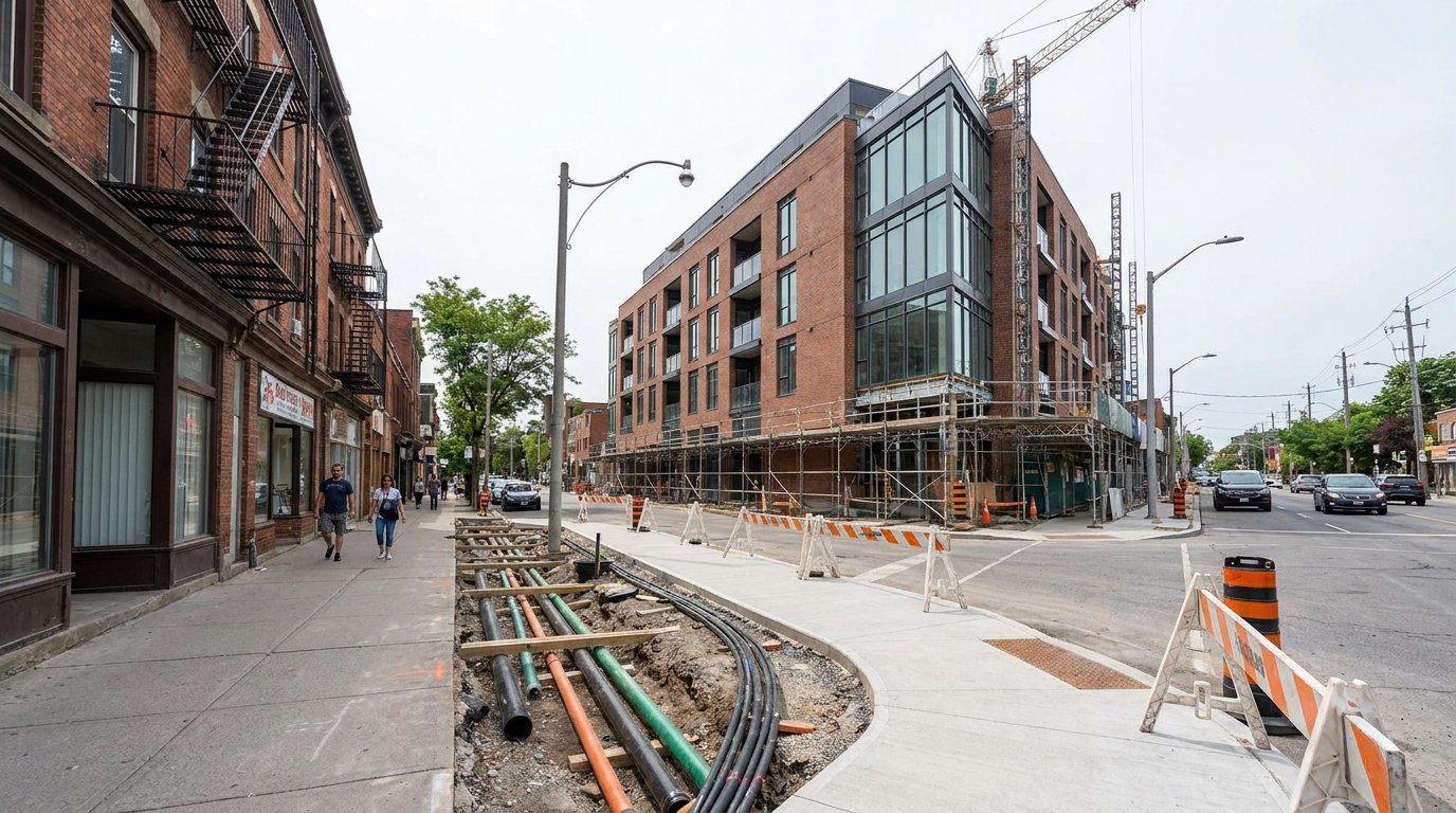
Evaluating greenfield versus infill through a land value lens
One of the most practical uses of land value analysis is comparing development patterns. Greenfield sites at the edge of urban regions may appear less expensive on a per-acre basis, but that does not mean they create better long-term value. Servicing extensions, road expansion, school needs, utility costs, and auto dependency can materially reduce the net benefit of outward growth. Infill sites, by contrast, may carry higher acquisition costs yet benefit from existing infrastructure, stronger transit access, and lower per-unit servicing burdens when planned well.
A disciplined analysis compares these patterns not only through market revenue but also through fiscal and social performance. What is the cost of servicing additional households in each location? How much housing can be delivered per hectare? What transportation outcomes result? How do parks, schools, emergency services, and utilities scale over time? These questions move land value analysis beyond transaction price and into the realm of city-building.
For municipalities, this is where the framework becomes especially powerful. It can demonstrate that strategic infill near transit and services creates stronger long-term tax productivity than low-density expansion. It can also reveal where greenfield growth remains appropriate if phased logically and supported by infrastructure finance. The goal is not ideological purity. The goal is to align land use decisions with durable value, lower emissions, and more efficient urban form.
For developers and landowners, the comparison can reshape strategy. A seemingly cheaper site at the urban fringe may carry longer entitlement timelines and higher infrastructure uncertainty. An infill parcel may look expensive until zoning reform, parking reductions, or a mixed-use program improve residual value. Decisions become better when land is understood as part of a system rather than as an isolated acquisition.
A practical framework for applying land value analysis
For practitioners, the most useful approach is a step-by-step framework that links economics, policy, and implementation. The first step is to establish the site baseline. That means understanding existing use, current zoning, physical constraints, title issues, servicing conditions, and surrounding market context. Without a clear baseline, later assumptions about value uplift or redevelopment potential can become detached from reality.
The second step is to define realistic development scenarios. These should include an as-is case and one or more alternative futures, such as moderate intensification, transit-oriented mixed use, missing-middle housing, or phased redevelopment. Each scenario should reflect planning constraints, built form logic, and local demand conditions. This keeps the analysis grounded in what could actually be delivered.
The third step is to build residual land value models for each scenario. Revenue assumptions should be tested using local comparables and current absorption trends. Cost assumptions should include hard costs, soft costs, financing, municipal charges, contingencies, and profit thresholds. The analysis should not present one exact answer as though it were certain. It should show a value range under different assumptions, especially where interest rates, construction pricing, or timing risk remain volatile.
The fourth step is sensitivity testing. This is where many weak analyses fail. A strong model should test changes in density, unit mix, affordability requirements, construction costs, parking ratios, approval duration, and servicing timing. It should also identify breakpoints, such as the density level at which a project turns viable or the interest rate environment in which value falls below acquisition expectations. Those breakpoints are often more useful than the headline number because they guide negotiation and policy design.
The fifth step is strategic interpretation. Numbers alone do not create good decisions. The analyst must explain what the findings mean for zoning reform, infrastructure sequencing, public benefits, acquisition strategy, or landowner expectations. Sometimes the conclusion will support immediate development. Sometimes it will suggest policy change first. Sometimes it will indicate that a site should be held until servicing or transit arrives. Effective land value analysis does not end with valuation. It ends with action.
Common mistakes that weaken land value analysis
One of the most common errors is relying on a single data point or one appraisal method. Urban land markets are uneven and deeply local. A recent sale can be useful, but one transaction does not define a market. A residual model can be insightful, but if its revenue assumptions are too optimistic or its costs outdated, the result can mislead. Strong analysis cross-checks methods and updates assumptions regularly.
Another mistake is assuming that rezoning automatically creates value. In reality, value only materializes when there is demand, infrastructure capacity, financing availability, and a feasible path to construction. A paper upzoning in a weak market may do little. Conversely, a well-located site with modest zoning reform, faster approvals, and transit access may produce meaningful housing. The difference lies in integrated analysis, not in regulatory change alone.
A third mistake is confusing higher land values with better public outcomes. Rising values can signal economic vitality, but they can also reflect constrained supply, speculation, or exclusionary regulation. If a city celebrates land appreciation while housing production remains weak, the market may be telling a story of scarcity rather than success. Land value analysis must therefore be tied to delivery metrics, affordability objectives, and infrastructure performance.
Finally, some analyses ignore community impact. This is a strategic error because land development does not occur in a vacuum. Good projects depend on mobility, public realm quality, school capacity, parks, utilities, and neighbourhood acceptance. When land value analysis includes these dimensions, it becomes a tool for shaping stronger urban outcomes rather than merely maximizing short-term land price.
The long-term strategic value of getting this right
When land value analysis is done well, it helps cities grow with greater intelligence. It supports better use of transit investment, more disciplined zoning reform, stronger infrastructure finance, and more realistic development expectations. It gives municipalities a basis for negotiating public benefits without undermining feasibility. It gives developers a clearer view of what can be built, when, and under what conditions. It gives communities a more transparent explanation of why certain sites matter and how growth can improve neighbourhood quality.
This matters profoundly in an era of housing shortage and urban transition. Canada does not need growth in the abstract. It needs strategic growth that expands supply, improves accessibility, uses infrastructure more efficiently, and delivers long-term public value. Land is where those ambitions either become practical or break down. If site potential is misunderstood, policy can become performative, infrastructure can be misallocated, and housing goals can drift further out of reach. If site potential is analyzed rigorously, cities can sequence growth with far more precision.
Land value analysis is most powerful when it is used not to ask only what land is worth, but what kind of city that land can help create.
The future of urban development will belong to places that align land economics with public purpose. That means understanding value uplift around transit, evaluating infill against expansion, identifying where regulations suppress feasible housing, and using land-based finance tools with discipline and transparency. It also means building better public data systems and stronger local capacity, since land markets are interpreted most effectively when analysis is grounded in local conditions.
In the end, unlocking land value is not about extracting every possible dollar from a parcel. It is about revealing how land, policy, infrastructure, and market demand interact so that cities can make better decisions. In a period defined by housing pressure, fiscal constraints, and the need for more sustainable urban form, that is not a niche technical exercise. It is one of the defining capabilities of modern city-building.



No Comment! Be the first one.