



In land development, success rarely begins with architecture, marketing, or even zoning strategy alone. It begins with understanding the land itself. Before roads are aligned, buildings are massed, utilities are routed, or housing yield is projected, the physical form of a site has to be read clearly and accurately. That is the role of topographic analysis, and it remains one of the most important tools for unlocking land value while reducing development risk.
Table Of Content
- What Topographic Analysis Actually Means in Development
- Why Topography Is Foundational to Land Value
- How Topographic Analysis Reduces Cost and Risk
- The Growing Importance of Topography in Sustainable Urban Development
- What Topographic Analysis Reveals During Site Planning
- Core Development Decisions Informed by Topographic Analysis
- Modern Tools That Have Changed Topographic Analysis
- Common Misconceptions About Topographic Analysis
- How Topography Connects to Approvals and Policy
- Topographic Analysis as a Value Creation Tool
- Best Practices for Using Topographic Analysis Early
- A Practical Early Stage Topographic Review Should Address
- The Strategic Takeaway
Topographic analysis examines the elevation, slope, drainage, contours, and surface characteristics of a parcel to determine how the land functions in real conditions. It translates raw terrain into planning intelligence. For developers, municipalities, engineers, and urban planners, this intelligence shapes decisions about where to build, how much can be built, what it will cost to service the site, and how to manage water, access, and long term resilience. In an era of intensification, climate adaptation, and pressure to make better use of serviced land, topography is no longer a background technical exercise. It is a strategic input into urban growth.
Across Canada and North America, that importance is growing. Municipalities are under pressure to support housing supply, improve infrastructure efficiency, reduce flood exposure, and align growth with sustainability objectives. At the same time, the quality of terrain data has improved dramatically. High resolution LiDAR, digital elevation models, and more robust GIS analysis now allow project teams to understand sites with much greater precision than in the past. What was once treated as a survey deliverable is now central to development feasibility, approvals, servicing design, and long term value creation.
This article explores why topographic analysis matters so much in land development, what it reveals, how it affects project economics, and why it is essential for sustainable urban planning. The key point is simple: when teams understand the land early, they make better decisions later.
Topographic analysis is not just about measuring land. It is about understanding how land can perform, what it can support, and how to shape growth in a way that is economically sound and environmentally resilient.
What Topographic Analysis Actually Means in Development
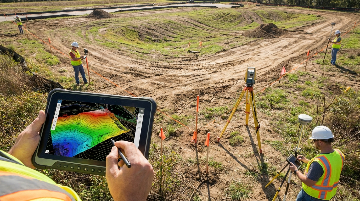
At its core, topographic analysis is the study of a site’s surface form. That includes the visible characteristics most people recognize, such as hills, slopes, low areas, ridges, and drainage paths. It also includes more subtle changes in grade that can significantly affect development outcomes, especially in urban and suburban sites that may appear flat at first glance. A few centimetres or a minor shift in runoff direction can change drainage performance, utility depth, retaining requirements, and building pad design.
For a development team, topographic analysis typically examines several critical dimensions. Elevation identifies how high or low different parts of the site sit relative to one another and to surrounding properties or infrastructure. Slope reveals how steep the terrain is and whether grading, terracing, or access modifications will be required. Drainage patterns show where water naturally flows, where it collects, and how storms may affect site function. Watershed boundaries help determine how the site interacts with broader hydrological systems. Together, these factors help define constraints, opportunities, and realistic development envelopes.
The work often starts with surveyed contours, but modern development increasingly relies on more advanced sources such as Digital Elevation Models and LiDAR derived terrain data. Natural Resources Canada has emphasized the growing importance of accurate elevation information for urban planning, route design, flood mapping, and hazard assessment. LiDAR in particular can create a three dimensional picture of land surfaces with accuracy in the range of roughly five to ten centimetres, which makes it highly useful for site design and terrain modeling in populated areas.
That precision matters because development is a game of compounding decisions. A misread slope affects grading. Grading affects drainage. Drainage affects servicing, erosion control, stormwater storage, and municipal approval conditions. Those in turn affect cost, phasing, timelines, and even achievable density. Topographic analysis is therefore not an isolated technical step. It is the beginning of an interconnected planning process.
Why Topography Is Foundational to Land Value
Land value is not determined by size alone. It is determined by utility, risk, cost, entitlement potential, and the realism of execution. A parcel may look promising on paper, but if its topography creates excessive grading, poor drainage, difficult access, or major servicing complications, the gap between theoretical value and actual value can become substantial. This is why topographic analysis plays such a direct role in development economics.
Sites with favourable terrain often support simpler and more efficient development patterns. Roads can be aligned with less earthwork. Building pads can be created with fewer retaining structures. Utilities can be installed at practical depths with fewer conflicts. Surface drainage can be managed more naturally. In these situations, the site tends to yield more usable area and lower construction complexity. That combination enhances feasibility and can improve residual land value.
Constrained sites are not necessarily bad sites, but they require more strategic handling. A sloped parcel may need cut and fill balancing, stepped foundations, retaining walls, specialized stormwater infrastructure, and carefully phased servicing. A low lying parcel may require floodproofing, overland flow management, and tighter development envelopes. These conditions can still support successful projects, especially in high demand markets, but only if the physical realities are understood early enough to shape the concept plan and financial model.
One of the most important misconceptions in the market is the idea that if land is technically buildable, terrain has only a minor economic role. In reality, topography can meaningfully change development cost structures. The amount of earth moved, the depth of trenching, the location of stormwater infrastructure, the need for retaining systems, and the impact on road design all influence project viability. Topographic analysis helps teams distinguish between land that merely looks developable and land that can be developed efficiently.
How Topographic Analysis Reduces Cost and Risk
Development risk often hides in the ground long before it appears in budgets or approvals. Topographic analysis brings that risk into view. By identifying drainage issues, slope transitions, low points, erosion pathways, and access challenges at an early stage, teams can design around problems rather than react to them after capital has been committed. In practical terms, this can reduce redesigns, delays, cost overruns, and operational failures after construction.
Stormwater is one of the clearest examples. Urban development typically alters the natural behaviour of a site by removing vegetation, compacting soil, reshaping grades, and adding hard surfaces and drainage systems. As the United States Geological Survey has noted, these changes can increase runoff and intensify downstream flood peaks and flood frequency. That means topographic analysis is not just about understanding the existing site. It is also about predicting how development will change water movement across and beyond the parcel.
If a site is not analyzed properly, the consequences can be long lasting. Poor grading can create ponding around foundations, which may lead to seepage or structural deterioration over time. Inadequate overland flow routing can put streets, garages, and lower units at risk during extreme rainfall. Misjudged slope conditions can accelerate erosion or destabilize embankments. Utility corridors may end up in difficult locations, forcing expensive redesigns. Each of these outcomes can undermine both financial performance and community confidence.
Topographic analysis improves decision making because it allows teams to test scenarios before they become liabilities. It helps answer critical questions early in the process.
- Where can building pads be placed with minimal earthwork?
- How will water move across the site during major storm events?
- Which areas require slope stabilization or retaining structures?
- Can roads maintain safe grades while connecting efficiently to the surrounding network?
- What portions of the land are realistically buildable once drainage and setbacks are considered?
When these questions are answered early, a project becomes more predictable. Predictability is one of the most valuable assets in development.
The Growing Importance of Topography in Sustainable Urban Development
Sustainable development is often discussed in terms of energy efficiency, transit access, or building materials. Those issues matter, but sustainable growth also depends on using land wisely. That means understanding where density fits, where infrastructure can be extended efficiently, where natural systems should be preserved, and where development pressure may conflict with flood resilience or watershed health. Topographic analysis is central to all of those decisions.
As cities intensify, more projects are moving onto infill parcels, underused sites, edge lands, and places with physical constraints that would once have been avoided. These sites may be valuable because they are well located, but they often require a more careful understanding of terrain. Subtle elevation changes in a flat urban district can determine basement risk, utility connection feasibility, and stormwater storage opportunities. In this way, topography becomes part of the larger strategy for accommodating growth without simply expanding outward.
There is also a climate resilience dimension that cannot be ignored. More intense rainfall events, floodplain pressures, and aging drainage systems are forcing municipalities to take terrain more seriously. High quality elevation data supports flood mapping, hazard assessment, overland flow analysis, and stormwater planning. Natural Resources Canada has continued investing in high resolution elevation datasets and flood related terrain tools, underscoring how terrain intelligence has become linked to public safety and smarter growth management.
In many cases, topography also reveals where land should not be pushed too hard. Some areas are better suited for parks, stormwater features, naturalized buffers, or lower intensity uses rather than maximum buildout. This is not lost value. In many successful communities, land use patterns that respond to terrain create more durable and attractive development outcomes. They support amenity, reduce infrastructure burden, and improve long term performance for both residents and municipalities.
What Topographic Analysis Reveals During Site Planning
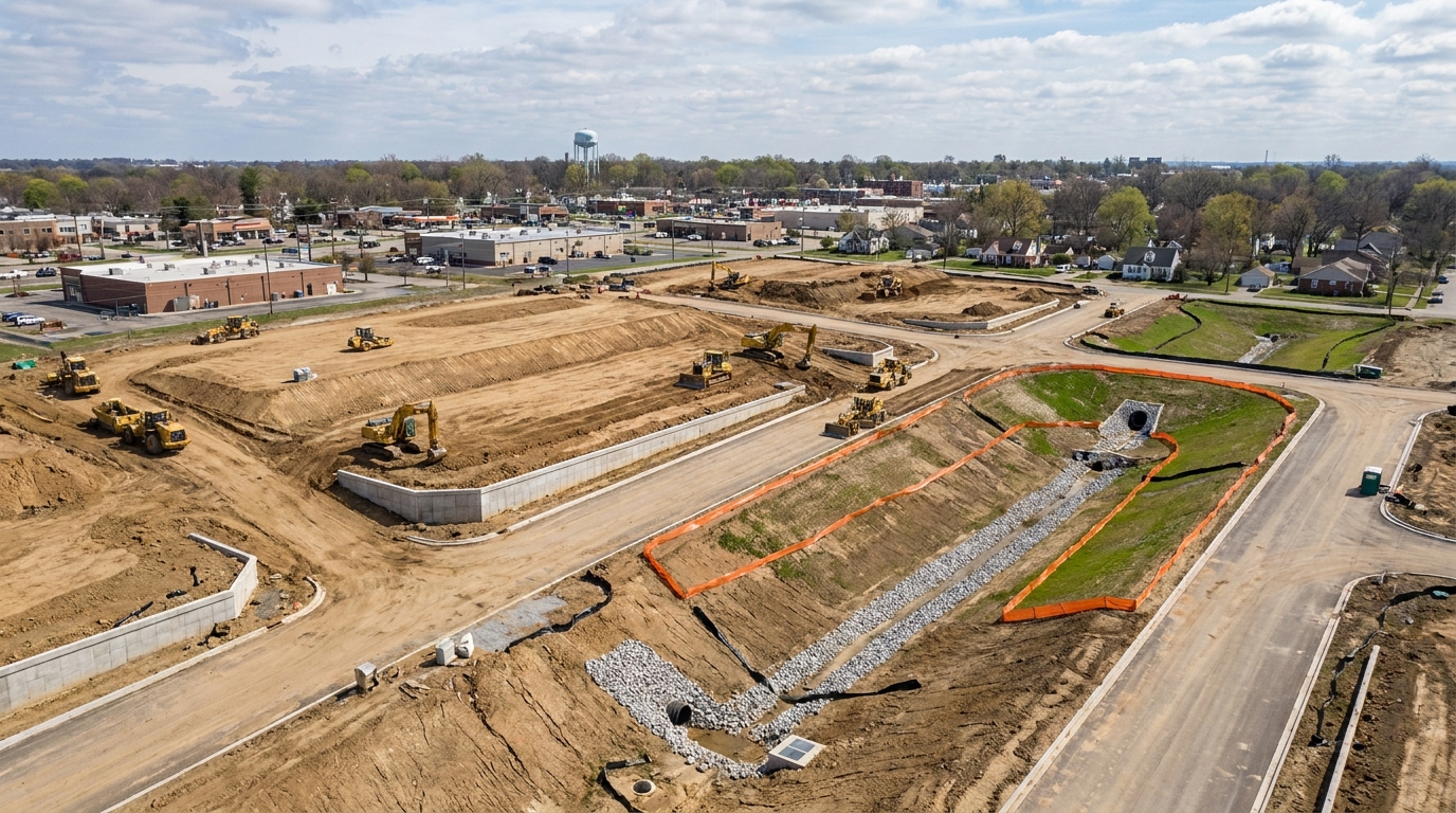
A strong site plan is not simply drawn onto land. It is shaped by the land. Topographic analysis gives planners and engineers the insight needed to align development with physical conditions instead of fighting them unnecessarily. This often leads to more efficient layouts, better infrastructure placement, and stronger integration between built form and open space.
Road alignment is one major example. Streets need workable grades for safety, accessibility, servicing, and constructability. If the terrain is not understood properly, road design can become excessively expensive or functionally compromised. The same is true for utilities. Gravity systems such as sanitary sewers are highly sensitive to elevation relationships. A seemingly minor misunderstanding of grade can create deep trenching, pumping requirements, or awkward routing that affects both capital cost and long term maintenance.
Building placement is equally influenced by topography. The orientation of structures, the amount of exposed foundation, the interface with sidewalks and driveways, and the ability to provide accessible entries all depend on grade. On denser sites, these relationships become even more important. Terraced solutions, podium levels, stepped massing, and grade integrated parking can create excellent results, but only if the terrain is understood early enough to support thoughtful design.
Open space planning also benefits from topographic intelligence. Parks, trails, natural corridors, and stormwater systems often perform better when they are organized around existing landform logic rather than imposed arbitrarily. Lower areas may be ideal for stormwater attenuation or habitat functions. Elevated areas may offer visibility, amenity value, or better conditions for certain building types. Topography helps turn site planning from a two dimensional exercise into a three dimensional strategy.
Core Development Decisions Informed by Topographic Analysis
- Buildable area assessment: Teams can distinguish usable land from constrained land more accurately, which improves yield assumptions and concept planning.
- Grading and earthworks strategy: Understanding cut and fill needs early helps estimate cost and identify opportunities to balance earth on site.
- Stormwater management design: Surface flow paths, pond locations, infiltration opportunities, and flood controls all depend on terrain behavior.
- Road and access planning: Slopes influence road safety, driveway design, emergency access, and integration with adjacent streets.
- Utility routing: Water, sanitary, and storm systems all rely on practical elevation relationships and available corridors.
- Phasing logic: Large projects can sequence development more effectively when terrain constraints and servicing dependencies are clear.
Modern Tools That Have Changed Topographic Analysis
The quality of planning decisions depends heavily on the quality of underlying data. In the past, developers often relied on contour plans with wider intervals and limited detail. While those plans are still useful, today’s projects increasingly benefit from much more precise terrain information. LiDAR, GIS based analysis, and advanced digital elevation models have significantly improved how sites are evaluated and designed.
LiDAR has been especially transformative. By using laser scanning to capture the earth’s surface in detail, LiDAR can generate highly accurate three dimensional terrain models. Natural Resources Canada notes that LiDAR can produce land surface information accurate to within about five to ten centimetres. That level of precision is particularly important in populated regions where minor grade changes can have major implications for drainage, building interface, and servicing design.
Canada’s public data environment has also become more useful to planners and developers. High resolution elevation data for many of the country’s most populated areas is publicly available through products such as HRDEM and the HRDEM Mosaic. This matters because it lowers barriers to early stage analysis and allows project teams to assess constraints and opportunities before they commit to more detailed design work. It also supports municipalities in standardizing expectations around flood resilience, hazard mapping, and infrastructure planning.
GIS based suitability analysis adds another layer of value. Good development decisions do not treat topography in isolation. They integrate terrain with soils, geology, floodplain conditions, ecological constraints, infrastructure capacity, and socioeconomic context. This multi criteria approach reflects the real complexity of land evaluation. It helps identify which sites are suitable for higher density growth, which require mitigation, and which should be protected or assigned different functions in the urban system.

Common Misconceptions About Topographic Analysis
One of the most persistent misconceptions is that topographic analysis only matters on steep or mountainous land. In reality, some of the most consequential terrain issues emerge on sites that appear flat. Subtle differences in elevation can determine where water ponds, whether a basement is vulnerable, how deep utilities must run, and whether a site can support efficient grading. Flat does not mean simple.
Another misunderstanding is that a contour map alone is enough for development planning. Contours are useful, but modern projects often require much more. High resolution terrain models, hydrological interpretation, watershed context, floodplain awareness, and coordination with geotechnical and servicing information are all essential. A contour plan may show shape, but it does not necessarily reveal behaviour. Development decisions need both.
There is also a tendency to overstate the power of topography by treating it as the single determinant of suitability. Terrain matters enormously, but it is only one layer in a broader development framework. Soils, geology, environmental constraints, regulatory conditions, market demand, infrastructure availability, and community planning objectives all shape the ultimate outcome. The best projects are grounded in integrated analysis rather than one dimensional conclusions.
Finally, some landowners assume that topography is a design problem to solve later rather than a feasibility issue to understand now. That mindset can be expensive. When terrain constraints are discovered after a project concept or valuation has already been established, the entire business case may have to be revised. Early analysis protects against false assumptions and allows land strategy to be based on reality rather than optimism.
How Topography Connects to Approvals and Policy
Topographic analysis is not only relevant to private design teams. It is increasingly tied to public policy, development approvals, and municipal growth management. Cities and regions are under growing pressure to ensure that new development is safe, serviceable, and aligned with climate adaptation objectives. Terrain data helps public authorities evaluate whether that standard is being met.
Floodplain mapping is one obvious area of connection. As flood risk becomes more central to planning policy, elevation data plays a crucial role in determining setbacks, hazard boundaries, overland flow routes, and minimum finished floor elevations. In many jurisdictions, terrain informed review is now embedded in the development process. That is a positive shift because it encourages better alignment between private proposals and public risk management goals.
Topographic analysis also influences infrastructure review. Municipalities need confidence that roads can be built safely, that water can be managed without creating downstream impacts, and that utility systems will function over time. On larger sites, terrain may shape subdivision patterns, parkland location, stormwater blocks, and phasing plans. In other words, topography often becomes part of the language through which a project is judged for approval.
From a strategic standpoint, this reinforces an important lesson for landowners and developers. Good terrain analysis is not just about smoother engineering. It can also improve approval readiness. When an application demonstrates that site design has been informed by a clear understanding of slope, drainage, watershed context, and resilience, it is more likely to be viewed as credible and well considered.
Topographic Analysis as a Value Creation Tool
The most forward looking way to think about topographic analysis is not as a constraint checklist but as a value creation tool. It helps identify where a site can perform better than expected, where design innovation can unlock difficult land, and where the economics of a project can be improved through better alignment with physical reality. This is especially important in land constrained markets where every hectare must work harder.
On some sites, topographic analysis reveals opportunities for premium views, stepped built form, integrated open space, or efficient drainage strategies that reduce infrastructure burden. On others, it may support a smarter phasing approach that uses higher ground first while sequencing major earthworks over time. In redevelopment and infill contexts, it can reveal how subtle grade relationships can support underground parking access, pedestrian connectivity, or transitions between old and new urban fabric.
Even constrained terrain can support value when handled strategically. A sloping site may allow walkout units, terraced public spaces, or differentiated product types. A low area may become a stormwater amenity integrated into a park network. A ridge may guide street orientation and create stronger identity. The point is not to romanticize every site condition. It is to recognize that informed terrain analysis expands the range of viable responses.
In this sense, topography is deeply connected to long term city building. It helps determine not only what can be built, but how well a place will function once occupied. Roads that follow logical grades are easier to maintain. Stormwater systems that respect landform perform more reliably. Open spaces placed in harmony with terrain tend to feel more natural and useful. Value is created not only in the pro forma, but in the durability of the urban environment itself.
Best Practices for Using Topographic Analysis Early
The greatest benefits of topographic analysis come when it is integrated early in the development process. Too often, terrain is treated as something to verify after a land concept has already taken shape. A better approach is to let topography inform site selection, acquisition strategy, preliminary yield, and concept design from the outset. That sequence produces stronger and more realistic decisions.
For landowners and development teams, a disciplined process usually includes several steps. Start with the best available elevation data, including public sources where appropriate, but move quickly toward site specific survey and technical review as the project advances. Integrate topographic findings with hydrology, geotechnical information, servicing constraints, and planning policy. Test multiple layout scenarios rather than assuming a single concept is optimal. Most importantly, let terrain information influence the financial model rather than sitting outside it.
Projects also benefit when topographic analysis is understood collaboratively. Planners, engineers, surveyors, architects, and landscape professionals often see different implications in the same terrain data. When these perspectives are coordinated early, the development concept becomes more coherent. Fewer surprises emerge later, and the project is better positioned to balance cost, function, resilience, and design quality.
A Practical Early Stage Topographic Review Should Address
- Existing grades across the site and at property boundaries
- Surface drainage routes and low points
- Potential flood exposure or overland flow conflicts
- Road access feasibility and grade transitions
- Preliminary cut and fill implications
- Utility servicing relationships and depth concerns
- Areas better suited for development, open space, or stormwater functions
- How terrain interacts with zoning, setbacks, and environmental constraints
The Strategic Takeaway
Topographic analysis is one of the clearest examples of how technical knowledge drives better strategic outcomes in land development. It links the physical reality of a site to the economic, regulatory, and urban design decisions that determine whether a project succeeds. It can reduce risk, sharpen feasibility, improve servicing logic, support climate resilience, and guide more sustainable growth patterns.
In a market shaped by housing demand, infrastructure pressure, and rising environmental risk, understanding land at the terrain level is no longer optional. It is foundational. High resolution elevation data, LiDAR based mapping, and GIS driven suitability analysis have made it possible to evaluate sites with far greater sophistication than in the past. The opportunity now is to use that information strategically, not just technically.
For developers, this means viewing topography as part of value creation. For municipalities, it means integrating terrain intelligence into growth management and approvals. For communities, it means better performing places that respect natural systems while accommodating urban growth more effectively. The strongest land decisions are rarely the ones that ignore the land. They are the ones that understand it deeply and build from that understanding with discipline and vision.
When topographic analysis is done well, it does more than describe a site. It reveals the logic of development itself. It shows where risk sits, where opportunity lies, and how growth can be shaped in a way that is practical, resilient, and economically sound. In that sense, topographic analysis is not just a technical input. It is a key to successful land development.



No Comment! Be the first one.