Yonge North Moves From Transit Promise To Land Value Reality
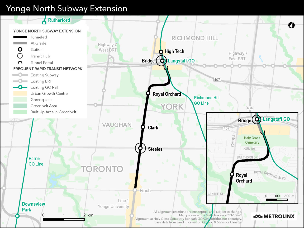
The completion of the tunnel launch shaft for the Yonge North Subway Extension is more than a construction milestone. It is the point where a long debated regional transit idea begins to harden into a land use certainty. As UrbanToronto reported, excavation is now complete just south of Langstaff Road East in Markham, setting up tunnel boring machines to drive more than six kilometres of twin tunnels toward Finch station.
For developers, planners, and institutional landowners along the Yonge corridor, the signal is clear. The northern extension of Line 1 is no longer a speculative planning layer. It is becoming fixed infrastructure, and fixed infrastructure changes the economics of land. Parcels around Steeles, Clark, Bridge, High Tech, and Richmond Hill Centre will increasingly be judged not by their current built form, but by their future transit capacity, assembly potential, and ability to absorb density.
The project also shows how transit feasibility and housing feasibility are now tied together. The Yonge North Subway Extension was held back for years because Line 1 was already at or near capacity south of Eglinton before the pandemic. The political and technical breakthrough came only after Ontario advanced the Ontario Line, which is intended to relieve pressure on the existing downtown subway network. That sequencing matters. New density cannot be planned responsibly without network capacity, and major transit investment is increasingly being justified by future growth rather than existing ridership alone.
The Yonge and Steeles area is the immediate development story. Expropriated properties, demolition activity, and the coming temporary rerouting of Yonge Street point to the scale of intervention required to build Steeles station under an active arterial. The former Hudson’s Bay location at Centerpoint Mall and the cleared plaza on the southeast corner are not isolated construction impacts. They are early evidence of a broader land reset at one of the most important municipal boundary intersections in the region.
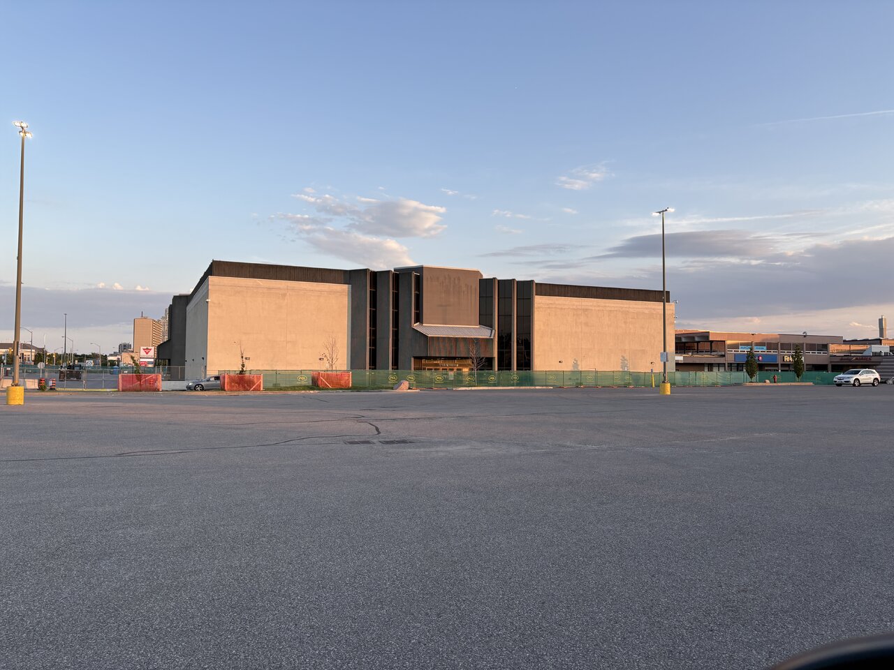
That reset will create opportunity, but also complexity. Yonge and Steeles sits at the edge of Toronto, Vaughan, and Markham influence, with York Region growth ambitions pressing against Toronto infrastructure constraints. Any serious redevelopment strategy in this node will need to account for station construction staging, road realignment, servicing capacity, pedestrian access, bus integration, and the policy posture of multiple governments. Land value will rise, but so will entitlement risk for owners who assume transit proximity alone guarantees approvals.
Subway construction does not simply improve access. It rewrites the development logic of every parcel within walking distance of a station.
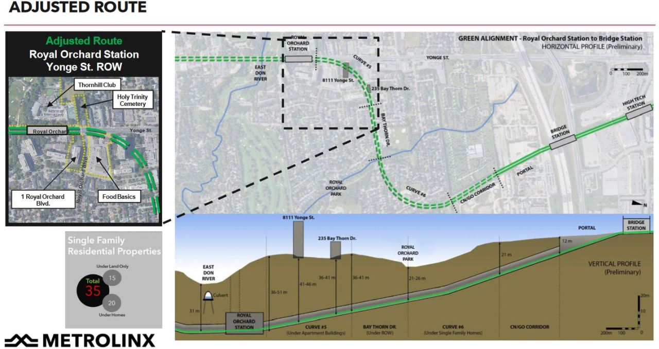
The Royal Orchard alignment also deserves attention. Metrolinx’s decision to tunnel deeper beneath established low-rise neighbourhoods reflects the political cost of inserting regional infrastructure through stable residential areas. For planners, it reinforces a difficult truth. The region wants subway-enabled growth, but the path to building it still runs through local resistance, impact mitigation, and expensive engineering adjustments.
The next phase to watch is not only tunnelling progress. It is how municipalities translate this infrastructure into zoning, as-of-right density, parkland strategy, community benefits, and servicing commitments. Developers should be tracking land assemblies before station areas are fully repriced, but they should also be testing projects against long construction timelines, disruption, and evolving inclusionary or affordability expectations.
The Yonge North Subway Extension is now moving underground. The development market above it will not wait for opening day.
Source: UrbanToronto