Transit Lines Are Now the GTA’s Development Blueprint
Land development in the Greater Toronto Area no longer starts with a site plan. It starts with a transit map. Across the region, the strongest signal of where housing growth is headed is not zoning alone, it is proximity to a subway extension, a GO line, or a future LRT stop. That shift changes how I think about feasibility, and it should change how every developer, planner, and municipal partner approaches land decisions for the next decade.
The Vaughan Metropolitan Centre is the clearest proof of concept the region has produced. A district once defined by industrial and commercial use was repositioned into a dense residential and office node once Line 1 arrived. That is not a coincidence of timing, it is a lesson in sequencing. Infrastructure investment came first, and density followed at a scale that would have been financially and politically difficult to justify without it. Any developer studying feasibility today should treat that sequence as a template, not an anomaly.
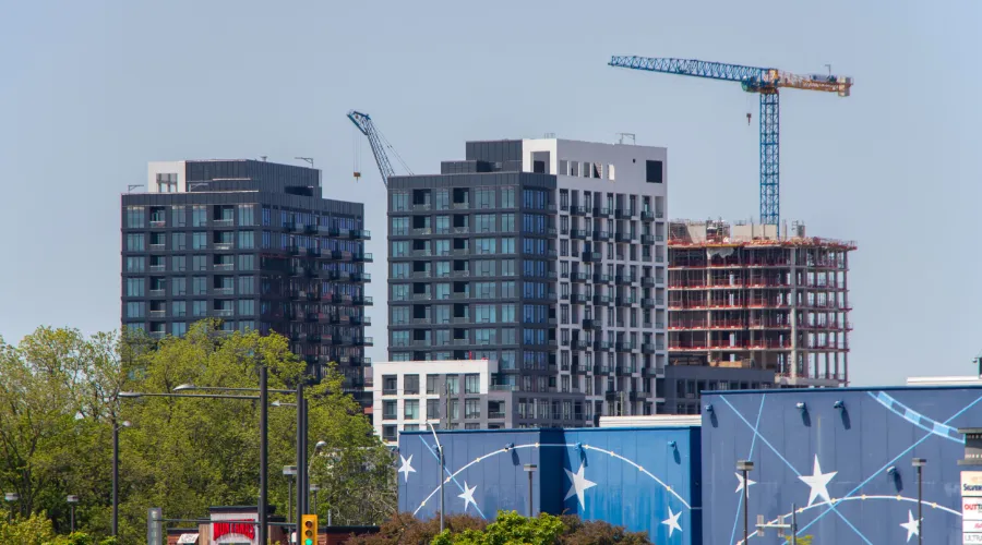
Yonge and Eglinton tells a related but distinct story, intensification along an already established corridor, amplified further by the Eglinton Crosstown LRT. That kind of layered transit access, subway plus LRT plus GO connections, is exactly what makes long term land value defensible even through market cycles. It is also why emerging projects deserve close scrutiny now, before the infrastructure is finished and the land premium is already priced in.
East Harbour is the project I would point to as the region’s next major test case. A 38-acre community built around a hub expected to move roughly 100,000 daily riders, connecting the Lakeshore East and Stouffville GO lines with the future Ontario Line, is not incremental development. It is city-building at a scale that requires patient capital, coordinated planning, and a willingness to commit before every amenity exists. Infrastructure Ontario’s plan for more than 4,000 residential units alongside commercial and cultural space is the kind of integrated vision that defines what transit-oriented growth is supposed to achieve.
Strong projects are built from a wider understanding of timing, access, infrastructure, and policy, not from land price alone.
The Ontario Line corridor is where I expect the next wave of feasibility studies to concentrate. Corktown, Thorncliffe Park, Flemingdon Park, and the Exhibition district are all attracting development interest years ahead of stations opening, which means land positioning decisions are already being made on the assumption of future ridership and connectivity. Mississauga’s Brightwater and the emerging Hazel McCallion corridor show the same logic extending beyond Toronto’s borders, as regional transit stitches municipalities together into a single competitive housing market.
None of this happens without policy cooperation. TRREB’s continued advocacy on development charges, zoning near transit stations, and parking requirements is directly tied to whether these projects remain financially viable. For developers, that advocacy is not background noise, it is part of the feasibility model. The municipalities and provinces that clear those barriers fastest will capture the growth. The ones that do not will watch it move elsewhere.