



Walkable communities are often described in simple lifestyle terms. People picture a pleasant main street, a corner cafe, a short walk to school, or a quick trip to the park without needing to get in the car. Those images are appealing, but they only capture part of the story. In reality, walkability has become a serious urban planning, housing, infrastructure, and economic development issue. It is increasingly understood as a long term strategy for building cities that are healthier, more resilient, and more efficient in the way they use land and public investment.
Table Of Content
- Why Walkable Communities Matter More Than Ever
- What Actually Makes a Community Walkable
- The Role of Housing Diversity
- The Economic Case for Walkable Urbanism
- Why Zoning Laws Often Stand in the Way
- Infrastructure Is More Than Sidewalks
- Walkability, Affordability, and the Risk of Exclusion
- Case Studies That Show the Path Forward
- Hamilton and Growth Around Future LRT
- Barcelona’s Superblocks
- Toronto’s Priority Retail Streets
- Common Misconceptions About Walkable Communities
- What Cities Need to Do Next
- Conclusion: Walkability as a Development Strategy
That shift matters. For decades, many North American communities were planned around separation of uses, wide roads, large parking fields, and low density growth at the urban edge. That pattern made driving the default for even the shortest daily trips. It also came with consequences, including higher infrastructure costs, housing pressure in desirable urban areas, weaker local retail environments in some districts, and growing concern about public health and emissions. Walkable communities offer a different model, one that organizes urban life around access rather than distance and around proximity rather than dependence on the automobile.
At its core, a walkable community is a place where daily needs such as housing, jobs, schools, transit, parks, groceries, and services can be reached safely and conveniently on foot, rather than requiring a car for every short trip. In practice, truly walkable places also support cycling and transit, because walking works best when it is part of a broader mobility system rather than a standalone feature. Canada’s active transportation policy makes this point directly by emphasizing complete networks that connect main streets, schools, parks, transit hubs, and neighborhoods, rather than treating sidewalks as an isolated amenity. That is an important planning lesson. Walkability is not just a sidewalk program, and it is not simply a matter of adding a bike lane or repainting a crosswalk. It is a land use and infrastructure strategy that determines how neighborhoods function over time, shaping everything from household transportation costs to local business vitality and municipal budgets.
This is why walkability has become central to conversations about complete communities, transit oriented development, missing middle housing, and long term urban competitiveness. It sits at the intersection of planning and public health, real estate and public policy, local business vitality and climate resilience. The cities that understand this are moving beyond cosmetic streetscape upgrades and into deeper reforms such as mixed use zoning, parking reform, station area planning, affordable housing requirements, and connected street design. The future of urban living will not be shaped by one isolated intervention. It will be shaped by whether cities can align housing, mobility, and land value with a more human scale pattern of growth.
In this article, I want to look at walkable communities through that broader lens. We will explore why walkability matters to residents and businesses, the design principles that make it work, the policy barriers that often slow progress, and the case studies that show what successful implementation looks like. The underlying argument is straightforward. Walkability is not a luxury feature for a few downtown districts. It is a practical, long term urban development strategy that can help cities grow more intelligently and more equitably.
Why Walkable Communities Matter More Than Ever
There is a reason walkability has moved from a design aspiration to a policy priority. Cities across Canada and the United States are under pressure to deliver more housing, modernize infrastructure, reduce emissions, improve public health, and create stronger local economies without endlessly expanding outward. Walkable communities respond to all of those pressures at once. They make better use of land, support more transportation choices, and allow cities to concentrate investment where it produces the greatest long term return.
Health is one of the clearest reasons for this shift. The U.S. Centers for Disease Control and Prevention states that designing communities around walking, biking, and rolling can improve health, safety, social interaction, local economies, and air quality. The World Health Organization has also linked poor walkability and limited access to recreational areas with physical inactivity, noting that physical inactivity accounts for 3.3 percent of global deaths. Those are not cosmetic concerns. They show that community design directly affects everyday health outcomes. When residents can incorporate movement into ordinary routines such as commuting, errands, school drop offs, and social visits, physical activity becomes part of daily life rather than an extra task.
Walkability also affects household economics. In car dependent communities, families often need to own and operate multiple vehicles simply to manage basic routines. That can consume a large share of household income, especially for lower and middle income households. In more walkable neighborhoods, the ability to complete some trips on foot, by bike, or by transit reduces transportation costs and gives people more flexibility. That matters in a period when housing costs are already putting pressure on affordability. If urban planning can lower the cost of living beyond just rent or mortgage payments, it creates real value for residents.
There is also a city building argument that cannot be ignored. Low density sprawl stretches infrastructure networks over larger geographies, increasing the cost of servicing growth with roads, pipes, utilities, and public services. Compact, walkable development tends to use infrastructure more efficiently, especially when it is coordinated with transit. Agencies such as the U.S. Environmental Protection Agency and organizations like Smart Growth America have consistently argued that compact, walkable development creates economic benefits not only for residents and businesses but also for local governments. Over the long run, the financial performance of urban form matters. Cities that can support growth without perpetually subsidizing inefficient expansion are in a stronger fiscal position.
The timing is especially relevant in Canada. Statistics Canada reported that 6.0 percent of commuters walked or biked to work in May 2024, and it has recently expanded data on cycling infrastructure using municipal open data sources. At the federal level, Canada launched its first National Active Transportation Strategy in 2021 along with a $400 million Active Transportation Fund, and the broader policy environment is increasingly tying housing, transit, and active transportation together. This tells us that walkability is no longer a niche issue discussed only by designers and advocates. It is now embedded in national and municipal infrastructure strategy.
What Actually Makes a Community Walkable
One of the biggest misconceptions about walkability is that it can be created simply by adding sidewalks. Sidewalks are essential, but they are only one component in a much larger system. A truly walkable community depends on the relationship between land use, street design, density, safety, and destination mix. If the nearest grocery store, school, transit stop, and daily services are separated by long distances or disconnected by hostile roads, then a sidewalk alone does not produce meaningful walkability.
The most important ingredient is proximity. Residents need destinations worth walking to, and those destinations need to be close enough to make walking practical. That is why mixed use planning is fundamental. Housing, retail, schools, employment, parks, and community services should not be isolated from one another in rigidly separated districts. They should be arranged in a way that supports daily life. This does not mean every block needs every use. It means the neighborhood as a whole should function as a connected ecosystem rather than as a collection of isolated pods.
Street connectivity is equally important. Smaller blocks and more connected street networks create direct routes and multiple choices for getting around. By contrast, cul de sacs, super long blocks, and discontinuous pathways force people onto longer, less intuitive journeys. Connectivity is a hidden determinant of urban behavior. A place may look pleasant on a map, but if the path to a school or a transit stop requires several detours around barriers, the practical experience becomes less walkable. Good planning respects desire lines and everyday convenience.
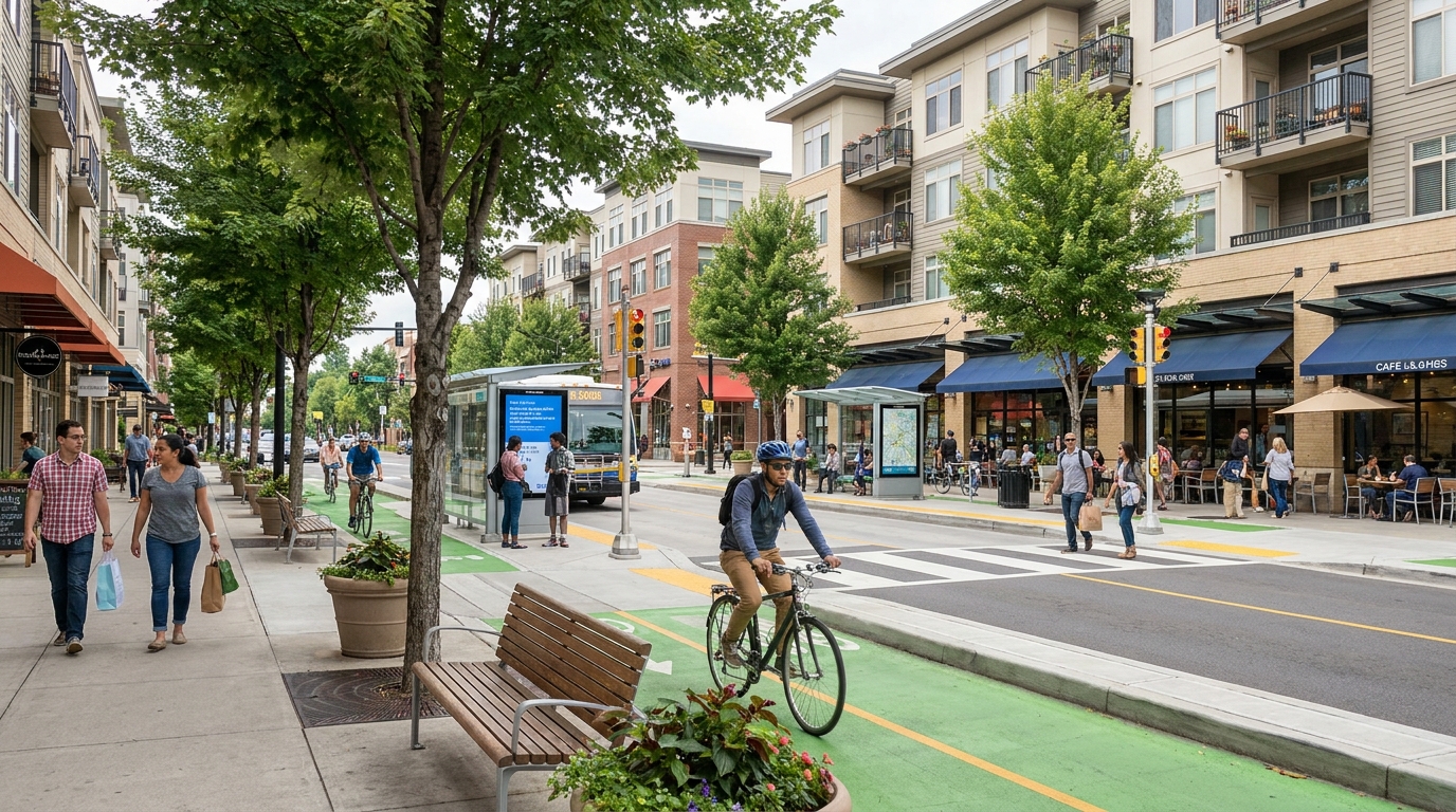
The public realm also matters. Wide sidewalks, shade trees, seating, weather protection, safe crossings, active building frontages, and human scaled lighting all shape whether a street feels comfortable and safe. A walk that is technically possible but unpleasant or dangerous will not attract many users. This is where complete streets principles become important. Streets should be designed not only to move vehicles but also to support pedestrians, cyclists, transit users, children, seniors, and people with mobility challenges. Accessibility is not an optional add on. It is part of what makes a community truly complete.
Transit integration is another defining feature. Walkable communities are strongest when walking and transit reinforce each other. Frequent transit expands the range of destinations residents can reach without needing a car, while walkable station areas make transit more useful and attractive. In Canada’s largest cities, CMHC notes that housing supply often concentrates near transit in higher density forms, especially in urban cores. That pattern reflects both market logic and planning logic. Transit and walkability together create some of the most effective conditions for sustainable urban growth.
The Role of Housing Diversity
Walkability cannot be separated from housing type. If only a narrow band of housing forms is allowed in large areas of a city, it becomes much harder to create enough local population to support frequent transit, neighborhood retail, and a healthy mix of services. This is one reason missing middle housing has become so important in current planning debates. Duplexes, triplexes, fourplexes, townhouses, courtyard apartments, and mid rise buildings can add population in a form that supports walkable neighborhoods without requiring every area to redevelop as high rise towers.
Housing diversity also helps communities evolve over time. A walkable district needs residents at different life stages and income levels. Young adults, families, seniors, and workers in service and creative sectors all contribute to neighborhood vitality. If zoning allows only detached housing in one area and only high rise apartments in another, cities limit their ability to create balanced, inclusive communities. Fine grained housing mix is not just about aesthetics or variety. It is a structural part of walkability because it determines who can live close to daily destinations.
Walkability works best when land use, housing, and mobility are planned together. Sidewalks matter, but they cannot compensate for zoning that separates people from the places they need to reach.
The Economic Case for Walkable Urbanism
Walkability has sometimes been framed as a lifestyle preference associated with a small segment of the market. That framing is outdated. Today, walkable urbanism is closely tied to economic productivity, land value, local business strength, and municipal efficiency. Well designed walkable districts tend to generate higher foot traffic, more street level commercial activity, and stronger demand for complete communities. For developers and municipalities alike, that combination can support durable long term value.
Local business performance is one of the clearest examples. Streets that are easy and pleasant to walk typically support more spontaneous visits, longer dwell times, and greater visibility for small businesses. Retail in walkable districts benefits from proximity to residents, workers, and transit users rather than relying exclusively on destination driving. This helps explain why many cities protect active frontages in key corridors. In Toronto, for example, Priority Retail Streets zoning requires at least 60 percent of lot frontage on designated streets to be dedicated to street related retail and service uses. That is a planning tool designed to preserve the conditions that animate walkable commercial districts.
There is also a broader public finance angle. Compact, mixed use neighborhoods can generate strong tax productivity per hectare while using less land and often less infrastructure per resident than dispersed greenfield growth. Municipalities facing budget constraints should pay close attention to this. Growth is not just about adding units or population. It is about where that growth occurs and how expensive it is to service over time. When development is concentrated in places where infrastructure, transit, and public amenities can be shared more efficiently, cities improve their long term fiscal outlook.
From a real estate and development perspective, walkable places are valuable because they create optionality. A resident can live close to work, transit, school, recreation, and services. A business can capture passersby from multiple trip types. A developer can build residential, office, or mixed use product that benefits from stronger placemaking. A city can justify better transit and public realm investment because demand is concentrated. This is not accidental. It is the result of urban form that aligns mobility, density, and land use in a coherent way.
Why Zoning Laws Often Stand in the Way
If the case for walkable communities is so strong, why are they still difficult to build at scale? The answer often comes back to zoning and development rules that reflect older assumptions about how cities should grow. Many zoning frameworks still separate housing from retail, cap density near transit, mandate excessive setbacks, or require large amounts of parking. These rules can make it illegal or financially impractical to build the very kinds of neighborhoods that policy makers say they want.
Parking minimums are a good example. Requiring large amounts of off street parking consumes land, raises development costs, and weakens the pedestrian environment by pushing buildings farther apart. It also assumes that car ownership and car use must remain the dominant mode for all trips. In a walkable community, the goal is not to eliminate cars entirely. It is to reduce car dependence by giving people viable alternatives. Parking reform is therefore not anti car. It is pro flexibility, pro affordability, and often pro good urban design.
Single use zoning can be just as limiting. When residential areas are separated from shops, services, and workplaces, even short trips become vehicle trips. That undermines both walkability and local economic vibrancy. Mixed use zoning allows neighborhoods to support a daily rhythm of activity and makes the public realm safer and more interesting. Ground floor retail, small offices, community services, and housing can coexist successfully when regulations are designed around compatibility rather than rigid separation.
Another issue is density permission near transit. Cities regularly invest billions into rail lines, bus rapid transit, and station upgrades, yet surrounding land is sometimes still governed by low intensity zoning. That is a major missed opportunity. Transit oriented development only works when the planning framework allows sufficient housing, jobs, and services within walking distance of transit stations. Without that alignment, public transit investment underperforms and households continue to face pressure to drive even in areas that should support alternatives.
Infrastructure Is More Than Sidewalks
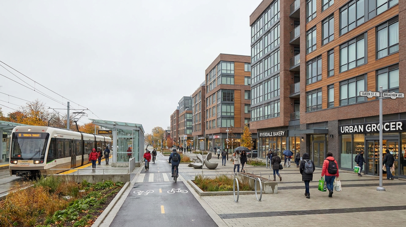
When cities talk about walkability, there is often a tendency to focus narrowly on visible pedestrian infrastructure. That is understandable, but insufficient. Walkability depends on complete networks, not isolated segments. Canada’s Active Transportation Fund explicitly defines effective active transportation infrastructure as a complete network connecting main streets, schools, parks, transit hubs, and residential neighborhoods. That network logic is critical because people do not experience cities one block at a time. They experience them as whole journeys.
Safe crossings are one of the most consequential but underestimated parts of that network. A neighborhood can have sidewalks on every street, yet still feel unwalkable if major intersections are dangerous, poorly timed, or intimidating for seniors, children, and people with disabilities. Intersection design, crossing distance, signal priority, curb geometry, and traffic calming all influence whether walking is realistic. This is why Vision Zero and complete streets frameworks have become increasingly relevant to walkability. Safety is not a separate issue. It is foundational.
Street trees, lighting, benches, weather protection, and access to public washrooms may seem secondary compared with zoning or transit, but they strongly influence comfort and dignity in public space. A city that wants more residents to walk has to consider the practical reality of climate, age, and mobility. In colder or hotter climates, shade and shelter matter. In neighborhoods with more seniors, seating and shorter crossing distances matter. In family oriented areas, safer school routes and visible public spaces matter. Good walkability is not abstract. It is deeply tied to the lived experience of different kinds of users.
Digital and governance infrastructure matter too. Municipal coordination across planning, transportation, public works, parks, and housing departments is often what determines whether a walkability agenda succeeds. Too many projects still move through fragmented systems where one department widens roads, another seeks transit ridership, and another talks about complete communities. Implementation requires a common strategic direction. Cities that perform well in this space tend to integrate capital planning, land use approvals, and mobility policy rather than treating them as separate silos.
Walkability, Affordability, and the Risk of Exclusion
One of the most important realities in this conversation is that walkable communities can become expensive when demand rises faster than supply. The market often recognizes the value of proximity, amenity, and mobility before planning systems fully adapt to provide more housing in those locations. As a result, some of the most walkable neighborhoods become difficult for lower and middle income households to access. That is not an argument against walkability. It is an argument for coupling walkability with serious housing policy.
CMHC research on transit oriented development in Canada found that land cost is the biggest obstacle to adding affordable housing near transit. That finding should reshape how cities think about implementation. If walkable, transit rich areas are where public investment is concentrated and where households can reduce transportation costs, then those areas should not become accessible only to the highest bidders. Inclusionary housing, land assembly strategies, public land partnerships, affordable housing incentives, and stronger as of right permissions all have a role to play.
Supply also matters. If cities preserve large amounts of low density zoning around desirable transit and amenity rich corridors, they constrain housing production where it is needed most. That drives up competition and pricing. Expanding permissions for missing middle housing and mid rise mixed use development in walkable areas can help distribute access more broadly. The objective should be clear. Walkable communities should be widely available as a normal urban condition, not treated as an exclusive lifestyle district.
Equity also includes accessibility and social inclusion in the public realm. Walkability must work for children, seniors, people with disabilities, shift workers, and residents from diverse cultural and economic backgrounds. A polished streetscape is not enough if key services are unaffordable, if housing options are too narrow, or if public space feels unwelcoming. Strong communities are built when access is designed into the system from the start.
Case Studies That Show the Path Forward
It is useful to move from principle to practice. The best walkable communities are usually not created by a single street improvement or one isolated development. They emerge when transit investment, land use reform, and public realm design are aligned over time. Several recent examples show how that alignment can work in different contexts.
Hamilton and Growth Around Future LRT
Hamilton offers an important Canadian example because it illustrates how walkability can be tied directly to housing supply and transit planning. The city’s efforts to fast track housing near future light rail transit stations reflect a larger logic that many Canadian regions now face. Major transit investments create an opportunity to support denser, more walkable growth, but only if zoning and approvals allow that growth to happen. If station areas remain underbuilt or heavily constrained, the full value of transit investment is lost.
What makes the Hamilton case strategically important is that it links future mobility infrastructure to present day land use decisions. Rather than waiting for transit to arrive and then reacting to market pressure, station area planning can establish the framework for mixed use, mid rise, and higher density development in advance. That helps cities capture ridership, support local retail, and create neighborhoods where daily life becomes less car dependent. It is also a reminder that walkability is often future oriented. The form a city permits today determines how people will move tomorrow.
Barcelona’s Superblocks
Barcelona is often cited in walkability discussions because its superblock model demonstrates how street redesign can radically change the public realm. Evaluations highlighted reductions in traffic related air pollution and improvements in perceived walkability and accessibility. While Barcelona’s urban structure differs from many North American cities, the broader lesson is highly relevant. Traffic calming, reallocation of street space, and neighborhood scale redesign can produce measurable health and livability benefits when they are implemented as part of a coherent strategy.
The transferable lesson is not that every city should copy Barcelona block for block. It is that street space can be repurposed to support public life when policy goals are clear. Cities often assume road capacity is fixed and untouchable, but in many cases there is room to prioritize safety, public space, and local access over high speed through traffic. Where that is done well, perceived walkability rises because people feel more comfortable occupying and moving through the neighborhood.
Toronto’s Priority Retail Streets
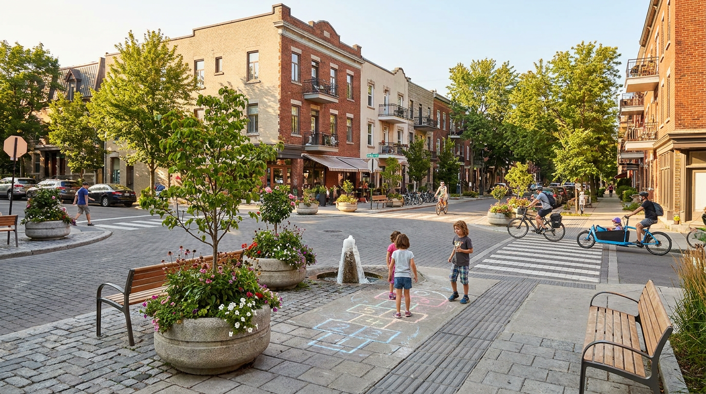
Toronto’s Priority Retail Streets zoning is a more targeted but highly instructive example. By requiring a minimum share of street frontage to be dedicated to street related retail and service uses on designated corridors, the city is using zoning not simply to regulate buildings but to shape street life. That is a subtle but important distinction. Walkability depends on active edges and meaningful destinations. If ground floors become blank walls, lobbies, or inactive private uses across major pedestrian corridors, the quality of the walking environment declines.
This kind of policy matters because it recognizes that urban vitality can be protected through precise land use rules. It also shows that walkability is not just about movement. It is about what happens along the route. A successful walking environment is animated by commerce, services, transparency, and social interaction. Cities that value walkability need to think about frontage, tenancy patterns, and ground floor design as much as they think about sidewalks and crossings.
Common Misconceptions About Walkable Communities
Because walkability has become a popular idea, it is also often misunderstood. One of the most common misconceptions is that walkable communities are only possible in dense downtowns. In reality, walkability can be advanced in suburban retrofits, traditional main streets, mid sized cities, and emerging transit corridors. The form may differ, but the principles of connectivity, mixed uses, safe public space, and local access still apply.
Another misconception is that walkability means eliminating cars. That is not the objective. Most cities will continue to accommodate cars, and many households will still choose to own one. The goal is to reduce forced car dependence by making walking, cycling, and transit practical for everyday trips. A city where residents have real mode choice is more flexible, more inclusive, and more resilient than one where nearly every task requires driving.
There is also a tendency to treat walkability as an aesthetic issue. Attractive streets matter, but the real stakes are much larger. Walkability affects health outcomes, emissions, household costs, municipal infrastructure efficiency, local retail performance, and social connection. It changes how cities grow and how people experience opportunity. When viewed through that lens, walkability is not a design trend. It is a structural feature of high performing urban environments.
What Cities Need to Do Next
If the future of urban living is more walkable, then the next question is what cities should do now. The answer begins with governance. Municipalities need to align planning, transportation, housing, and capital investment around a shared objective of complete communities. That means updating zoning to allow mixed use and missing middle housing in more locations, reducing parking requirements where appropriate, and focusing density near transit and key corridors.
Street design standards also need to evolve. Cities should prioritize complete networks over isolated projects, improve crossings and accessibility, calm traffic in neighborhood contexts, and treat the public realm as essential social infrastructure. Investments should be sequenced in a way that supports both present needs and future growth areas. A disconnected bike lane or a short sidewalk gap closure is useful, but transformational change comes from connected systems that make everyday trips viable without a car.
Affordability must be integrated into this agenda from the beginning. Transit oriented development and high demand walkable districts need housing policies that preserve access for a wide range of residents. This includes affordable housing requirements, partnerships on public land, faster approvals for supportive housing forms, and stronger permissions in areas where demand is high. If cities fail on this front, walkability risks becoming a premium amenity rather than a broadly shared public good.
Finally, cities need patience and ambition at the same time. Walkable communities are built incrementally through zoning reform, redevelopment, infrastructure upgrades, transit expansion, and public space improvement. But they also require a clear long term vision of what urban life should look like. The places that succeed are usually those that understand walkability not as a project, but as a governing framework for growth.
Conclusion: Walkability as a Development Strategy
The conversation around walkable communities is no longer just about urban charm or lifestyle branding. It is about whether cities can deliver a more efficient, healthy, and inclusive pattern of growth in a period of intense housing demand, infrastructure pressure, and environmental constraint. Walkability is one of the clearest ways to connect land use, mobility, public health, and local economic development into a single strategic agenda.
That is why this issue deserves serious attention from planners, developers, policy makers, and residents alike. The strongest walkable communities are not accidental. They are created through deliberate choices about zoning, housing mix, active transportation networks, transit integration, and public realm investment. They require cities to move beyond isolated interventions and embrace a complete communities mindset.
In the years ahead, the most successful urban regions will be those that make proximity a core part of their development model. They will permit more homes near transit, protect active streets, invest in safe and connected networks, and ensure that walkability is accessible to more than a narrow slice of the market. That is the real future of urban living. Not simply denser cities, but better connected, more livable, and more human ones.
- Plan for proximity. Put housing, schools, parks, services, and jobs within practical walking distance wherever possible.
- Reform zoning. Allow mixed uses, missing middle housing, and transit oriented density in more locations.
- Build complete networks. Connect neighborhoods to transit, main streets, schools, and parks with safe walking and cycling routes.
- Protect affordability. Pair walkability initiatives with housing policy so high demand neighborhoods do not become exclusionary.
- Design for real users. Make streets comfortable and accessible for children, seniors, and people with disabilities, not only for peak vehicle movement.
Walkable communities are not a passing trend. They are one of the most practical answers to the central challenge of modern city building: how to accommodate growth while improving quality of life. The cities that act on that insight will be better positioned to compete, to include, and to endure.



No Comment! Be the first one.