



Cities are entering a new phase of growth. The world is already majority urban, and the United Nations projects that roughly 67.3 percent of the global population will live in urban areas by 2050. In Europe and Northern America, that figure is projected to reach about 83.2 percent. For planners, developers, governments, and residents, that shift is not an abstract demographic trend. It is a direct challenge to how cities manage housing demand, infrastructure strain, mobility, energy use, public health, and climate risk.
Table Of Content
- What Smart City Planning Really Means
- Why Smart City Planning Matters More Than Ever
- The Core Technologies Behind Smart City Planning
- From Gadgets to Governance: The Real Planning Challenge
- Smart City Planning and Housing Supply
- Mobility, Transit, and the Efficient City
- Climate Resilience, Public Health, and Urban Quality of Life
- Canada’s Smart City Context
- Common Misconceptions About Smart Cities
- What Successful Smart City Planning Looks Like
- The Future of Urban Living
In Canada, the pressure is especially visible. Statistics Canada estimated the national population at 41,288,599 on July 1, 2024, while census metropolitan areas grew by 3.5 percent from July 1, 2023 to July 1, 2024, faster than the national rate. Growth is concentrating in urban regions where land is limited, infrastructure is aging, and affordability is under intense pressure. This is the context in which smart city planning matters. It is not a trend layered onto city building. It is increasingly a practical framework for managing urban complexity.
Smart city planning is best understood as the integration of urban design, infrastructure, governance, and digital technology to improve quality of life and city performance. The most important distinction is that effective smart city planning is not technology first. It is outcome first. Cities should begin with real planning goals such as reducing congestion, improving transit reliability, lowering emissions, increasing housing supply, protecting public health, and strengthening resilience. Technology then becomes a tool in service of those goals.
That distinction matters because the term smart city has often been misunderstood. Some people imagine a city covered in sensors, cameras, and apps, as though data collection alone creates better urban outcomes. It does not. A city becomes smarter when it can coordinate decisions across transportation, land use, housing, utilities, and public services in a way that is more responsive, more efficient, and more equitable. In other words, smart city planning is ultimately a governance and design challenge, not just a procurement exercise.
This is why the future of urban living depends less on flashy devices and more on integrated planning. The cities that will perform best over the next generation are likely to be those that combine traditional planning principles with digital infrastructure, open data, strong privacy rules, and measurable service improvements. They will use technology to support compact growth, complete communities, safer streets, resilient infrastructure, and better public service delivery. That is the real promise of smart city planning.
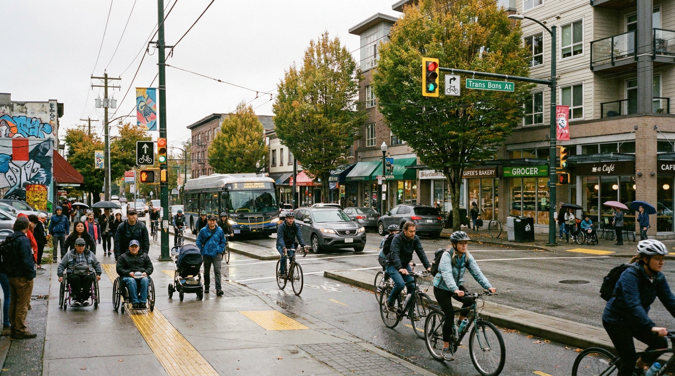
What Smart City Planning Really Means
At its core, smart city planning is about how a city functions as a system. Urban life depends on interdependent networks. Transportation affects access to jobs and housing. Land use decisions affect affordability and travel patterns. Energy systems affect emissions and climate resilience. Public realm design affects health, safety, and social cohesion. A smart city approach recognizes those connections and uses data, digital tools, and coordinated institutions to manage them more effectively.
In practice, this means combining conventional planning with technologies such as sensors, Internet of Things networks, broadband infrastructure, geographic information systems, open data platforms, urban dashboards, digital twins, and AI-enabled analytics. These tools allow cities to understand conditions in real time, model future scenarios, and respond with greater precision. But their value depends on planning discipline. Installing infrastructure without a governance framework simply produces isolated systems and fragmented datasets.
The National Institute of Standards and Technology has long framed smart cities as an architecture issue as much as a technology issue. That is a useful lens. Cities are made up of departments, agencies, utilities, contractors, community groups, and private operators, each with their own systems and responsibilities. Without interoperability, common standards, and agreed metrics, a smart city effort can quickly collapse into disconnected pilot projects. Many cities have learned that the hard part is not buying tools. The hard part is aligning institutions around shared outcomes.
The Organisation for Economic Co operation and Development makes a similar point through its focus on data governance. Real time data can improve operations, but only if there are clear rules for collection, access, sharing, protection, retention, and deletion. Without those rules, digital systems can weaken public trust, create privacy risks, and increase surveillance. This is one of the defining tensions in smart city planning. The same tools that can improve transit service or energy management can also create new governance risks if they are not designed with accountability from the start.
A smart city is not the city with the most technology. It is the city that uses technology most effectively to achieve better urban outcomes for people.
That people first perspective is gaining ground internationally. Recent work from UN Habitat emphasizes people centred smart cities, with a focus on equity, inclusion, accessibility, resilience, and quality of life. This is an important corrective. Cities are not software platforms. They are social environments where infrastructure, governance, and built form shape everyday life. When smart city planning is done well, technology becomes a quiet but powerful enabler of better urban living rather than the headline itself.
Why Smart City Planning Matters More Than Ever
The case for smart city planning begins with scale. Urban growth is accelerating at the same time that cities are being asked to decarbonize, improve resilience, and restore affordability. In Canada, major metropolitan areas continue to absorb strong population growth while facing severe housing constraints. The Canada Mortgage and Housing Corporation has stated that returning to 2019 affordability levels will require roughly 430,000 to 480,000 new housing units per year over the next decade. That is an extraordinary delivery challenge, and it cannot be met through analog planning systems alone.
Housing is only one side of the equation. Every new home also depends on transportation, water, wastewater, energy distribution, schools, healthcare access, emergency response, and public space. A city that expands housing supply without coordinating infrastructure creates new forms of strain. Conversely, a city that uses digital tools to map capacity, forecast growth, and target investment can unlock more efficient, better timed development. Smart city planning is therefore not separate from housing policy. It is increasingly part of how cities make new housing feasible and sustainable.
Climate and public health pressures add another layer of urgency. The World Health Organization reports that air pollution remains one of the greatest environmental risks to health, with almost the entire global population exposed to unsafe levels. Urban planning decisions have a direct influence on that risk through mobility systems, energy choices, land use patterns, waste management, and green infrastructure. Cities that support walking, cycling, clean transit, compact growth, and efficient buildings can materially improve health outcomes while reducing emissions.
North American cities also face more frequent heat events, flood risks, wildfire smoke, and infrastructure disruptions. Smart city planning allows municipalities to connect resilience strategies across departments. Sensor based flood monitoring, AI supported forecasting, digital asset management, and integrated emergency systems can all improve response capacity. Yet the larger value comes from using those tools to support long term planning. A digital map of vulnerable roadways or overheated neighborhoods is useful, but it becomes transformative when it guides capital planning, zoning updates, tree canopy investment, and building standards.
There is also an economic reason smart city planning matters. Cities compete for talent, investment, and productivity. Businesses and households are drawn to places that function well, where mobility is dependable, services are responsive, public space is attractive, and infrastructure can support growth. Smart planning improves operational performance, but it also improves confidence. It signals that a city understands where it is growing, where it is constrained, and how it intends to manage change responsibly.
The Core Technologies Behind Smart City Planning
While smart city planning is not technology led, technology does play an essential role. The challenge is knowing which tools matter and how they fit into a broader planning strategy. The foundational layer is often digital infrastructure. This includes broadband networks, wireless connectivity, cloud systems, interoperable databases, and secure platforms that allow public agencies to exchange information. Without this foundation, higher level applications remain limited or unevenly distributed.
The next layer involves sensing and monitoring. Sensors embedded in roads, utilities, transit systems, buildings, and public infrastructure can generate real time information on traffic flow, water use, air quality, energy demand, waste collection, noise, and asset condition. The value of this data is not merely operational. It can reveal where systems are under pressure, where service gaps are occurring, and where investment will have the greatest impact. A well designed sensor network does not collect everything. It collects what is necessary to improve defined outcomes.
Geographic information systems, or GIS, remain among the most important smart city tools because they connect data to place. Planning decisions are spatial by nature. Whether a city is evaluating transit access, flood exposure, development capacity, or service equity, GIS allows decision makers to see patterns and relationships geographically. This helps move planning conversations from anecdotal impressions to evidence based analysis.
Urban dashboards and open data platforms add another layer by making information visible and actionable. Dashboards allow staff and the public to monitor key indicators such as congestion, ridership, service response times, development activity, or emissions trends. Open data can also strengthen transparency and civic innovation by allowing researchers, entrepreneurs, and community organizations to build their own tools and insights. However, openness must always be balanced with privacy, security, and public interest.
One of the most powerful developments in recent years is the rise of the digital twin. A digital twin is a dynamic virtual model of a city or urban system that integrates real world data and can be used to test scenarios. Planners can model how a new transit line might affect development patterns, how a flood event could disrupt infrastructure, or how growth in one district would affect utilities and traffic in another. This is where smart city planning becomes especially strategic. The city gains the capacity to evaluate consequences before they are built into the physical landscape.
Artificial intelligence also has growing applications, especially in forecasting, optimization, and asset management. AI can support transit scheduling, detect anomalies in water systems, improve energy management in municipal buildings, or help identify patterns in permit processing and infrastructure maintenance. Yet AI should be approached carefully. Models can replicate bias, obscure decision making, or create overconfidence if they are treated as objective truth. In planning, AI is most valuable when it supports professional judgment rather than replacing it.

From Gadgets to Governance: The Real Planning Challenge
Many smart city initiatives fail not because the tools are weak, but because the governance is weak. Cities are institutionally fragmented by design. Transportation departments manage roads and signals. Utilities manage power, water, or waste systems. Planning departments manage land use and development approvals. Transit agencies operate separately. Private firms may own critical digital platforms. If these actors do not share standards, data protocols, and strategic objectives, the city cannot function as an integrated system.
This is why governance is central to smart city planning. Strong governance defines what data is collected, why it is collected, who can access it, how it will be protected, and how performance will be measured. It also clarifies procurement rules, vendor relationships, accountability structures, and public reporting. Without that framework, a city may invest heavily in technology while gaining very little strategic value. At worst, it may create systems that residents do not trust.
The OECD has been particularly clear that robust data governance is essential. Smart city systems need rules for collection, access, sharing, protection, and deletion of data. They also need institutional accountability. Residents should know how urban data is being used and what rights they have over it. In an era of surveillance concerns, cybersecurity threats, and growing dependence on connected infrastructure, trust is not a secondary issue. It is a prerequisite for implementation.
The Toronto Quayside controversy remains one of the most important cautionary examples in North America. The project attracted global attention because it promised a digitally advanced urban district, but it also raised serious questions about governance, control of data, public oversight, and the role of private technology companies in shaping city building. The lesson was not that innovation should be avoided. The lesson was that urban innovation must be governed in the public interest from the outset.
For city leaders, the implication is straightforward. Smart city planning must be anchored in public purpose. The city should define the outcomes, the standards, the accountability mechanisms, and the privacy protections before selecting tools or vendors. Technology partners can help deliver components, but they should not determine the civic vision. When planning authority remains clear and public trust is protected, smart systems become more durable and scalable.
Smart City Planning and Housing Supply
One of the most important but underappreciated connections in this field is the relationship between smart city planning and housing delivery. Housing shortages are often discussed in terms of zoning, approvals, financing, and construction costs, all of which matter. But housing supply is also constrained by information gaps, infrastructure uncertainty, and poor coordination between growth planning and servicing capacity. Smart city tools can help cities understand where capacity exists, where it can be expanded efficiently, and where policy changes will have the greatest effect.
For example, digital mapping can identify underutilized land near transit, infrastructure corridors, or service rich areas that are well positioned for infill and intensification. GIS based analysis can help planners evaluate whether those areas have enough sewer, water, road, and school capacity to support additional density. Digital permit systems can improve transparency, reduce delays, and surface bottlenecks in approvals processes. Scenario modeling can show how different zoning changes might affect unit yield, travel demand, and infrastructure timing.
This matters because housing affordability is inseparable from urban structure. A city that channels growth toward transit oriented, mixed use neighborhoods can reduce transportation costs, lower emissions, and create more complete communities. A city that pushes growth outward without integrated infrastructure planning can increase car dependence, infrastructure costs, and environmental impact. Smart city planning supports better choices by making tradeoffs more visible.
It is also useful for public communication. Housing debates are often shaped by fear of change or uncertainty about impacts. Clear visual models, accessible data dashboards, and scenario based planning tools can help residents understand what different growth options actually mean. When people can see how added density supports transit viability, local services, public realm investment, or climate goals, the conversation becomes more grounded and less reactive.
Mobility, Transit, and the Efficient City
Mobility is where many people encounter smart city systems most directly. Real time transit information, smart fare systems, adaptive traffic signals, curb management platforms, and integrated journey planning tools are already reshaping urban travel. But the larger planning issue is not convenience alone. It is whether these tools help cities shift toward more efficient, lower carbon, and more accessible mobility patterns.
The most successful cities do not use smart mobility to move cars faster at all costs. They use it to support broader goals such as reliable public transit, safer walking and cycling, reduced congestion, and stronger access to jobs and services. This is where smart city planning intersects with concepts like complete streets, transit oriented development, and the 15 minute city. The objective is not speed for its own sake. The objective is access.
Adaptive traffic systems can improve bus reliability when coordinated with dedicated lanes and transit priority. Mobility data can help identify where sidewalks are missing, where cycling demand is growing, or where curb space is being used inefficiently. Integrated planning platforms can reveal how land use intensity around stations affects ridership and infrastructure return on investment. In this sense, mobility data is not simply operational. It helps shape the physical form of the city.
Accessibility is also essential. A smart mobility system that works only for digitally fluent users or affluent neighborhoods is not a successful one. Transit information must be accessible, payment systems must accommodate diverse users, and services must remain reliable across the full urban geography. A people centred smart city treats mobility as a public good, not merely a consumer service.
Climate Resilience, Public Health, and Urban Quality of Life
Perhaps the strongest long term case for smart city planning is its ability to support resilience and health. Cities concentrate people, buildings, infrastructure, and environmental exposure in ways that create both vulnerability and opportunity. The same urban density that can reduce per capita emissions can also intensify heat islands or magnify flood impacts if poorly planned. Smart city tools help cities see those conditions earlier and respond more strategically.
Air quality monitoring is one example. The World Health Organization has made clear that air pollution remains a major threat to health. Hyperlocal monitoring can help identify pollution hotspots near schools, major corridors, industrial edges, or vulnerable neighborhoods. That information can guide changes in traffic management, tree planting, building filtration, transit investment, or freight routing. Data alone does not improve health, but data linked to planning action can.
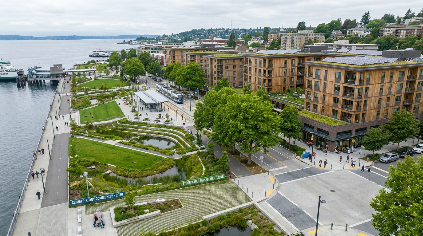
Flood management offers another compelling case. Sensor networks, predictive analytics, and digital twins can help model drainage performance, identify low lying infrastructure, and improve emergency response during major storm events. But the most effective strategy is still a planning strategy. It combines those tools with green infrastructure, updated building standards, land use controls, and long term capital investment. Smart city planning works best when digital intelligence strengthens physical resilience.
Heat resilience is becoming equally important. Cities can use satellite and street level data to map extreme heat exposure, then target shade infrastructure, cool materials, urban forestry, and public cooling access where it is most needed. This is especially important for lower income communities, seniors, and renters, who often face greater exposure and fewer adaptation options. A city that uses technology to reveal inequity can make fairer decisions, provided it is willing to act on what the data shows.
Canada’s Smart City Context
Canada has already developed an important policy foundation through the federal Smart Cities Challenge. What made that program notable was not simply its support for technology driven innovation. It framed smart city work around measurable outcomes, open and interoperable systems, scalability, transferability, and collaboration. In other words, it treated smart city planning as a community improvement model rather than a gadget competition.
The challenge’s winners, including Montréal, Nunavut communities, Guelph and Wellington, and Bridgewater, helped demonstrate that smart city methods are relevant across different scales and contexts. That is an important point because one of the common misconceptions is that smart cities are only for large, wealthy metropolitan regions. In reality, smaller communities may benefit just as much from better data, digital coordination, remote service delivery, and resilient infrastructure planning.
Recent federal evaluation materials have also emphasized knowledge sharing, capacity building, and alignment between infrastructure investment and digital transformation. That is exactly the direction the field needs to take. Technology is only one component of the transition. Municipal capacity, intergovernmental coordination, local digital skills, and long term institutional learning are equally important. A city does not become smarter in one procurement cycle. It does so through sustained modernization of planning and service systems.
Common Misconceptions About Smart Cities
Because the term smart city has been overused, it is worth clarifying what it does and does not mean. First, smart city planning does not mean adding sensors everywhere. The best projects begin with a clearly defined urban problem and then choose only the tools needed to address it. More data is not automatically better. What matters is relevant data tied to accountable action.
Second, smart city planning is not only for large metropolitan areas. Canadian guidance has consistently emphasized transferability and scalability. Smaller communities may use digital platforms to improve water management, emergency coordination, accessibility, or service delivery in ways that are highly impactful relative to their size.
Third, smart city work is not just an IT issue. It involves land use planning, public policy, infrastructure strategy, housing, transportation, public engagement, and finance. Treating it as a narrow technical function usually leads to weak implementation because the decisions that shape city outcomes are cross disciplinary by nature.
Fourth, smart systems are not inherently sustainable. Sustainability depends on urban form, energy sources, transportation choices, material systems, and governance. A city can deploy advanced technology and still produce poor environmental outcomes if it continues to support sprawl, inefficiency, or inequitable service patterns. Technology amplifies planning choices. It does not redeem bad ones.
What Successful Smart City Planning Looks Like
The strongest smart city strategies share several characteristics. They start with public goals that are concrete and measurable. They use interoperable systems rather than isolated pilots. They build strong data governance from the outset. They connect digital infrastructure to physical planning. They invest in public trust, transparency, and inclusion. And they focus relentlessly on outcomes that residents can actually feel in daily life.
Those outcomes may include shorter transit wait times, safer intersections, faster emergency response, more housing capacity in the right places, lower utility losses, better flood preparation, cleaner air, or easier access to public information. The point is that residents should experience smart city planning as improved urban living, not as a layer of invisible complexity managed only by experts.
There is also a design lesson here. The future of urban living will not be defined by software alone. It will be defined by neighborhoods that are compact, mixed use, walkable, transit supportive, climate resilient, and connected by reliable infrastructure. Smart planning adds a digital layer that helps those neighborhoods perform better and adapt faster. It does not replace the fundamentals of good city building.
The Future of Urban Living
The future city will need to house more people, move them more efficiently, protect them from climate risk, improve public health, and do all of this while preserving trust, equity, and fiscal discipline. That is a profound planning challenge. It demands more than traditional methods, but it also demands restraint. Cities should not chase technology for its own sake. They should use digital systems where they improve outcomes that matter.
In practical terms, this means the next era of urban planning will be hybrid. It will combine zoning reform with digital permitting. It will combine transit oriented development with real time mobility data. It will combine green infrastructure with predictive climate tools. It will combine public engagement with open data and accessible digital platforms. The planners and city leaders who succeed will be those who can connect these layers into a coherent operating model.
For Canada and North America, this approach is especially important. Rapid urban growth, housing pressure, climate risk, and infrastructure renewal are converging in ways that make fragmented planning increasingly costly. Smart city planning offers a path toward better coordination, but only if it remains grounded in public purpose. The goal is not a city that feels more automated. The goal is a city that feels more livable, more humane, and more capable.
That is the real future of urban living. A smart city is not the one with the most screens, the most sensors, or the boldest marketing language. It is the city that understands how to align technology, governance, land use, and infrastructure around long term civic outcomes. When that alignment is achieved, the result is not just a smarter city. It is a better one.



No Comment! Be the first one.